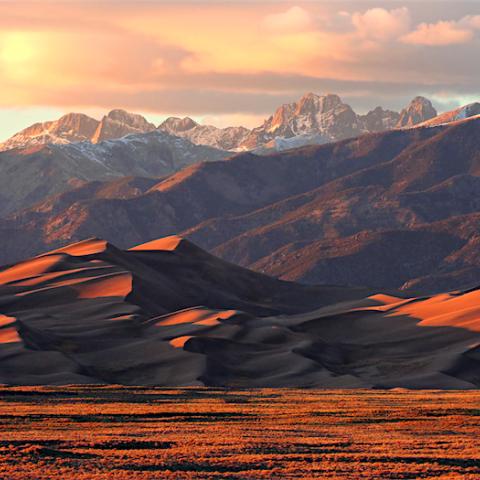
Up to 3,300 acres will be burned at Great Sand Dunes National Park to reduce vegetative undergrowth that could fuel larger fires/NPS, Patrick Myers file
Crews at Great Sand Dunes National Park in Colorado are planning to burn up to 3,300 acres in an effort to reduce vegetative undergrowth that could lead to a more severe wildfire if one started.
The prescribed burn, near the northern end of the park near the Baca Grande Subdivision and about 3 miles south of Crestone, Colorado, will occur either October 26-29 or November 8-12.
The fire operation, staged with help from Rio Grande National Forest, will remain west of Liberty Road. Temporary closures along Liberty Road may occur during the operation to ensure public health and safety when firefighters are working along the road, a park release said.
The dates were chosen to fall between hunting seasons and were selected to reduce impacts to recreational users on adjacent public lands where hunting is allowed, the release added.
“Prescribed fire is a proactive tool used to achieve a number of purposes,” said Mike Lewelling, Great Sand Dunes fire management officer. “The primary purpose of this prescribed burn is the reduction of hazardous fuels (overgrown vegetation). It helps decrease the threat of high-intensity, high-severity wildfires and reduce the risk of wildfire danger to nearby communities."
Prior to and during prescribed burns, fire managers closely monitor weather conditions with multiple weather forecasts generated by the National Weather Service. Forecasts are customized to the burn location with frequent on-site weather measurements. Fire personnel at the scene are constantly monitoring conditions during a prescribed burn and adapt accordingly. If at any time conditions are outside of predetermined acceptable levels, the operation will be halted. All burns are monitored until they are declared completely out.
Smoke will be visible from the Crestone and Baca Grande Subdivision, Colorado State Highway 17, and other locations in the San Luis Valley. Air quality considerations are an important part of prescribed fire, and each fire prescription is planned to disperse smoke rapidly and reduce lingering haze. However, smoke may still have adverse effects on some people’s health.
“It is impossible to burn without generating smoke,” sai Lewelling. “The targeted prescribed burn area will be subdivided into smaller sections and potentially burned over several days to limit daily smoke production.
Neighbors and towns adjacent to the park should be aware that the prescribed burning may temporarily generate large plumes of smoke and that some burn units have the potential to smolder for several days, the park release said. Signs will be posted along major roads during the operation.
Fire information updates, including anticipated daily smoke impacts, will be posted on https://inciweb.nwcg.gov.


 Support Essential Coverage of Essential Places


Add comment