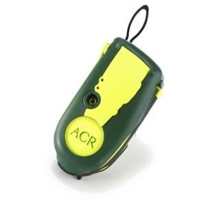
More and more, modern technology allows us to save us from ourselves. A perfect example occurred earlier this week in the Grand Canyon, where hikers who were beaten down by the heat used a “personal locator beacon” to save themselves. The help, incidentally, came from across the country in Florida.
The beacon's signal was detected from the canyon’s Surprise Valley, a remote area on the north side of the park, by the Air Force Rescue Coordinator Center at Tyndall Air Force Base in Florida.
Air Force personnel called the park about 6:30 p.m. on July 2 to alert them to the signal. Rangers used a helicopter to reach the location, where they found a hiking party of four. One of the hikers was suffering from dehydration and heat exhaustion and was taken out of the canyon by the helicopter. The other three remained in the canyon and were given ice and water by the rangers.
The use of the personal locator beacon technology was the first not only in the Grand Canyon, but supposedly the first “legitimate use” of the technology in the state of Arizona, according to park officials.
For better or worse, the park’s chief of emergency services, Ken Phillips, thinks search and rescue teams will see more use of the locator beacons. The use of satellite phones, which have the advantage of offering two-way communication, is also on the rise.
I say “for better or worse,” because there’s the very real possibility that some folks will overlook their own abilities and lean too much on this technology and get into backcountry locations and conditions where they shouldn’t venture.
“A person who carries a PLB should always take the proper measures to prevent themselves from ever having to use it,” Phillips says.


Comments
Erik,
I think part of the argument for these beacons is just that it will provide a little more security for rangers and pilots out doing Search And Rescue. These beacons have the ability to guide SAR to within 10 feet or so of the device. We've probably all seen some of these past wilderness searches go on for a week, with TV reporters providing hour-by-hour coverage. But with these devices, SAR might spend less than a day on a rescue precisely because of the type of pin-point electronic accuracy available.
The question of abuse is fair. I think we could get a decent idea of the abuse potential if we were to ask SAR how often cell phones are used for less-than-emergent need in the backcountry today. We've probably all heard stories of it happening, but what is the real scoop? At this point, I'd say the potential for abuse of these Personal Locater Beacons is low, only because of the high cost associated with buying them. They cost hundreds of dollars and are really useless unless you are hiking, which limits the number of people who would be attracted to such a device, and limits those would also pay for such a device. Just like cell phones and other technology, prices will come down over time, and this type of story may not be that unusual in the future.
I believe that as the price of these PLBs come down, they'll become standard fare in a day-pack. I'm hopeful that the NP Service will attach a Hefty fine on people who'll sound the alarm, only to get "rescued" so they don't have to climb back up the Canyon. I agree w/Phil that people have to take responsibilty, but alot of people today figure a way that Nothing is Their fault. They'll be the ones that will say that there weren't enough warning signs.
I'd like to climb Mt Everest; but guess what, I can't..but then again maybe I can...someone will pick me off the Mt when I need'em. I'll send my PLB signal.
help me help me help us all.
These things will save people - they are a good thing.
I agree there will need to be action taken to discourage misuse. I will pay at least $100 if I ever fat finger the alarm on my home - and a police visit is somewhat less risky and costly than a mt. rescue.
Are there areas of the Grand Canyon where a gps can not see enough satellites to calculate an accurate location?