It's been a rather cold, wet winter in much of the country, and Olympic National Park includes a smorgasbord of outdoor delights to help cure a case of cabin fever. Here's some important travel information for anyone planning a visit to the park during the next two months--and a tip that can save you some money on your trip.
A popular route to Olympic National Park crosses the Hood Canal Bridge. As previously reported on the Traveler, that bridge will close on May 1st for approximately six weeks for major repairs. The park will be open and accessible during that work, and you'll find tips on alternate routes and other details about the bridge work on-line.
It's hard to predict how much impact the bridge work will have on early summer travel to the park and surrounding Olympic Peninsula, but this could be a great opportunity for you to enjoy a somewhat less crowded--and potentially less expensive--visit. A number of businesses in the area are offering discounts during the work on the Hood Canal Bridge. You'll find more information on a website sponsored by the local tourism commission appropriately called no bridge no problem.
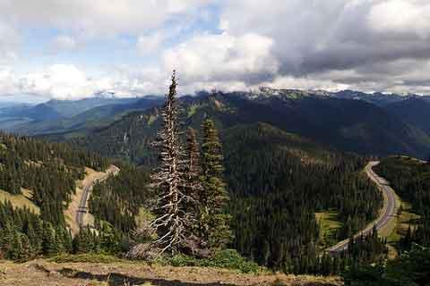
Baring last-minute weather problems, the popular Hurricane Ridge Road is scheduled to open for the summer season on May 8, 2009. Until then, the winter schedule is in effect, and the road is open (weather permitting) only on Friday, Saturday and Sunday. All vehicles are required to carry tire chains when traveling the Hurricane Ridge Road between November 21 and May 1. Click here for current Hurricane Ridge conditions and information.
Some park roads, campgrounds and other facilities at Olympic close each year for the winter season, including the Staircase, Deer Park and Obstruction Point roads. The park website includes a schedule of opening dates for those and other facilities. You can also hear a recorded message with recent road updates at 360-565-3131.
If you aren't familiar with the area, the park website includes several useful maps to help plan a visit—and identify roads and other facilities mentioned on the recording.
Park crews continue repair work on the roads, trails and campgrounds that were damaged during major storms during the past three years. Although work in most areas is complete, the following roads are still closed:
• In the Quinault Valley, the Graves Creek Road and Campground are open to pedestrian, stock and bicycle access only. This area was severely damaged by floods in December 2007. The park hopes to begin repair work in 2009.
• The Dosewallips Road remains closed by a washout 3.5 miles outside the park boundary, in the Olympic National Forest. The park's Dosewallips Campground is open, with pit toilets only and no potable water. There is a 5.5 mile walk to the campground from the road closure.
You'll find downloadable maps, plus driving directions and travel tips on the park website.


 Support Essential Coverage of Essential Places


