The first-ever management plan for the Blue Ridge Parkway treads a fine line between two forces park managers have juggled for the 76-year history of the high road—the economic development aspirations of adjacent communities and the need to ensure the integrity of a “national park” that’s 469-miles long and a half-mile wide.
This most-visited unit of the national park system (generally just less than 20 million annual visitors) was born as a Depression-era public works project in part intended to bring tourism and transportation to the once-isolated Southern Appalachians.
The 654-page Park Service document, available for review on the Web, is the Environmental Impact Statement for the Parkway’s Draft General Management Plan. It features three options for the public to review and comment on, with option B being the one preferred by the Park Service. After the comment period closes December 16th, final decisions will be made.
Option A is a “do nothing” approach, while options B and C are viewed by the Parkway as competing plans designed to “enhance recreation.” But "B," the Parkway's preferred alternative, seems much less aggressive in expanding recreation, especially in how it connects with trail and recreation sites located in increasingly outdoorsy communities adjacent to the Parkway.
Given the Parkway’s at times controversial jousting with commercial “neighbors,” it might be understandable that alternative B simultaneously takes a conservative approach to expanding recreational opportunities while also trying to reduce growing commuter traffic on the road.
At Grade Crossings
Alternative B intends to enhance separation between the Parkway and commuter traffic, in part by restricting major changes where 199 rural roads cross the Parkway “at grade.” The fear is that improved access to the Parkway, and from the Parkway to adjacent rural areas, will encourage development that is increasingly turning rural Parkway vistas into suburban settings.
The National Parks Conservation Association singled out this issue, stating in a release that, “Road connectors that may trigger adjacent residential development and ... commuter traffic flows must be minimized. This can be partially accomplished by maximizing grade-separated crossings and exploring opportunities where at-grade crossings could potentially be eliminated...”
“We feel strongly that if the GMP fails to embody strong preservation and resource protection principles,” said NPCA Program Manager Chris Watson, “then the very nature and purpose of the Parkway could be lost in the coming generation given the enormous growth and development pressures.”
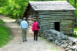
Parkway officials are trying to devise a management strategy to protect the historic nature of the Parkway from development. Mountain Farm at Humpback Rocks. Photo by Randy Johnson.
NPCA points out the startling statistics that “since 1976, western North Carolina’s mountains have experienced a 42% increase in population and a 568% increase in land development.”
The NPCA supports option B, saying it will allow the Parkway to “preserve its integrity as a self-contained, scenic motorway separate from the regional highway system, rather than allow piecemeal road developments to transform the historic parkway into a commuter traffic route.”
Ironically, the Parkway was built in part to bring at least one good road to a region largely devoid of modern highways. To this day, the Parkway is the best route to work for some mountain residents.
National Historic Landmark
As the GMP effort moves forward, the Parkway intends to complete the nomination of the road as a National Historic Landmark, in part to ensure that preserving the classic recreational experience of the Parkway, including its vistas, road alignment, and isolation, has the force of historic status behind it.
That possibility might concern Parkway neighbors who are more “community engagement” oriented. The Parkway’s GMP seems intent on “actively” managing the Parkway “as a traditional, self-contained, scenic recreational driving experience and designed landscape, while enhancing outdoor recreational opportunities and regional natural resource connectivity.”
The Recreation Connection
The recreation situation is so complex that a number of Parkway areas are undergoing separate planning processes (as in some other national parks). These other plans reflect how recreation, particularly cycling and mountain biking, are challenging the isolation of the Parkway.
The Roanoke Valley Trails Plan closed for comments on September 12 amidst much controversy in the Roanoke, Virginia, area. Rather than embrace a plan to more closely integrate Parkway recreation with nearby trails and greenways, the Park Service proposed to close many “social” trails that cyclists use to reach the road and eliminate mountain biking from consideration as a permitted use of the Chestnut Ridge Trail. Currently the trail is limited to hikers and horseback riding.
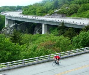
Cycling and mountain biking are surprisingly controversial in some areas of the Parkway. Randy Johnson photo.
Dan Casey, Metro Columnist for the Roanoke Times, quoted a Parkway official as saying that, “Horseback riders don't want bikes on Chestnut Ridge.”
One of many Roanoke residents who added on-line comments to Casey’s article wrote, “Despite overwhelming support, they (Parkway officials) seemed to bow to a small number of equestrians who wanted to keep bikes off that trail, even though there are far more cyclists who use it than horses.”
Casey complained that the Parkway’s historic concept was getting in the way. “In its 14-page introduction, the plan calls the parkway a ‘motor’ road nine times. You get the drift: It was built for cars and shall always be predominantly for cars. That was true in the 1930s. But this is 2011.”
Nevertheless, Roanoke is one of two areas along the Parkway where paved multi-use trails are planned to parallel or complement the Parkway as a cycling route (the other is Asheville, North Carolina). The Parkway’s preferred option also proposed a paved multi-use trail for the High Country area of Boone, North Carolina, another cycling hotspot.
But a surprise retraction of that proposal was handed out at the November 3 public meeting at the Blowing Rock Art and History Museum.
Road and mountain biking are very popular in the area, on the Parkway, and at the new Rocky Knob Mountain Biking Park in Boone. The High Country area is where Lance Armstrong had the post-cancer epiphany that led him to a legendary record number of wins in the Tour de France.
As in Roanoke, some High Country locals hope to see greenway connections to the Parkway and the possibility that mountain biking might be a permitted use somewhere in the Price Park or Cone Park area. That hope was based in part on a separate Developed Area Management Plan proposal for Cone Park to be released in 2012 that is expected to eliminate mountain biking from consideration as a permitted use there. Many cyclists believe Cone Park’s 25 miles of gradual, rocky surface roads are perfect for mountain biking, but they are currently restricted to hikers and horseback riders.
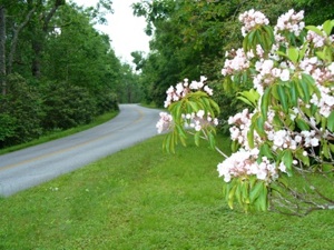
One aspect of a new general management plan for the Blue Ridge Parkway is to help preserve the Parkway's idyllic nature. Photo by David and Kay Scott.
Elsewhere on the Parkway, the preferred alternative gives equestrians a further nod with expanded options at Doughton Park, long the Parkway’s premier backcountry area largely devoted to hiking and backpacking.
The document says, “Designating mixed use trails for horses and hiking; constructing trailhead parking that would accommodate horse trailers; and providing equestrian camping would be a local long-term beneficial impact on equestrian opportunities in this recreational area. This mixed use of current hiking trails would be a minor adverse impact on some hikers’ experience.”
A Parkway official at the Boone area meeting acknowledged that equestrian groups were lobbying for the change, but mountain bikers are also hoping for new Parkway trail access.
The horse/mountain bike debate turns attention back to the plan’s focus on the Parkway’s “historical” emphasis versus accommodation of new activities. Moses Cone’s guests walked or took horse-drawn carriages around his estate—but mountain bikers wonder why a relatively small group of equestrian recreationists should be grandfathered in when equestrian use has declined recently in the United States and mountain biking groups claim as many as 50 million Americans as riders. A facility in Blowing Rock that once rented horses for public use in Cone Park has not done so in years, focusing access on an even smaller group of horse owners.
Some proponents of increased recreation on the Parkway could think that the Park Service intends to institutionalize a 1950s' concept of recreation acceptable on the Parkway.
“Concessions” to Tough Times
The Parkway’s many concessions—private business providing lodging, dining, and other services to the public—seem to be struggling.
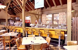
Parkway officials need to find a new company to operate the Bluff's Lodge restaurant. Forever Resorts photo.
Throughout the Parkway management document, concessions come in for assessments like, “These facilities are outdated, do not meet the needs of many visitors...”
Many sections discuss concessions with troubling phrases such as, “If no longer economically viable...”
Just this year, the Forever Resorts concessions company pulled out of its Parkway businesses, including Bluffs Lodge and restaurant at Doughton Park in North Carolina.
The Park Service’s preferred option seems intent on keeping the concessions open and upgrading facilities: “Under alternative B, develop a strategy (such as a new commercial services plan) to provide viable concession services at all locations to ensure the long-term availability of in parkway lodging, food, and other services.”
The Park Service also says that option B, “best preserves the original design intent of the parkway and ensures the long-term viability of the historic lodges and other historic resources.” Though the Parkway does boast Civilian Conservation Corps-constructed cabins at Rocky Knob, there is no facility like Mount Rainier National Park’s Paradise Lodge on the Parkway. One could ask the question, are the Parkway “lodges” historic or just aging motels?
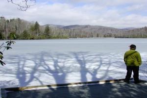
How easy might it be to expand the Parkway's main tourist season to 9 months? Near the Price Lake Trail. Randy Johnson photo.
Length of Season
Despite its location in the Southern Appalachians, the Parkway’s full staffing season is only six months long. That’s understandable at high elevations where a New England-like winter prevails from November to April. But the Parkway’s preferred option B proposes to expand to a nine-month season at some lower elevation sites.
In Virginia, those locations include Humpback Rocks, James River/Otter Creek, Peaks of Otter, Mabry Mill, and the Blue Ridge Music Center. In North Carolina, Linville Falls is proposed to have a nine-month season, while no expansion is planned for popular Price Park near Blowing Rock. Craggy Gardens, a very high elevation, severe weather area near Asheville, is also proposed to be open for nine-months.
Campground Considerations
The Parkway’s most urban campground, Roanoke Mountain, in Virginia, is proposed for conversion to a day-use facility. Though only minutes from dining in downtown Roanoke, the low-elevation campground is “the hottest of the parkway campgrounds during the summer” and thus sees far less use.
Many campgrounds are in line for improvements, with new features such as bigger, “family-size” tent pads, accessible restrooms, showers (especially at warmer, lower elevation sites), and for RVs, water and electrical hookups and widened access loops, entrances, and parking. In Virginia, campground showers are aimed at Peaks of Otter, Otter Creek, and Rocky Knob. In North Carolina, Doughton Park would get showers and a significant boost of RV space and facilities under the park's preferred alternative.
South of Asheville Mount Pisgah—the first and only Parkway campground with showers, as well as the loftiest and likely coolest campground on the road—nevertheless would get more showers and RV upgrades. Price Park Campground near Blowing Rock, “one of the most heavily used on the Parkway,” would receive some RV upgrades, but no water and electrical hook-ups or showers are planned. Instead, those more modern touches seem aimed nearby, at smaller campgrounds, such as Linville Falls and Crabtree Falls.
Also at Mount Pisgah, the popular campground may actually shrink. It was built around an 8,000-year-old high mountain bog that’s at risk from camper activity and the interruption of natural water flow by a campground road.
No firm plan is yet decided upon, but option B wants to “close and rehabilitate all tent camping sites that are directly adjacent to the bog ... convert a portion of existing RV sites to tent camping sites” and restrict use of trails “in sensitive resource areas near the bog.”
Parkway officials say possibilities for adding new campsites might include conversion of a nearby picnic area to camping and the creation of picnic sites on a parcel at the so-called “No name Overlook.”
Environmental Issues
Environmental concerns are sparking other noteworthy proposals for change that might alter popular recreation sites. The Mount Pisgah bog highlights how times have changed when “environmental impact” is assessed. At one time, the now glistening waters of Lake Abbott, the focal point at Peaks of Otter, were a mountain wetland that today would be handled with kid gloves.
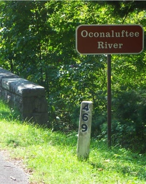
The Great Smokies' Oconaluftee River Trail runs under the Parkway's final milepost. Randy Johnson photo.
Other changes are planned or could be considered that redress problems with earlier flood plain siting choices. Those include the proposed relocation of the Price Park picnic area out of the flood plain, with the stream site restored to its natural condition.
The popular Craggy Pinnacle Trail at Craggy Gardens, where a path reaches a historic rock work observation deck, would be closed under the preferred plan to protect a variety of rare species. Currently, trail signs warn about the plants but users stray nevertheless. A new trail would be built nearby to spectacular Craggy Dome, a very enticing prospect for trail users who love the Parkway’s status as a premier hiking destination. (Hiking is the Parkway’s third most popular activity behind scenic driving and taking in visitor centers.)
It might be naive to expect time to stand still along a nearly 500-mile linear park through one of the nation’s most scenic areas increasingly known for an enviable outdoor lifestyle. Simple solutions will be difficult to find for the dilemma of how to keep the road involved in the local economy and community while remaining “above it all” for the millions seeking to escape their own suburban environments.
Your Comments
You can review the entire proposal at this website. You can make your comments on that page, or submit written comments by mail as late as December 16, 2011, to: Superintendent Philip A. Francis, Jr., Blue Ridge Parkway, 199 Hemphill Knob Road, Asheville, NC 28803.
Costs and Staff
The Park Service’s preferred option B would increase staff to 232 (from 175), and include an annual operating budget of $20,929,000. Option C would increase the staff to 252, and include an annual operating budget of $22,768,000. The options differ more in other costs.
One time facility/non facility costs would be $79,201,000 under Park Service-preferred option B, and $82,576,000 under option C. Option B would entail $68,436,000 in additional costs, while option C dramatically elevates those expenses to $144,270,000.
Randy Johnson is the author of the Parkway’s premier trail guides, “Hiking the Blue Ridge Parkway” and “Best Easy Day Hikes Blue Ridge Parkway," as well as the best-selling statewide guide, “Hiking North Carolina.” Visit Randy’s web site www.randyjohnsonbooks.com


 Support Essential Coverage of Essential Places


Comments
I enjoy driving the blue ridge parkway, and we are planning on camping along the parkway this coming year and in the future. I completely support plan B that the Park Service has recommended.
While option C is attractive, during our rocky economic environment - I believe that being more fiscally prudent is the wise way to go.
Obviously option A is environmental suicide along with the moral and physical decay of the park way.
Again, please let me be clear that I support Plan B.
Thank you
What a surprise. The horseriders are getting preferential treatment (without any kind of rational argumentation) while cyclists get the shaft...