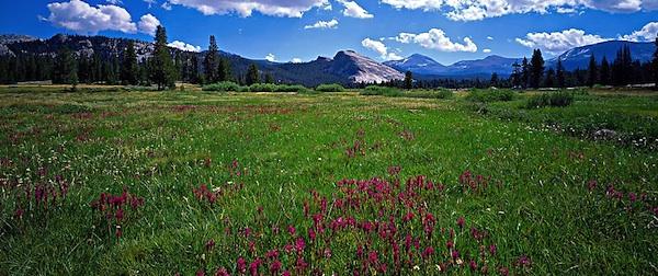
A management plan for the Tuolumne Wild and Scenic River in Yosemite National Park promises to better protect the Tuolumne Meadows area. Photo by QT Luong via www.terragalleria.com/parks.
Parking in national parks can always be precarious at times and damaging to natural resources (see Zion National Park), and the high country of Yosemite National Park is no exception, as visitors faced with full parking areas often resort to parking on the shoulders of the Tioga Road.
Yosemite officials are looking to tackle that problem via the preferred alternative in their Tuolumne Wild and Scenic River Final Comprehensive Management Plan and Environmental Impact Statement. In that document the officials lay out their intention to ban roadside parking. Instead, visitors will be "directed to designated parking lots in less visible and less sensitive upland areas nearby with a limited number of scenic viewing pullouts retained. The total amount of parking will increase slightly."
While some additional parking will be available, park officials also are using the ban on roadside parking to create a user capacity for the popular Tuolumne Meadows area.
"... under all alternatives a visitor capacity will be enforced to protect the quality of the visitor experience from increasing congestion, as well as protecting other river values from visitor use related impacts," the plan's executive summary says. "The day use capacity will be managed through the availability of day parking and through the capacity of the buses that serve the Tuolumne River corridor, while the overnight capacity will be managed by the number of lodging units, campsites, and wilderness permits."
Kathleen Morse, the lead park planner, said under the plan connector trails will lead from parking areas to trailheads and so keep hikers from walking along the road.
"The plan will re-locate parking for the Cathedral Lakes trailhead at the existing visitor center and provide a connector trail from parking to the trailhead. This will eliminate the concentration of roadside parking for this use and provide safe access," she said in an email. "A new visitor contact center would then be located closer to existing visitor services, campground, etc. It would be co-located with the trailhead for another popular trail (to Parsons Memorial Lodge).
"Finally, small amounts of parking would be added to areas that currently provide access for other trailheads. These solutions prevent further meadow encroachment while guiding access to popular locations without requiring people to park or walk along Highway 120."
This plan comes, relatively, on the heels of the park's Merced River Plan, which addresses the human footprint in the Yosemite Valley. That plan, released in February, would restore nearly 200 acres of meadow and riparian areas along the Merced River, remove another 6,000 linear feet of riprap along the river, and create a 300-vehicle satellite parking lot in El Portal with shuttles taking visitors into the valley. It also would allow a nearly 40 percent increase in campsites, to 640 (which still is below the 828 that once existed in the iconic valley), and a 5 percent boost in lodging.
The Tuolumne plan also calls for restoration work, of 171 acres of meadow and riparian areas in the river corridor and 2 acres of upland habitat. It also aims to erase social trails that dart across the meadows, improve wastewater treatment facilities, improve water conservation in the area, move Tuolumne Meadows campsites at least 100 feet from the river, and reduce stock use by ending daily concessionaire rides.
Limited whitewater boating will be allowed on a trial basis, through the Grand Canyon of the Tuolumne from Pothole Dome to Pate Valley. However, the park notes that, "few boaters have the requisite skills to float this advanced stretch of whitewater, and all boaters would not only have to carry their boats about 3 miles to the put-in but would also have to carry them up 4,000 feet (over about 8 miles) from Pate Valley to the White Wolf trailhead."
You can find the entire river plan here.
The Tuolumne River was designated a Wild and Scenic River by the U. S. Congress in 1984 to preserve its free flowing condition, water quality, and outstandingly remarkable values. Under the Wild and Scenic Rivers Act, Yosemite National Park is required to develop a management plan to protect and enhance the 54 miles of the Tuolumne River that are within the park boundaries.

 Support Essential Coverage of Essential Places


