It's not often that I'm stopped in my tracks by a product. After a quick loop through our local REI in Salt Lake City a while back, I headed over to International Mountain Equipment just a few doors away. This small shop is the real deal for climbers and outdoors people. It's the type of store that sells things you'll use for decades until they wear out. So, as I looked over some climbing nuts and harnesses I spotted a book on the glass counter: the 3D Atlas of Zion National Park in Utah. Sounded interesting.
Now, as a former aerial navigator in helicopters, I admit I'm map crazy, and I donned one of the two pairs of red/cyan glasses which are provided and flipped open the book.
To me it seems that the 3D movie craze is winding down, as patrons realize that it's a bit gimmicky and often detracts, not enhances the film. The one exception, in my opinion, was the space adventure Gravity - probably because it's the closest I'll ever get to being up there, plus the 3D was applied with a deft hand.
So, when I opened this book, published by Steven L. Richardson and his son, Benjamin M. Richardson, I was blown away. I know Zion very well. As a Utah native I've spent decades exploring and hiking and climbing its canyons, wading through its waterholes, swimming the Virgin River, and hiking across the mesa tops. So to see my stomping grounds from above in full relief was thrilling.

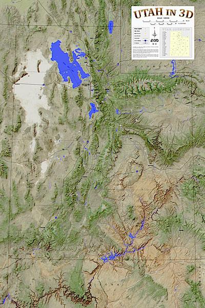
With 3D glasses, included with the book, this state map of Utah really jump out.
There are 39 topographic maps in 86 pages, covering all of Zion, each paired with aerial photographs on the facing page. The scale is 1:24,000 and there's an introduction that explains how they created such great 3D graphics.
This 3D really, really works. The fins pop up, the canyons are slots, and the steep walls drop away.
I was mesmerized. What a great way to recon a trip, plan a route, and get an overview.
The book is printed on 100 pound coated paper, spiral-bound so the pages lay flat. This book is always going to accompany me from now on in Zion, and I'll be using it to plan a foray into the Checkerboard Mesa and the South Fork of the Virgin River this fall.
But, wait, there's more.
The Richardson's company, 2i3D Stereo Imaging (meaning 2eyes for 3D), has also published a Tri-Canyon book, which covers the Mill Creek, and the Big and Little Cottonwood canyons east of Salt Lake City, and is perfect for climbers, backcountry skiers, hikers, and map nuts.
They've also created, but not yet published, books on Bryce Canyon and Yosemite national parks. But they do have posters of Yosemite Valley, Rocky Mountain National Park, Mount St. Helens, and Grand Teton National Park, which are very well done.
Until there's 3D without glasses, this is as good as it gets.
The Zion book is available at two of the Zion Natural History Association gift shops in the park. Books and posters are also seen at Utah ski resorts and outdoor shops, but you can visit the company's website at www.2i3D.com, or write to 2i3D Stereo Imaging, 7425 W. 3500 South, Magna, Utah 84044 to order them.
Obviously I'm be collecting the whole set.


 Support Essential Coverage of Essential Places


