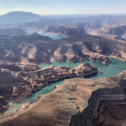
The changing landscape at Glen Canyon is being documented in a new Living Atlas/NPS, Gary Ladd

With a years-long drought gripping the Southwest, the landscape at Glen Canyon National Recreation Area is in a constant state of change. Of course, the most dramatic change came when the Colorado River was dammed in 1963 near the Utah-Arizona border, flooding the red-rock gorges to create Lake Powell. But with recent water shortages, the reservoir has begun to recede and canyon walls are being exposed for the first time in decades.
To document the re-emergence of the canyon, the Glen Canyon Institute has launched the Glen Canyon Living Atlas to provide a virtual tour of restoring areas in the canyon. With cooperation from National Geographic Maps and numerous Glen Canyon explorers, the Living Atlas is an ongoing “story map” that presents a series of geo-referenced photographs and hiking trails. The map includes photos from the past 13 years, highlighting the transformation that's taking place.
The Glen Canyon Institute will update this map with new photos and information in the years to come, and encourages volunteers to submit photos and observations to [email protected].


 Support Essential Coverage of Essential Places


