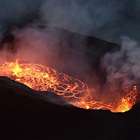
The view from Chain of Craters Road/Eric Fandick via NPS
Editor's note: The following is an unedited release from Hawai'i Volcanoes National Park.
The newest lava from Kīlauea volcano is drawing visitors to Hawai‘i Volcanoes National Park, as flows from Pu‘u ‘Ō‘ō vent in the remote east rift zone stream down the Pulama Pali, spread onto the coastal lava plain and slowly advance towards the Pacific Ocean.
Although portions of the flows are within the park, the closest viewing is from the County of Hawai‘i Kalapana Lava Viewing Area off Highway 130, near the eastern border of Hawai‘i Volcanoes. The viewing area is open daily from 3 p.m. to 9 p.m.
From the park side, the easiest vantage point to view the flows, dubbed “61G” by the USGS Hawaiian Volcano Observatory, is at the end of Chain of Craters Road, past the Hōlei Sea Arch, where the pavement ends and the gravel emergency access road begins. The park is open 24 hours a day.
Park rangers do not encourage visitors to hike out to the lava flows from either side, but to instead view them from a safe distance. From the park side, hikers can expect a grueling 10-mile roundtrip hike over very uneven and sharp lava rock terrain riddled with earth cracks. There is no trail, and it’s easy to get lost after dark.
“There’s definitely been an increase in injuries since the 61G lava activity amplified,” said Chief Ranger John Broward. “We responded to calls about turned ankles, lacerations, dehydration, and disoriented visitors in the coastal lava plains all weekend. It’s exceedingly important to plan ahead, have proper footwear, and bring plenty of water, or better yet, enjoy the show from the end of the road on either side,” he said.
Volcanic gas is another hazard, particularly to people with heart or respiratory problems, and infants, young children and pregnant women. If air irritates smells bad or makes breathing difficult, Broward said visitors should leave the area.
Although hikers are walking along the gravel road constructed as an emergency access route to access the flows, park management does not encourage its use.
For hiking tips, visit the park website https://www.nps.gov/havo/planyourvisit/upload/Hiking-Tips.pdf. For the latest eruption updates, visit the USGS Hawaiian Volcano Observatory website: http://hvo.wr.usgs.gov/activity/kilaueastatus.php. Monitor air quality at http://www.hawaiiso2network.com/


 Support Essential Coverage of Essential Places


Add comment