A Promising Future For Katahdin Woods and Waters National Monument

Mount Katahdin is ever-present from Katahdin Woods and Waters National Monument/George Wuerthner
Editor's note: Erika Zambello, a National Geographic Young Explorer, has spent time in all four seasons in the Maine North Woods landscape that now is Katahdin Woods and Waters National Monument. After the designation was bestowed, she caught up with Lucas St. Clair and discussed the immediate future of the new monument.
It was my last day in the Maine North Woods for my National Geographic Young Explorer grant. I paddled on Munsungen Lake, a headwater to the famous Aroostook River. The lake’s shoreline, rising from the water in sand and small rocks, bordered stands of young forest, including bright white birch trunks that stood out from the dark green shades of the surrounding woods. Here and there, a tall tree stood above the rest, perhaps a remnant of an older forest.
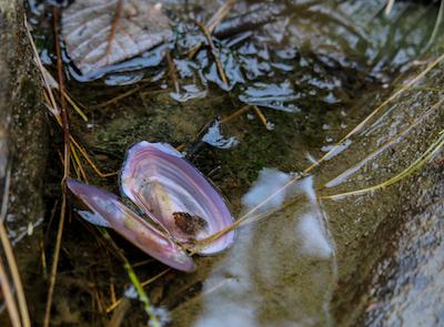
A freshwater mussel shell lies on the banks of the headwaters of the East Branch of the Penobscot River/Erika Zambello
The water was so clear that I could see at least 20 feet down, and in the shallows, the soft mud was peppered with the shells of freshwater mussels. In front of our bow, blue and green mountains rose above the edge of the lake, forming a beautiful vista that I could not stop photographing.
As we floated, I closed my eyes, feeling the warmth of the August sun and the light breeze forming tiny waves on the water. I wanted everyone to experience this moment.
Almost exactly a year ago, I embarked on a series of expeditions as a National Geographic Young Explorer, experiencing first-hand both recreational opportunities and conservation issues in the Maine North Woods in each of the four seasons. On my first trip, I stood within the 87,500 acres that have just become the Katahdin Woods and Waters National Monument. My fall expedition was focused on the headwaters of the East Branch of the Penobscot River, and I had followed the waterway from its emergence through a series of larger and larger ponds and lakes, until it eventually flowed through the new national monument. Though it was late September, much of the canopy remained green, casting dappled shade on the trails I followed near the river. Here and there flashes of crimson, or a golden leaf upon the path, announced the coming of the fall season.
It has taken years and years for the idea of the Katahdin Woods and Waters National Monument to become a reality. Lucas St. Clair, president of the board of Elliotsville Plantation, Inc. (which also funded my expeditions), has worked tirelessly towards this moment. “I’m really excited for [the people] and for me that I was able to help and contribute to a potential new era of life in the Katahdin region and be able to start helping diversify the economy," he told me.

Erika Zambello, a National Geographic Young Explorer, has spent time in each of the four seasons in the landscape now protected as Katahdin Woods and Waters National Monument/Courtesy photo
Along the same vein, Lisa Pohlmann, executive director of the Natural Resources Council of Maine, noted that President Obama's designation of the monument through his authorities under The Antiquites Act “also was made possible by the leadership and vision of residents from across Maine, and particularly from the Katahdin region, who helped shape and support the monument proposal and worked tirelessly to make it a reality. At a time of economic hardship due to the closure of many paper mills in Maine, this new national monument will help boost and diversify the economy of the Katahdin region and provide new jobs and investment opportunities throughout Maine.”
The designation was not without contention. When I visited, signs opposing the national monument were common, and the decision will be both positive and negative news to people throughout Maine. Part of the concern over the designation stemmed from questions of access to the land, but St. Clair stressed that going forward “we’ve guaranteed the snowmobiling and hunting on the parcels that it’s already allowed, in perpetuity. It’s definitely going to be part of the monument, it will definitely be allowed still.”
However, the announcement from President Obama is not the end of work for St. Clair and other proponents, but only the beginning. Moving forward, St. Clair spoke of the need for a general management plan, and the arrival of a trail-building team within the next year or so to build “onto the system of trails that’s already there.”

Moosehead Lake, located in the North Woods, is part of the Kennebec Lake headwaters system./Erika Zambello
Moreover, “We’re going to put together a fundraising team, and that’s going to be a big effort of the foundation over the next few years…to put together a plan and think about how we’re going to raise that money," he said. "It’s going to be a heavy lift, but you know the nice thing about it is that there’s a lot of people that care really passionately about the national parks and so we’ll be able to really dig in and try to get it done as quickly as we can.”
There are additional benefits to the fundraising campaign, especially from a communication perspective. “In trying to raise the funding,” he explained, “we’ll be able to bring people up to the landscape and show them the resource, and that’s one of my favorite things to do.”
The Katahdin Woods and Waters National Monument has a long history of human-environment interaction, from the Native Americans to Henry David Thoreau to the conservation movement in general, St. Clair noted, going on to talk about the beauty of the watershed and the East Branch of the Penobscot River, of the giant Atlantic Salmon that were found in the remote parts of the forest.
“It’s an incredibly beautiful place that has its own heartbeat in a lot of ways,” he added, including “bringing the energy from the ocean all the way up into the forest.”
I agree. I had an amazing experience on the lands now designated as a national monument, But now I wonder: what will happen to the rest of the North Woods?

Beavers are only some of the many species of wildlife visitors can spot in the new monument/Erika Zambello
Throughout my expeditions, I visited the headwaters of the Penobscot River, the Kennebec River, the Saint John River, the Allagash River, and the Aroostook River. I saw moose, fox, birds, fish; I discovered colorful wildflowers and huge hemlock trees; but I also realized that the North Woods are not “pristine,” but working forests, both today and in centuries past.
As Pohlmann continued in her statement, “the Katahdin Woods and Waters National Monument will be protected for the ages as a place where visitors can sit along the pristine shores of the East Branch of the Penobscot River, camp under the dark skies of Maine’s North Woods, watch the sun set behind majestic Mount Katahdin, learn about the region’s history, and explore the area’s woods and waters in hopes of seeing a moose, loon, or Bald Eagle.”
But my question remains, what about the rest of the Maine North Woods? How can we preserve the resiliency of the region?
These are questions that must be answered in the future, and it is my hope that by trips into the new national monument, Mainers and visitors alike will fall in love with the North Woods as a whole, as I did, and support sustainable forestry and conservation initiatives.
Erika Zambello is a writer, birder, photographer, and National Geographic Young Explorer living and working along the Emerald Coast of Florida. She has a master’s degree in environmental management from Duke University, specializing in ecosystem science and conservation. Erika believes in the power of communicating conservation, and she has written for BirdWatching Daily, 10000birds.com, the Conservation Fund, Triangle Land Conservancy, the Maine Sportsman, and more. You can follow her adventures on zambellophotography.com or on Instagram at @a_day_in_the_landscape.
Katahdin Woods And Waters National Monument, A Video Sampler From Down East Magazine
Alongside the Rockefellers, Mathers, and Mellons, We Now Add Quimby
That headline is not a gesture of hyperbole. Not after Roxanne Quimby's latest gift to the country, the 87,500-acre Katahdin Woods and Waters National Monument.
Stephen Mather, the first director of the National Park Service, used a vast amount of his personal fortune to give the National Park System a hand up. Yosemite National Park visitors can thank him whenever they drive the Tioga Road, and the thousands of rangers who spent time in the Rangers' Club in Yosemite Valley can thank him for that wonderful lodge.

Stephen Mather paid nearly $40,000 to build the Rangers' Club in Yosemite/NPS
Rockefellers -- John D. Rockefeller, Jr., at the lead -- donated vast sums to expand and strengthen the park system, with their dollars invested in museums in Mesa Verde National Park, Yosemite, Grand Canyon National Park, Lassen Volcanic National Park, and Yellowstone National Park. And, of course, we owe John D. Rockefeller, Jr., for today's Grand Teton National Park, and the Carriage Roads in Acadia National Park. Laurence S. Rockefeller, his son, continued the philanthropy in the parks, with contributions that helped launch Virgin Islands National Park and Great Smoky Mountains National Park. The list goes on, touching Glacier, Big Bend, Haleakala, Olympic, Rocky Mountain, Shenandoah and other units.
The Mellon family's contributions went towards surveys of national seashores and lakeshores, land for Cape Hatteras National Seashore as well as Cumberland Island National Seashore, and the Richard King Mellon Foundation donated substantially to such Civil War parks as Antietam, Fredericksburg and Spotsylvania, Gettysburg, and Petersburg.
Roxanne Quimby and her children, Lucas St. Clair and Hannah Quimby, are just the latest Americans who have dug deeply into their personal fortunes to move the National Park System forward. For years Roxanne worked to see a national park sprawled across the rumpled and river-cut North Woods of Maine, and her son, Lucas St. Clair, brought her vision to fruition. Their donation of the land that President Obama bestowed national monument status upon on August 24 was just the most visible, and certainly the largest to date, philanthropic gesture by this family. It quickly overshadowed the 100 acres of land scattered in and about Acadia National Park that she donated to the park a week earlier.
U.S. Rep. Rob Bishop of Utah couldn't have been more wrong when he charged that President Obama was "subverting the will of Maine's citizens" turning Ms. Quimby's generous gift into a national monument.
Voters in Maine's Second Congressional District, in which the new monument is found, overwhelmingly supported the move, as did the Bangor City Council and the towns of Millinocket, East Millinock, and the Penobscot Indian Nation, more than 200 business owners who wrote their congressional delegation in support of the move, and the state's leading newspaper, the Bangor Daily News.
U.S. Sen. Angus King of Maine, an Independent, had this to say about the designation:
"...the benefits of the designation will far outweigh any detriment and – on balance – will be a significant benefit to Maine and the region. This conclusion is confirmed by the comments made by Secretary of the Interior Jewell shortly after the designation was announced, explicitly mentioning hiking, canoeing, fishing, snowshoeing, snowmobiling and cross country skiing.
“It is critical to see this as an opportunity fully compatible with our existing forest products industry, including potential growth in woods-related businesses. This isn’t either-or, it’s both – and will provide much-needed diversity to the region’s economy."
National park philanthropy is not a misguided or evil practice, as Rep. Bishop would have us believe. Indeed, in these days of a broken Congress, it, along with The Antiquities Act, just might be the best way to preserve, and continue to evolve, our National Park System. -- Kurt Repanshek, editor, National Parks Traveler
Ready To Visit The Monument? Get A Primer From Down East Magazine
The lands comprising the Katahdin Woods and Waters National Monument are a rugged, underexplored playground for outdoor adventurers — and the years to come will see their further development as a recreation destination. Already, the folks from Elliotsville Plantation, Inc. (EPI), Quimby’s land-stewardship foundation, have been busy cutting trails, clearing scenic overlooks, installing signage, and building new campsites in preparation for the anticipated transition to NPS management. In recent years, Mainers’ debates over the benefits of that transition have been reported ad nauseam. Enough of all that: Here’s how to beat the coming crowds, head up north, and enjoy one of Maine’s unpolished jewels.
Click here to get the rest of the story.
Additional Resources To Kathadin Woods and Waters National Monument
Katahdin Woods and Waters National Monument: www.nps.gov/kaww, 207-456-6001
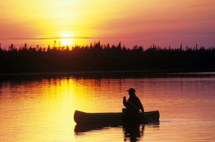
Visitors can continue to enjoy traditional activities, including canoeing, kayaking, hiking, bird watching, fishing, cross-country skiing, snowshoeing, snowmobiling on designated trails, and hunting on lands east of the Penobscot East Branch.
Helpful books:
The Survival of the Bark Canoe
John McPhee is one of the 20th century’s great storytellers, and paddlers shouldn’t overlook the stories he writes about Henri Vaillancourt’s talents for making birch-bark canoes. But this book goes beyond knitting together overlapping layers of bark with lacings of spruce or white pine roots and pitch, taking us on a 150-mile canoe trip through the Maine woods.
Canoeing Wild Rivers, 30th Anniversary Edition
This seminal book on wilderness paddling by Cliff Jacobson is the canoer’s bible. It covers everything from how to pick a river and how to pack for your paddle to how to pick a crew that won’t disappoint you when you’re running downstream in a rainstorm.
Comments
I'm not very impressed by another NPS unit with snomobiles, hunting, and a development agenda. So much for that so-called 'gold-star' level of preservation. What next to appease the locals, trapping and wood gathering? This generous donation of land might have have been better directed to the adjacent and more-protected Baxter State Park.
I want to correct some misconceptions by commenters.
Assuming that because these lands were accessible and relatively intact in the past ignores what has been happening in the Maine Woods in recent decades. Ownership of almost the entire region has changed hands in the last 25 years. The old-style timber and paper companies are almost totally gone, mostly replaced with speculators and real-estate development firms based far from Maine.
The largest Maine landowner today is J.D. Irving Ltd., a Canadian privately held company known for its intensive industrial logging practices. One of the other largest owners is Weyerhaeuser Inc., based in Seattle -- which recently bought out Plum Creek Corporation -- a company that is also notorious for unsustainable logging in the West. These companies have no long-term interest in protecting the Maine Woods or allowing public access. In fact, they are proposing major new real-estate developments, open-pit mines, and other industrial activities that will degrade and reduce public access.
If the current trajectory continues, it is only a matter of time before all the lakes, streams, scenic views, and other desireable lands in the Maine Woods are acquired by development interests and posted as off-limits to the public. The only way to ensure long-term protection of the area's ecological integrity and public access and recreational use is through public acquisition of the most important parts of the region and designation of new national parks and other protected lands.
Regarding the idea of adding the land to Baxter State Park, this was not an option. The state does not want more lands to care for, especially with the state government run by anti-environmental Governor Paul LePage. Moreover, the Quimby family did not want to just add their lands to Baxter Park. This would have little or no benefit in helping to boost the local economy, a major goal of their protection efforts. Baxter is beautiful, but it is virtually unknown outside Maine and even with an expansion would not draw significant numbers of new visitors.
Also, Baxter is well-protected overall, but it is not all wilderness. About 14 percent of the park allows logging and 25 percent of the park allwows hunting and trapping http://www.baxterstateparkauthority.com/about/history.htm. Snowmobiling is allowed on Baxter's Tote Road http://www.baxterstateparkauthority.com/outdoors/snowmobile.htm. So Baxter is similar to the new National Monument in the way most of it is managed, and even less protected in the case of the area open to logging.
Thanks for the information, Michael. And for the ongoing work of RESTORE.
The state doesn't run Baxter State Park and they have no authority over it. Baxter Park does have logging, but this was included in the original charter and they do this for forest scientific reasons, not to make money.
You're glad the Appalachian trail is federally protected? That trail has more trail destruction and erosion than any other trail in the world. Baxter State Park has stricter environmental rules than the National Park Service, who feel that it's acceptable to put a massive parking lot on the top of Cadillac Mountain in Acadia NP. How is this a good thing?