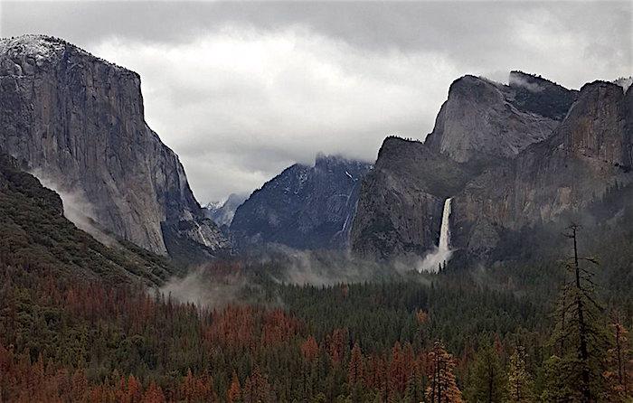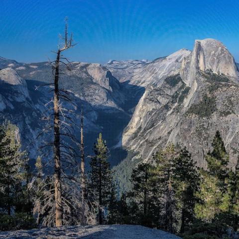
The Yosemite Valley was scheduled to reopen to the public at 8 a.m. Tuesday/NPS
Editor's note: This updates with the Yosemite Valley reopening to the public on Tuesday, lodging and commercial services to resume operations Wednesday.
In the end, the forecast was wrong. While the Merced River did rise above flood stage as it rolled through the Yosemite Valley, predictions of a crest more than 8 feet above flood stage never materialized, leaving Yosemite National Park's main destination drenched but seemingly little worse for the storm.
After checking the valley for damage, park officials announced that the valley could reopen to the public on Tuesday at 8 a.m. but stressed that there would be limited services.
"There is no access to Yosemite Valley via the El Portal Road (Highway 140) due to a rockfall that occurred early this morning. There is no estimated day or time for the road to reopen. The Hetch Hetchy Road is also closed due to a rockfall," park spokesman Scott Gediman said in an email.
Overnight accommodations and commercial services in the Yosemite Valley were to resume on Wednesday, while campground operations would resume Tuesday night.
Early Monday morning the gauge on the Pohono Bridge on the west end of the valley showed the river had peaked at 12.7 feet before starting to drop. Weather forecasts leading into the wet weekend carried predictions that the Merced would crest at more than 18 feet, or 8 feet above flood stage. That never happened as the storm veered to the north.
According to Mr. Gediman, "(A)lthough there was no major flooding in Yosemite Valley, both roads and infrastructure (water systems, sewer systems, etc.) were impacted."
"Park visitors are asked to be aware of hazards, including potential wet and icy road conditions, rockfall, and debris in roadways," he added. "The park has experienced significant rainfall over the past month and ground saturation could lead to hazardous conditions along park roadways."


 Support Essential Coverage of Essential Places


Comments
Hopeful news.
Yosemite had horror-show flooding in 1997, I think. It's good that they avoided flooding this time.
Also, if you want to see rockfalls, there is your national park.
Yes Steve, things looking good so far, great job by NPS employees. The weather cooperated also. Still have rain in forecast for tonight and tomorrow, but snowline dropping. The waterfalls are spectacular.
All those dead trees! I take it the drought was not kind to Yosemite's forests...
Yes, very interesting situation. Particularly hard hit are the seven western Sierra foothill counties, 3000 feet to 7500. Cedars, Ponderosa and Sugar Pine chief mortality. Many oaks lost, but they and the Digger Pines seem to be holding their own now. All this rain and snow is helping. There is a top notch forester assigned to Yosemite, he is very well versed on the issue.
Thanks Ron, I read an article recently that stated over 100 million trees have died in the forests of California from the latest 5 year drought that is estimated to be one of the worst in 1200 years. It's mindboggling to think of the reprucussions and changes to the forest this will have in the future.
Gary, a huge issue. Both Dr. Pyne's book "Between two Fires" and Tom Ribe"s book. "Inferno by Committee" deal in depth with much of the history of forest management and what we can do restore forest health. Interestingly enough, the University of California at Berkeley did several transects on a 15,000 acre parcel on the northwest border of Yosemite in the Stanislaus National Forest. This done in 1910, measurements were for dead and down biomass per acre, tree density per acre and tree diameter. The area chosen had not been logged and fire intervals had not to impacted. In 2010 they went back and ran the transects again. In 1910, dead and down per acre was 6-9 tons, in 2010 it was 60 plus tons. 1910, tree density was 60-90 per acre, in 2010, 400 plus, tree diameters shrunk. As both Dr. Pyne and Mr. Ribe point out, this has much to do with the fire suppression efforts of the last 100 years. Unfortunately this area burned up in the Rim Fire of 2013. Of course drought also had something to do with the recent tree mortality, as has climate change. The Grinell survey was also done a 100 years later and generally speaking the plants and animals are moving up. In any case, a complicated issue but the above books are extremely educational.
Thanks Ron, the parallels are eerily similar in the southern Appalachians as well. From the recent fire, certain forest types like Northern Hardwoods, that are not fire adapted and exist at the southern most extent of their range were incinerated in many areas. In theory, we could very well witness the advancement of fire adapted species that are more common in lower elevations encroach into these regions. I did order Inferno by Comittee a week ago, and i'm still waiting for it to arrive. And since I was planning on visiting family in New Mexico, I also plan on visiting Bandelier NM earlier this spring with hopes to dig through some archives. I appreciate your feedback on this topic.