
Sunrise at the summit of Haleakala/Asa Ellison
Haleakalā National Park in Hawaii is both relatively young (58), and pretty old (102). How can that be?
In 1916 Congress created Hawaii National Park, and packaged both today's Haleakalā and Hawai'i Volcanoes national parks under that umbrella. The goal back then was to add to the National Park System sites with active volcanic activity as well as dormant and extinct volcanoes. It took until 1960 for Congress to realize that each of those areas deserved to stand alone as individual national parks.
While Haleakalā hasn't been as explosive as its sibling since about 1790, it is considered to be a dormant, not extinct, volcano. More specifically, Haleakala is a "shield" volcano that currently rises to 10,023 feet, though it's thought it once stood another 5,000 feet taller.
The park, which takes its name from the Hawaiian word for "House of the Sun," is divided into three areas: the Summit Area (mountain), Kīpahulu Area (coastal), and the Wilderness Area (mountain). Each region displays its own beauty and unique qualities; however they all offer a multitude of activities for visitors of all ages.
If you enjoy hiking, the Summit Area features more than 30 miles of trails broken down into short, long, and overnight wilderness hikes that show off this part of Haleakalā. You can hike for a half hour or all day, but wherever you head, go prepared for varying conditions. Hiking at the very top of the park, for instance, can wrap you in temperatures 30 degrees cooler than what you'll experience along the coast.

There are many cinder cones in the Summit District/David Schoonover
This lofty landscape presents some unique high-elevation ecosystems. The very roof of the park has been described as a "moonscape" due to the craters of past volcanics that built the Hawaiian islands. Trails lead to the lip of the Haleakalā Crater at 10,023 feet. From there you can gaze down nearly 3,000 feet to the floor of the crater. All about you are rich ruddy soils and hardened lava flows that reflect past eruptions.
One of the most popular activities on the summit, indeed, in the entire park, is watching the sunrise. So popular is this activity that the park had to limit, through a reservation system, how many people could watch. Reservations are now available, online only, up to 60 days in advance of your sunrise visit. You can call the reservation line at 1-877-444-6777 to make a reservation ($1.50 per vehicle) over the phone.
If you decide to hike in the Summit Area, bring some binoculars, for this is a great place for bird watching, given the plethora of species and breathtaking desert landscape that will surround you. Most of the birds you'll see are not native to the island, but late arrivals. Species you might spot include Skylarks, finches, Cardinals, and even Ring-neck pheasants, which like the grasslands.
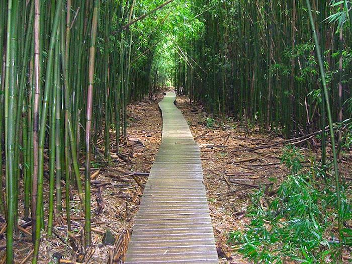
The Kīpahulu Area offers a half-day hike to explore the lower pools and coastline, or a more extreme option, the all day hike, to adventure through the upper pools, waterfalls, and bamboo forest. This region is great for photography, hiking, and gaining some insights on native Hawaiian culture through programs offered at the visitor center.The rainforests and freshwater streams and pools create a tropical setting and display many ways in which the Hawaiians have interacted with the land for hundreds of years. The hiking here is self-guided and very rewarding.
The Pipiwai Trail is a popular path in the Kīpahulu District/NPS
No visit to the Kīpahulu Area is complete without a walk down the Pīpīwai trail, which extends 4 miles through the 'Ohe'o Gulch (which some refer to as the Seven Sacred Pools area) and ends at the 400-foot Waimoku Falls. Worried about the tropical weather making it too hot to hike? Many visitors swim in the lower pools to cool off before, after, or even during long hikes to give themselves a break.
(Traveler note: The Pools of `Ohe`o have been closed to the public since January 2017, when a visitor received minor injuries from a rockslide attributed to saturated soils. Stabilization work was to have been completed earlier this year, but the area remains closed.)
The Wilderness Area will have you feeling as if you are on top of the world. This region encompasses the bulk of the 29,093-acre park and includes several microclimates, which can lead to some extreme climate changes. Differing from the mountains of the Summit Area, this part of Haleakalā is full of brown and red cinder cones towering hundreds of feet into dry, cold desert air.
This area can be accessed by two mountaintop trailheads: Halemau’u Trailhead at 8,000 feet and Keonehe’ehe’e, also known as the Sliding Sands Trailhead, near the summit at 9,740 feet. Eventually, both trails merge and lead down the southeast side of the volcano to the unpopulated coast in the Kaupō district.
To provide some simple comforts during extended explorations of this section of the park, you might want to rent one of backcountry cabins. To reach the cabins, which offer plank bunkbeds, you must hike a minimum of 3.7 miles from the Halemau'u Trailhead the to Hōlua Cabin, 5.6 miles from the Haleakalā Visitor Center to the Kapalaoa Cabin, and 9.3 miles from the Haleakalā Visitor Center to the Palikū Cabin.
"Hōlua Cabin, the closest cabin, lies at 6,940 feet (2,115 meters) in the shrubland near Koʻolau Gap, 3.7 miles down the Halemauʻu Trail or 7.4 miles down Keoneheʻeheʻe Trail. Visitors staying at Hōlua can enjoy day hikes into the central Wilderness Area. The landscape around Hōlua supports a native shrubland which colonized the lava flows. There is also a campground at Hōlua.
Kapalaoa Cabin, 5.5 miles down the Keoneheʻeheʻe or 7.3 miles from Halemauʻu Trailhead, lies at the base of the cliffs on the south side of the valley. The view from Kapalaoa takes in brightly colored cinder cones, subalpine plants, and dramatic cliffs.
The ʻuaʻu, or Hawaiian petrel. NPS photo.In the spring and summer months, the endangered ʻuaʻu (Hawaiian dark-rumped petrel) can occasionally be heard and seen near the high cliffs. This cabin lies at 7,250 feet (2,210 meters). There is no campsite near Kapalaoa cabin.
Palikū Cabin, at 6,380 feet (1,945 meters), is at the east end of the wilderness valley at the base of a rain forest cliff. The cabin is reached via a strenuous 9.3-mile hike on Keoneheʻeheʻe Trail, 10.1 miles on Halemauʻu Trail, or 8.6 miles up the Kaupō Trail.
Clouds and fog often roll over the top of the cliffs behind Palikū. The extra moisture makes this spot exceptionally cool and lush. There is also a campground at Palikū."

With a little planning and some good trail maps, you can piece together a great loop hike of several days. From the Sliding Sands Trailhead near the Haleakalā Visitor Center you can head east 5.6 miles to the Kapalaoa Cabin, and then on to the Palikū Cabin 3.3 miles away, and return via the Halemau'u and Sliding Sands trails, a trek of about 10 miles. Along the way you'll pass a few volcanic craters that dot this landscape.
 flowers. The flowers are engineered to fit the curved beaks of birds like the i'iwi and the nukupu'u, who sip nectar from the flowers and in turn pollinate them. NPS Photo")
In the upper reaches of Kipahulu Valley, an endemic Lobelia grayana ('oha wai) flowers. The flowers are engineered to fit the curved beaks of birds like the i'iwi and the nukupu'u, who sip nectar from the flowers and in turn pollinate them/NPS
Kipahulu Scientific Reserve
A fascinating region of the park, but one that is closed to most public entry, is the Kipahulu Scientific Reserve. This area, which covers the eastern third of the park, includes two broad valleys bordered by steep walls, not unlike a box canyon.
"In 1967, a group of scientists sponsored by The Nature Conservancy made a preliminary exploration of the remote valley. They discovered rare native Hawaiian birds, one previously considered extinct (the Nukupu`u), and made sightings of the very rare Maui Parrotbill," notes the Park Service on Haleakalā's website. "Ninety percent of the plants they recorded were native. They found 75 species of ferns and fern-allies, all but one native to Hawaiʻi, and recorded a dozen species of native lobelias, all unique to Hawaiʻi. They concluded that the valley was outstanding from a botanical and ecological standpoint and should be preserved.
"Through effort of TNC and Laurance Rockefeller, Kīpahulu was added to Haleakalā National Park. The upper valley is currently managed as a scientific preserve with entry restricted to resource managers and scientists conducting management and studies deemed necessary for preservation of Kīpahulu's native ecosystems."


