Storm waters washed over Highway 12 north of Ocracoke/NPS

Hurricane Dorian did substantial damage to sections of Highway 12 on Ocracoke Island/NPS
Cape Hatteras National Seashore and neighboring Cape Lookout National Seashore on North Carolina's Outer Banks largely escaped Hurricane Dorian unscathed, but surrounding infrastructure in some areas could take a while to repair for public use, according to Cape Hatteras Superintendent David Hallac.
North Carolina Highway 12, for instance, suffered substantial damage on Ocracoke Island, with residents and visitors facing the prospect of a lengthy repair.
"Highway 12 on Ocracoke near Southdock is badly damaged along two 500 foot sections, rendering the road unusable," Hallac said Monday. "I watched waves break over the crumpled asphalt during the high tide. We have numerous meetings with (North Carolina Department of Transportation) over the next two days to put our heads together and find a way to restore transportation, but it will take time. This will impact people’s lives. Something as simple as going to the grocery store, doctor, or a high school sports game has now gone from an hour ferry ride to a two-and-a-half-hour boat ride plus travel time from Swan Quarter to a nearby city."
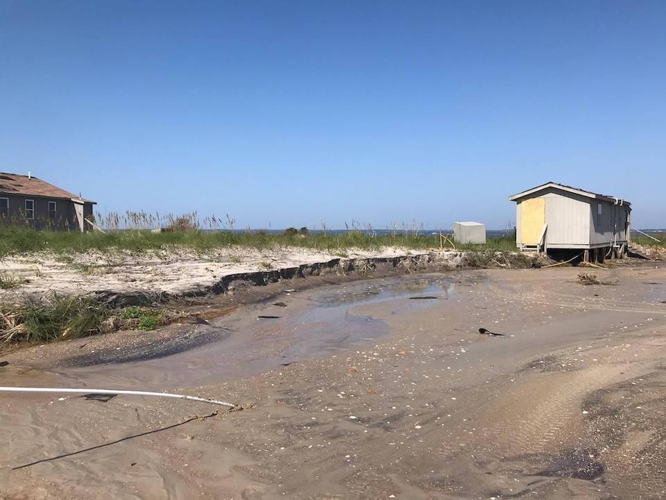
The old storehouse at the Ocracoke Light Station also was lifted off its foundation and moved during Hurricane Dorian. The inside of the building was flooded by several feet of water, the superintendent reported.

Stormwaters floated this Park Service shed off its foundation on Ocracoke Island/NPS
On Hatteras Island, the superintendent said the "dunes were generally intact and beach erosion was unremarkable. Remnants of the storm surge, a surge that many say rivaled the surge during Hurricane Mathew, became increasingly clear the further south we traveled. Most of our visitor areas suffered minor to moderate impacts. Many homes and businesses between Buxton and Hatteras Village were flooded and the high water marks showed several feet of water in some structures."
Though Dorian made landfall on the Outer Banks on Friday as a Category 1 hurricane, purportedly the weakest of hurricane classifications, the storm nevertheless battered the barrier islands in general, and Ocracoke Island particularly.
"District Ranger Ed Fuller brought me through residential neighborhoods to show me the devastation that most of our staff and Eastern National staff have experienced in their homes," Hallac said. "In many cases, everything our staff and Ocracoke residents owns was flooded by several feet of water from Pamlico Sound. I counted over 130 flooded vehicles just in the NPS parking lot across from the Visitor Center; certainly, there are hundreds more on the island."

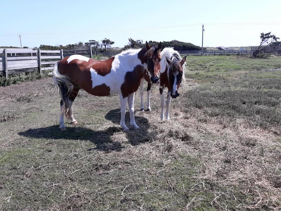
Cape Hatteras National Seashore ponies Lawton and Maya weathered the storm well and afterwards were enjoying some sunshine and fresh hay/NPS
At Cape Lookout, Superintendent Hallac reported that there were "major impacts in locations such as the Long Point cabin camps and historic Portsmouth Village. The National Park Service’s Eastern Incident Management Team will also be supporting Cape Lookout in their assessment of damages and stabilization of park resources."
Park Service response teams have arrived on the Outer Banks and were working to remove downed trees and other debris. On Sunday "they delivered vehicles and generators to Ocracoke and will set up a spike camp on Ocracoke to support recovery efforts," said Hallac.
"Park staff are now working side-by-side with Hyde County and N.C. officials and emergency managers on Ocracoke Island," he added. "Teams have already begun assessments of the park areas including roads, buildings, lighthouses, beaches and dunes. All of these efforts are vital to allowing the park to open for safe and enjoyable experiences to the public."
As the seashores reopen to the public, more impacts of the hurricane could become visible. Past storms have tossed up World War II munitions onto beaches, and revealed old shipwrecks. Shell collectors should have a field day.

Great Island Cabin Camp -- near cabin 1, a breach through the island with erosion/NPS


 Support Essential Coverage of Essential Places


Add comment