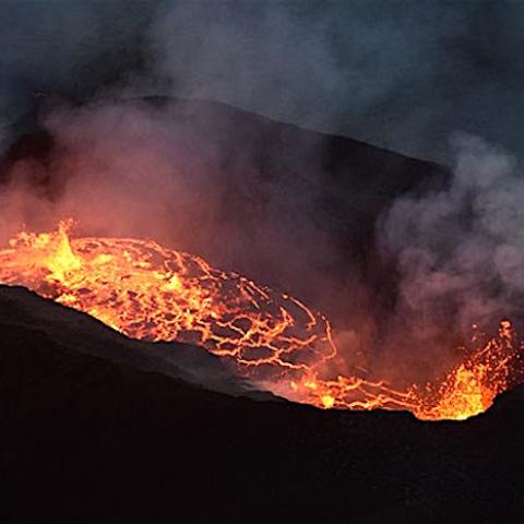
A 4.0 magnitude earthquake shook Hawai'i Volcanoes National Park, but didn't seem to affect the Kīlauea Volcano. This image was taken Jan 11, 2021/USGS
An earthquake with a magnitude of 4.0 rumbled across the island of Hawai'i, though U.S. Geological Survey staff say it had "no observable impact" on the Kīlauea Volcano at Hawai'i Volcanoes National Park.
It was a series of earthquakes in December that preceded the current, ongoing, eruption of Kīlauea. On December 20, the USGS's Hawaiian Volcano Observatory recorded a magnitude-4.4 earthquake located beneath Kīlauea's south flank. The earthquake was centered about 8.7 miles south of Fern Forest, near the Hōlei Pali area of the national park at a depth of 4 miles.
The 4.0 earthquake recorded Thursday evening was located beneath the south part of the Island of Hawai‘i, in the district of Kaʻū. The earthquake was centered about 5 miles northeast of Pāhala, at a depth of 21 miles. A map showing its location is posted on the HVO website. More details can be found at the National Earthquake Information Center website.
According to a USGS release, the temblor caused "moderate shaking, with maximum Intensity of V on the Modified Mercalli Intensity Scale ... across parts of the Island of Hawai‘i. At that intensity, significant damage to buildings or structures is not expected."
According to HVO acting Scientist-in-Charge David Phillips, the earthquake had no immediate observable impact on the ongoing eruption at Kīlauea’s summit.
“This earthquake is part of the ongoing seismic swarm under the Pāhala area, which started in August 2019. Unlike most events associated with this swarm, this earthquake was widely felt across the Island of Hawai‘i, and as far away as Oʻahu," said Phillips. "Please be aware that aftershocks are possible and may be felt."
According to the observatory, earthquakes beneath Kīlauea's lower Southwest Rift Zone occur mostly at depths of 15-25 miles, beneath the town of Pāhala and extending about 6 miles offshore. Earthquakes in this region have been observed at least as far back as the 1960s and are thought to be related to deep magma pathways under the island.
Kīlauea's south flank has been the site of over 30 earthquakes of magnitude-4.0 or greater during the past 20 years. Most are caused by abrupt motion of the volcano's south flank, which moves to the southeast over the oceanic crust.
During 2018, Kīlaeau started erupting in early May and continued into August. Some of the more violent eruptions and lava flows destroyed hundreds of homes and structures below the volcano, redesigned the Halema‘uma‘u Crater, and greatly damaged park infrastructure.


 Support Essential Coverage of Essential Places


Add comment