If you’ve ever taken a physical geology class, you’ll probably remember your textbook containing a chapter devoted to glaciers, how they develop, and the landforms resulting from these massive “rivers of ice.” Tens of thousands of years ago, almost all of Canada and many parts of the United States were covered by the vast, thick Cordilleran Ice Sheet, sculpting the scenery and leaving clues to its existence in the shape of cols, tarns, cirques, hanging valleys, and glacial moraines. If these terms sound pretty foreign, then check out this diagram of a glacier’s anatomy provided by the Washington State Department of Natural Resources. It’s possible you’ve seen these glacial reminders and didn’t know what they were, at the time.
Fast forward tens of thousands of years to the present, where it’s no secret that glaciers everywhere are receding and disappearing at an alarming rate due to current global warming trends. Because of this, different national parks and federal agencies have set up networks of glacial monitoring programs to track these changes. The U.S. Geological Survey has a page on their website specifically devoted to discussion of the retreat of the glaciers in Glacier National Park.
Although glaciers are retreating and, in some cases, almost gone or so small they are no longer considered active (or even considered a glacier any longer), there are still a number of national parks within the U.S. and Canada where you can see, photograph, and even stand on, a glacier (from personal experience, it’s pretty awesome to stand on a glacier).
Let’s check out a few of these parks.
United States
Glacier National Park
There are “roughly two dozen” named glaciers monitored by the USGS in this park, as well as a number of unnamed glaciers and snow fields. Probably the easiest glacier to see is Jackson Glacier, visible from the Jackson Glacier Overlook on the east side of Going-to-the-Sun Road.
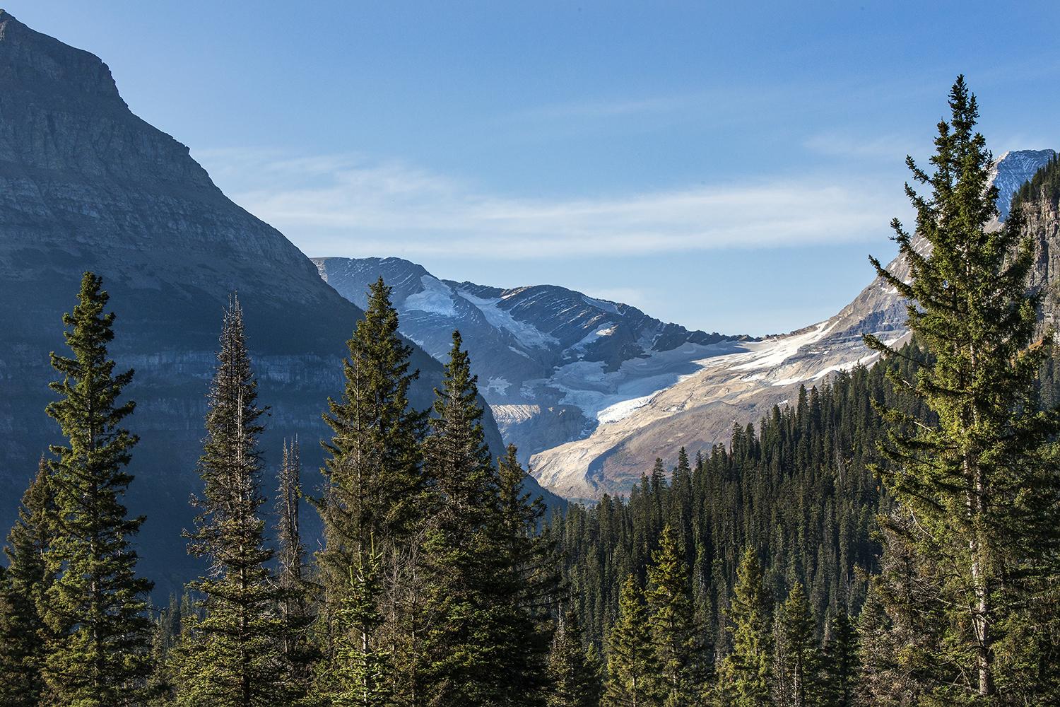
Jackson Glacier, Glacier National Park/NPS,Tim Rains
One of the most beautiful and popular trails from which to see a glacier (imo) is the challenging 10-mile roundtrip hike to Grinnell Glacier, located in the Many Glacier portion of the park.
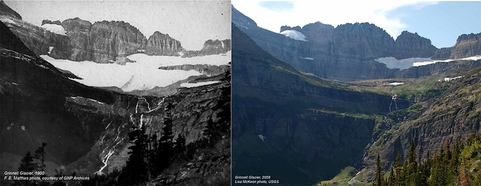
A 1900 and 2008 comparison of Grinnell Glacier, Glacier National Park / NPS-USGS-Lisa McKeon
As you can see from this comparison shot, Grinnell Glacier has receded quite a bit over the decades.
Other glaciers you can see from the road or hike to, include Salamander, Sperry, Piegan, Sexton, Vulture, and Two Ocean glaciers. To read more about Glacier’s glaciers, and how and where to see them, click here and here.
Grand Teton National Park
Vast inland seas, periodic volcanics, deep glaciations and geologic machinations all played a role in defining the Grand Teton landscape that today retains those events in fossilized plant and dinosaur remains, thick sedimentary rocks, stunning peaks and U-shaped canyons.
It was vast glaciations that ebbed and flowed over millions of years with rivers of ice 3,000 feet thick that sculpted the mountains with cirques and cols and created the Tetons' defining pyramid-shaped peaks. As the glaciers retreated, they left behind morainal lakes and kettles -- depressions created by the retreating glaciers. Today we know them as Jenny. Leigh, and String lakes.
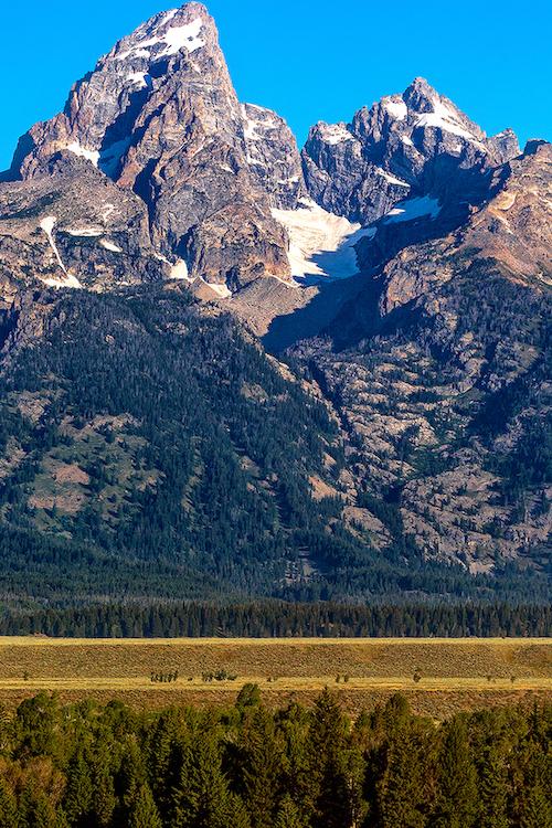
Teton Glacier, Grand Teton National Park / Rebecca Latson
Skillet, Teton, and Schoolroom glaciers remain today, vestiges of their "Little Ice Age" forefathers of 5,000 years ago.
There are 11 active glaciers in Grand Teton National Park, 10 of which are named. Glaciers easily visible from the roads within this park include Teton, Falling Ice, and Skillet glaciers. Click here to read more about Grand Teton’s glaciers.
Mount Rainier National Park
Mount Rainier bears the distinction of being the most glaciated peak within the Lower 48. There are 25 major glaciers on “The Mountain,” not counting the “numerous unnamed snow and ice patches.”
Two glaciers you can clearly see from different vistas within the park are the Nisqually and Emmons glaciers.
As you drive the road ascending to the Paradise area of the park, you’ll see several overlooks for Nisqually Glacier. Of the Paradise network of trails, you can hike the Nisqually Vista Trail and the Skyline Trail up to Glacier Vista for much closer views of this glacier.
A great view of Emmons Glacier in the Sunrise area of the park is from Emmons Vista, just a short walk down from the Sunrise parking lot. It’s a small view area, however, so you might have to wait your turn for a glacier looksee.
Parts or all of this glacier can also be seen from Emmons Moraine Trail, the trail up to Glacier Overlook, along the Sunrise rim trail toward the First Burroughs, and all along the trail to the Third Burroughs.
If you are willing to tackle more strenuous hiking, the Carbon Glacier area trails in the northwest portion of Mount Rainier National Park afford views of Carbon and Winthrop glaciers.
To learn more about Mount Rainier National Park’s glaciers, click here and here.
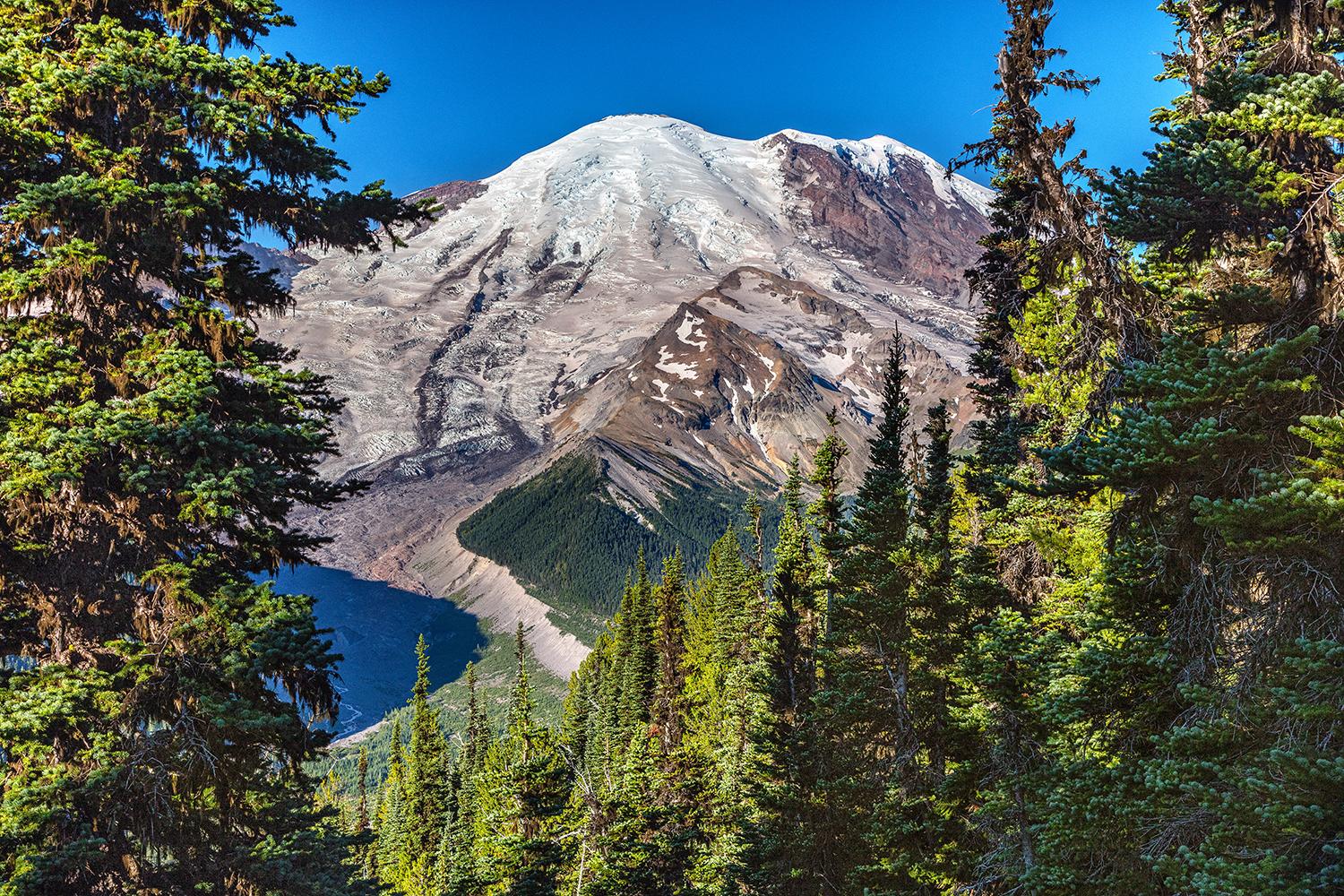
The view at Emmons Vista, Mount Rainier National Park / Rebecca Latson
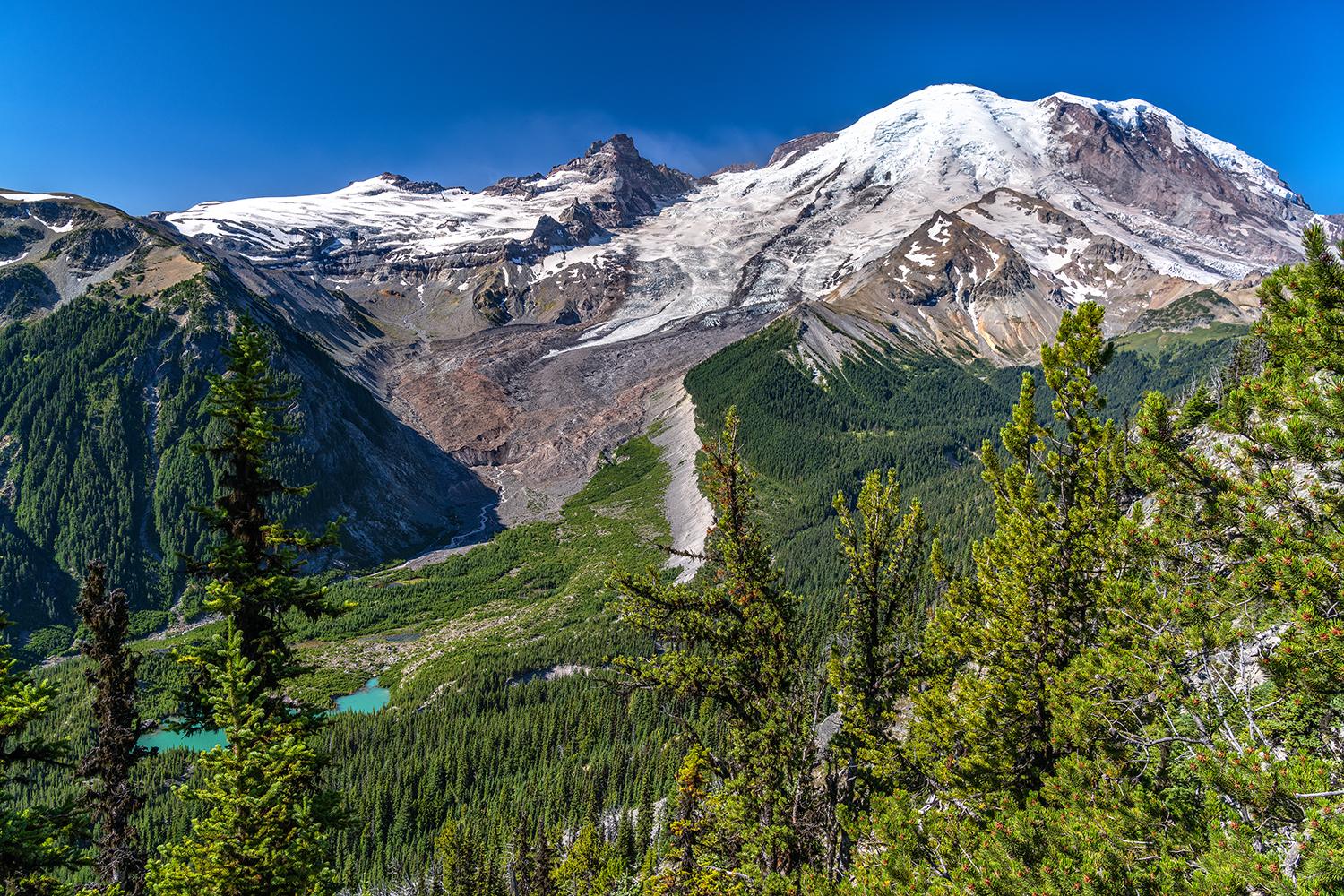
The view from Glacier Overlook, Mount Rainier National Park / Rebecca Latson
Although this national park is labeled as “one of the snowiest places on earth and the most heavily glaciated area (over 300 glaciers) in the United States outside of Alaska,” glaciers are receding in this park as they are elsewhere. Below are comparison shots of Banded Glacier, taken in 1960 and again in 2016.
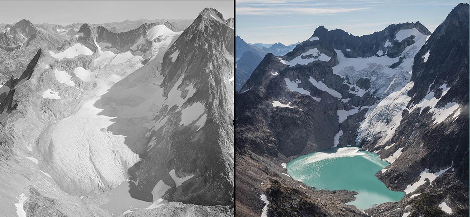
A comparison of Banded Glacier in 1960 and 2016, North Cascades National Park / Post (1960) and Scurlock (2016)
You might catch glimpses of glaciers hanging onto the rugged mountain peaks seen along the North Cascades Highway, but to really get a good view of the glaciers, you’ll need to do a little hiking in this national park.
If you are up for an approximately 12-mile roundtrip hike, then take the Cascade Pass Trail (considered one of the most popular hikes in the park) to the Sahale Arm Trail, which then “ascends steeply through subalpine meadows and talus fields to the base of the Sahale Glacier.”
The Fourth of July Pass via Thunder Creek is a little over 11 miles roundtrip and offers stunning mountain views that include Neve Glacier.
Desolation Peak Trail to the top offers an expansive view of the south, looking toward Ross Lake and the Nohokomeen Glacier on Jack Mountain. Be aware, though, that while the trail to the top is a little less than 5 miles one way, it takes a bit to get to the trailhead, either via a chartered boat ride across Ross Lake, or a 16-mile hike along the East Bank Trail. The summit view is worth the effort, say those who have hiked there.
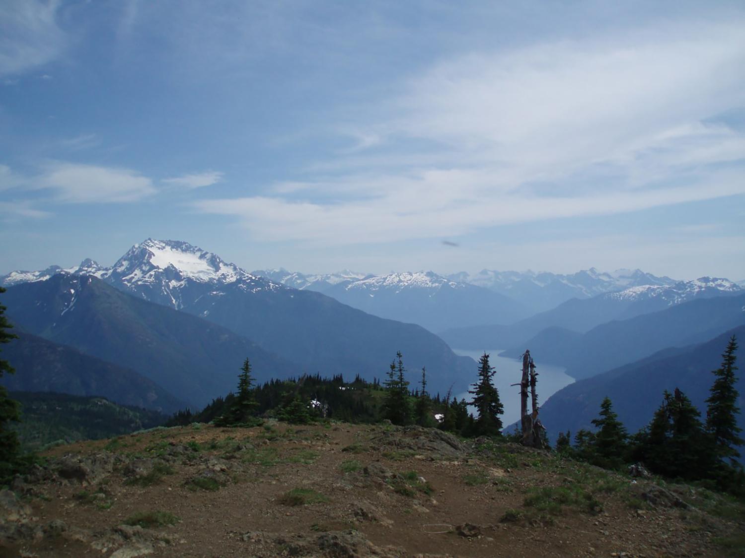
A view of Ross Lake and Nohokomeen Glacier from Desolation Peak summit, North Cascades National Park / NPS-Chelsea Gudgeon
Olympic National Park
There are about 200 glaciers within this national park. The easiest glacier to see is at Hurricane Ridge, where you are within viewing distance of 7,980-foot tall Mount Olympus and Blue Glacier. This is the park’s largest glacier, descending from Mount Olympus for almost 3 miles.
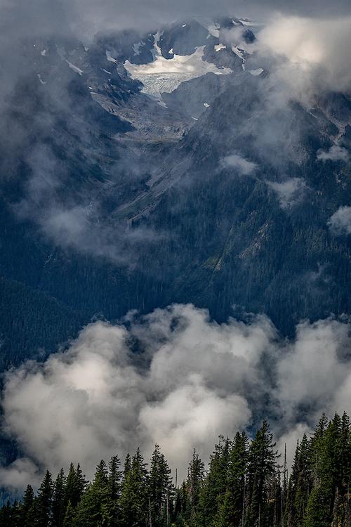
Blue Glacier, Olympic National Park / Rebecca Latson
The park staff has put together a nice primer on glaciers on Olympic's website. Here's part of it:
Mountains have been rising on the Olympic Peninsula for over 30 million years. Now dotted with moving ice, we can see influences from above the sea over the years as well. Today’s glaciers were created in the ‘geologically recent’ cold period, known as the Pleistocene Epoch, which began about 2.5 million years ago. Ice sheets, or large glacial masses, covered entire continents. Chunks occasionally split off as smaller individual glaciers and ice sheets that then advanced to other areas. According to Central Washington University’s geologist, Nick Zenter, at least seven of these advances came down from the Canadian Ice Sheet and onto what is now known as Washington State. The most recent, the Cordilleran Ice Sheet, advanced about 16,900 years ago, blanketing the region until about 14,000 years ago when it began to retreat with warming climates. With a thickness of about 3,500 feet (1,100 meters), this and previous ice sheets carved and changed the landscape drastically. The Puget Sound was dug out, valleys were created, and glaciers were left to mystify us still to this day.
As the ice advanced, it would move, but also grow. Like mold that spreads over the landscape, snow would continue to fall and accumulate, coming together to blanket the region as a whole. Glaciers would join together, split apart, and move wherever they could.
The glaciers present today continue to move, but in a different fashion. Glaciers can grow and advance or shrink and retreat. With the current warming climate and more melting periods than freezing periods throughout the year on average, the glaciers are melting, causing them to shrink and retreat. Due to their size, glaciers are subject to gravity that move them downhill, often moving the landscape with them.
Denali National Park and Preserve
According to the NPS, “glaciers cover one million acres, or one-sixth of Denali National Park.” I found one of the best ways to see glacier vistas within this park was to take a “flightseeing” tour. Back in 2014, I drove to Talkeetna and reserved a spot on a plane ferrying me and my fellow passengers between mountains and over glacier scenery to land on Eldridge Glacier for a little walkabout on the ice and snow.
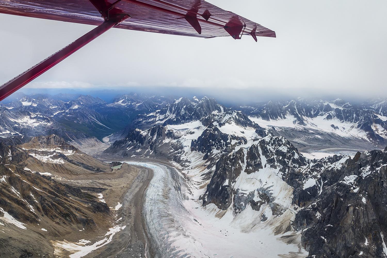
Flying over mountains and glaciers, Denali National Park and Preserve / Rebecca Latson
You don’t have to take a flightseeing tour, though, to view glaciers in this park. If you catch one of the bus tours for a ride along the Denali Park Road, you can see glaciers on the mountains of the Alaska Range. If you are lucky enough to be there when the weather is just right, not only will you enjoy a clear view of Denali, but you’ll also see the glaciers adorning the mountain’s flanks.
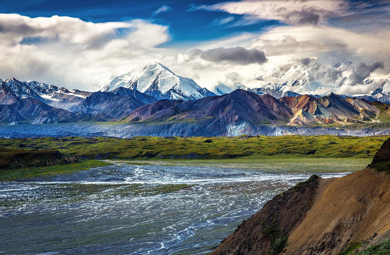
Glaciated mountains of the Alaska Range, Denali National Park and Preserve / Rebecca Latson
To learn more about glaciers in Denali, click here.
Glacier Bay National Park and Preserve
In addition to being a national park and preserve, Glacier Bay is also a World Biosphere Reserve and World Heritage Site as well as the homeland of the Huna Tlingit people. One thousand, forty-five glaciers cover 27 percent of the park. Of that number, 50 glaciers are named and seven are active tidewater glaciers, meaning they calve icebergs into the sea.
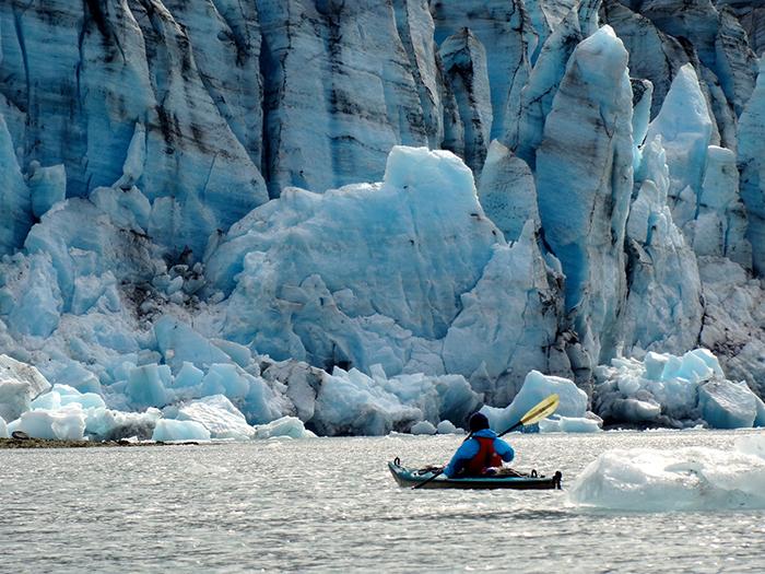
Kayaking near the glacier, Glacier Bay National Park and Preserve / National Park Service
Glacier Bay National Park and Preserve offers opportunities to view these glaciers via kayak, tour boats, and cruise ships. For an overview of tidewater glaciers, click here.
For more facts about Glacier Bay National Park, in general, click here.
Wrangell-St. Elias National Park and Preserve
The size of Yosemite and Yellowstone national parks plus Switzerland combined, Wrangell-St. Elias National Park and Preserve contains the greatest concentration of glaciers in North America. Like Denali National Park, flightseeing tours are a wonderful way to view this park’s glaciers.
If you really want to get away from it all for glacial travel on your own, the NPS site for this park recommends hiring a guide to help you plan your trip.
Kenai Fjords National Park
Here’s a national park 126 miles south of Anchorage, where you can park your vehicle and walk any of several trails to different views of Exit Glacier. How cool is that?
Click here to learn more about the Exit Glacier area.

Exit Glacier view from across the outwash plain from the "Glacier View Trail"/NPS
If you are looking to stretch your legs on a longer trail in that area, you can hike 8 miles roundtrip on the Harding Icefield Trail.
If you feel like a little glacial watersport, Bear Glacier Lagoon is the perfect place to kayak or paddleboard on the iceberg-dotted lake that fills the space between Bear Glacier and its glacial moraine.
Canada
Our northern neighbor Canada offers some pretty spectacular glacier viewing in their own national parks, a couple of which I’ve visited.
Banff National Park and Jasper National Park
All along the Icefield Parkway (Hwy 93), from Banff National Park to Jasper National Park, you’ll see glaciers clinging to the jagged mountain peaks. Banff National Park’s Crowfoot Glacier, is one such view along the Parkway at which I stopped for photos during my April 2016 visit.

Crowfoot Glacier on a snowy spring day, Banff National Park / Rebecca Latson

Crowfoot Glacier on a sunny spring day, Banff National Park / Rebecca Latson
About a half mile further up the road from Crowfoot Glacier is Bow Glacier, perched above the turquoise, glacially-fed Bow Lake.

Bow Lake and Bow Glacier, Banff National Park / Thomas Kriese
At the boundary between Banff National Park and Jasper National Park sits Athabasca Glacier, to your right. This impressive glacier is one of six “toes” of the Columbia Icefield. There’s plenty of parking at the Icefield Center where you can hike to closer views of this mighty glacier or reserve a spot on an Icefield Explorer Tour that takes you right out onto the glacier itself, if you so choose.

Athabasca Glacier, Jasper National Park / Rebecca Latson
As I was cleaning out my parents' house after Mom died, I found a box of old photos taken long before I was born, of Mom and Dad with friends, standing next to one of those snow tractors parked on the Athabasca Glacier. A couple of those photos showed Dad scooping a handful of glacier water to drink. Looking at how much fun they were having made me wish I’d bought a ticket and gone on that glacier tour, myself.
Next time, I’ll do that.
While this is by no means an exhaustive survey of all the glaciers in the national parks, or where and how to see them, the list here might entice you to consider visiting a national park specifically to view these icy treasures while they are still around.

A glacier, a waterfall, and a turquoise lake view along the Grinnell Glacier Trail, Glacier National Park / Rebecca Latson

 Support Essential Coverage of Essential Places
Comments
Rebecca's photos are gorgeous as always. For those considering the Fourth of July Pass trail in North Cascades National Park Complex, a bit of advice: the "pass" is a couple of rock stacks in the forest. Hike to Fourth of July Camp, about a mile shy of the pass, and eat your lunch while enjoying the views of Colonial Peak and Neve Glacier. Head down from there, unless you're doing a shuttle hike, in which case continue on past the uninteresting pass and down Panther Creek. Have fun on a beautiful hike!