Traditional And Emerging Roles Of Chesapeake And Ohio Canal National Historical Park
The Capitol's Corridor: What We See and What Cannot Be Seen
By Joel Cohen
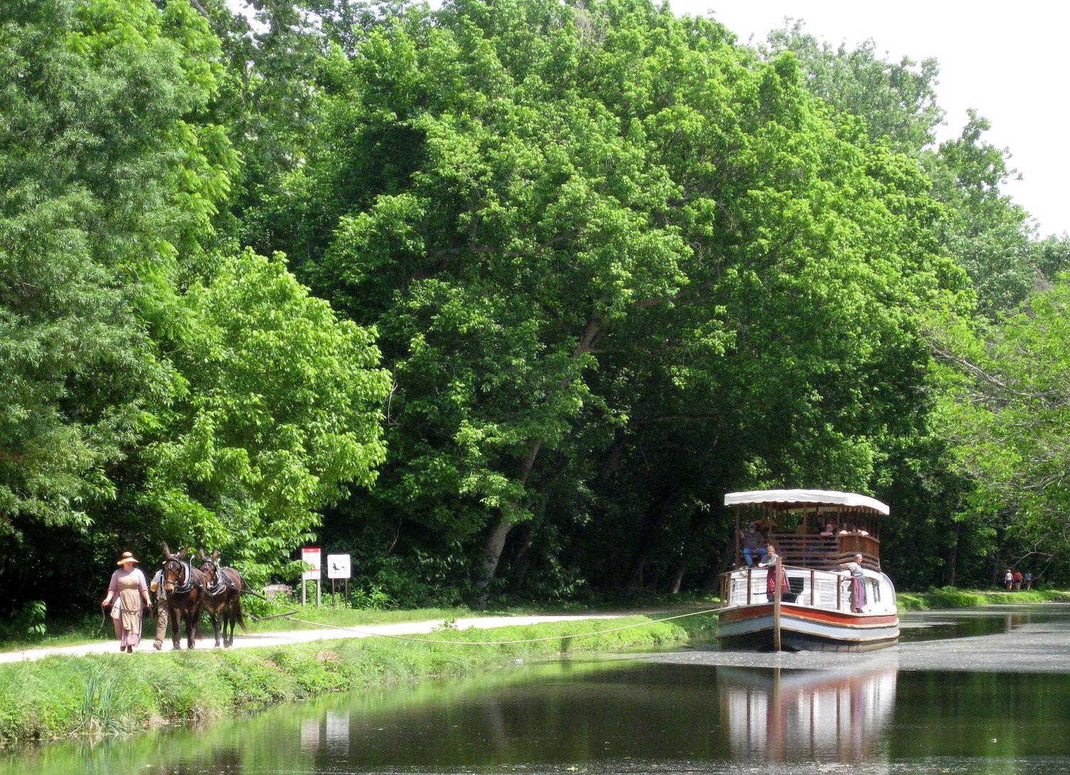
These days, when one ventures out on the Chesapeake and Ohio Canal National Historical Park, or “the Canal” as it is known locally, a long stretch of towpath leads off in either direction. Depending on your point of entry, a lock and nearby lockkeeper’s house may still be working and standing.
If your visit is in the spring, wildflowers are in bloom, followed by turtles sunbathing on logs as summer comes. Dragonflies can fill the skies, or dart out over the canal. In other seasons, the greenery that had been all around you is gone, leaves having fallen, letting the Potomac River that lies just west, beyond the tree line, become fully visible. This is what one sees from any given spot when walking, hiking, or biking on the 184.5 miles of the Capital’s Corridor, beginning at Georgetown as the most southeastern point, and then rising up to Cumberland, Maryland, the canal’s most north-western point.
As we walk through the upland woods or floodplain forest, it is easy to think of the canal as one of our country’s 3.5 million miles of rivers and streams. But we soon see the difference between the two --- the canal running through the entirety of the park was made by human hands; hands rushing to finish their job so canal boats loaded with goods and captains anxious to get underway could at last begin their passage.

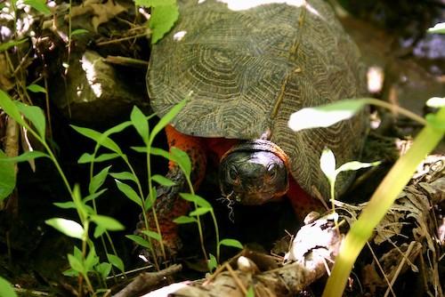
The canal provides great habitat for turtles/NPS file
It is remarkable that so much of this handmade waterway is still visible today and openly available to visitors. But equally important are things we cannot see so directly; changes that are occurring within the boundaries of the park itself, changes in the Potomac River, the canal’s west-hand side companion, and changes occurring among the numerous city parks, farms, and homes that form the east-hand side of the canal. What we are remiss in noticing is that the canal’s contiguous 184.5 miles have united numerous habitats and ecosystems that otherwise would have remained separate, fragmented, and distinct from one another. This continuity we enjoy today began in the heydays of the canal’s commerce, from 1850 to 1924, as canallers ferried goods and people up and down this waterway.
Today, however, the canal environs transport something entirely different – life itself, in the form of seeds and pollen, species and migrations, extending their boundaries from north to south or south to north. These living parts of the environs can now make their way through five geographic “provinces,” beginning with the Coastal Plain in Georgetown, moving north through the Piedmont Plateau, the Blue Ridge, the Valley and Ridge, and ending at Cumberland in the Appalachian Plateau. By facilitating such movement, the canal becomes more like a riverbed, carrying the living world alongside it, in it, and over it, and in so doing, defeating what otherwise time and development would have left in fragments.
By holding onto this continuity, the canal became what is now called a “corridor,” or, a strip of natural habitat connecting areas that otherwise would have been separated. As such, a corridor facilitates the migration of species.
“Properly designed corridors,” as noted by Crooks and Sanjayan, “allow for the natural ranging behavior of animals among foraging or breeding sites,” and “facilitate the exchange of genetic material among otherwise isolated populations.”
In this regard, the connectivity provided by the canal is most remarkable as it goes quietly, almost unnoticed, through urbanized environments where otherwise subdivisions would have occurred, rising up as either housing developments or roadways. “Small, isolated fragments of habitat are bad news for almost all species. Small populations go extinct,” whereas the canal provides “a continuous habitat that stretches from Georgetown to Swain’s Lock, which is remarkable in such an otherwise urban area,” observed Stuart Pimm, president of Saving Nature.
The Park’s The Thing
In 1971, President Richard Nixon signed the Chesapeake and Ohio Canal Development Act and established the canal as a national park. This meant that what had once been a vast combination of funding, ownership and use, came together under one organization, the National Park Service. For the full distance of the canal, one concept defined what was meant by a park, that being “a tract of land set aside for public recreational use.” This meant that there was as well a mandate to conserve park features while seeing that they provide enjoyment for the public.

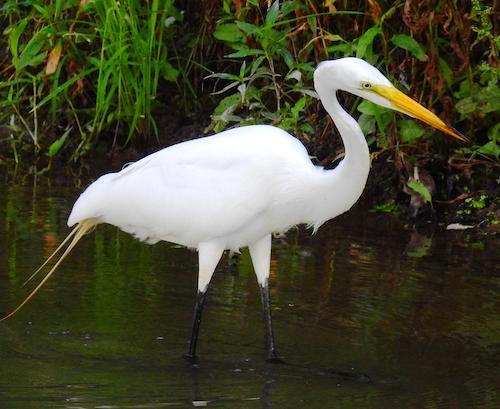
Great egret, milepost 25/Joel Cohen
As the canal becomes recognized as such a remarkable contiguous strip of wildlife, it attracts an increasing number of visitors, many of whom that offer advice on the park’s “relevant” recreational activities. Additionally, come numerous reports speaking to how best to meet the park’s ecological and conservation needs, now discussed in terms of biodiversity.
The concept of “biodiversity,” introduced in 1986 by E.O. Wilson, refocused our understanding and discussions regarding Earth’s speciation -- past, present, and future. Even more recently, global, national and local targets for the conservation and protection of species have been identified, adding to the importance of biodiversity conservation. For a national historical park responsible for “recreation-minded” visitors, such additional responsibilities for protecting and monitoring biodiversity may seem a challenging responsibility.
For example, to maintain or increase amphibian species present in parks, management actions might include enlarging wetlands and keeping them moist longer; preventing trails from breaking up wetlands, and maintaining a limit on roads. As amphibians are extremely sensitive to environmental change, pollution, and fragmenting of habitats, their numbers are closely monitored by the National Capital Region Inventory and Monitoring Network.
However, it has also been shown that areas able to enhance their biodiversity “index” by carefully counting and increasing species numbers could actually attract more visitors.
A recent planning document for the Canal Park, titled The Park’s Strategic Plan for 2019-2023, includes as its first goal to, “Maintain and Protect Wisely,” including Strategy 4, Action 1, stating that the Park Service should “develop and implement a resource management plan that prioritizes critical natural areas and species of special concern.” Will this act include and strengthen the idea of the park as a “conservation corridor”?
While not specifically mentioned, this is a common challenge facing many national parks, as they find themselves as the sole home of a great many species, reduced to one location as urbanization and other threats take away other sites from species too close to the expanse of the human race.
Permanent Residents, Itinerant Occupants, And The Unwanted
Accounting for the type and number of species in any given national park takes on new importance when considering options for establishing or maintaining corridors. The canal’s unique size and position has fostered some of the most species-rich spots of biodiversity among the national parks. One of the most biodiverse sites in the canal is found around mile 14, just north of Lock 17, where one enters a scenic trail ending at Olmstead Island, while passing over two crossing bridges, providing visitors remarkable views of Potomac Gorge. Here, the steady flow of the Potomac waters have cut out a 50-foot drop in less than a mile, creating unique globally-rare riparian vegetation containing many rare, endangered and threatened plants.

The red spotted newt is one of the amphibians that makes its home along the canal/NPS file
This stretch of the Potomac River, between it banks and on its islands, is one of our most biologically diverse riparian centers, being “home to more than 1,400 plant species, with at least 30 distinct natural vegetation communities, and several of them are rare and imperiled.” In total, the gorge provides habitats for more than 200 rare plant species and natural communities, as catalogued by The Nature Conservancy. The gorge also hosts the largest block of intact forest in the Piedmont, and a geology that is known internationally.
As for birds, well; some come and go while some stick around all year. If one goes to eBird, at https://ebird.org/hotspot/L490336, it identifies more than 200 birds seen at Fletcher’s Cove alone, located near Mile 3 on the Canal. Some of the permanent residents, as plants, include, based on records of 2011, 86 non-woody plants, 162 tree, and shrub and vine species. Shape shifters include 80 butterflies and many amphibians. Updated lists of animal species are found from the National Park Service, along with printable “check lists,” and items about specific species: https://www.nps.gov/choh/learn/nature/animals.htm.
In addition, in 2018 the National Park Service completed its Wetland Restoration Action Plan, which includes The Chesapeake and Ohio Canal National Historical Park. Work in this plan will improve the function of streams and encourage native wetland plants to grow by eliminating invasive plants. Making these improvements will help visitors to understand the importance of such areas to the surrounding ecology and that these improvements will prevent future disturbances, leaving the wetlands in a healthier condition.
Restoration of wetlands and ensuring conservation corridors are critical to the life cycles of migrating animals. At the present time, according to the Canal’s Official National Park Handbook, examples of migrations taking place include but are not limited to, the following:
• Southerly migrating species include: the Smooth green snake, the Northern white cedar, the Wake-robin, and the Brown wood rat, the Black-capped chickadee, and the Moss-ping, while migrations to the North have included the Rough green snake, the Willow oak and Black vulture.
• Bird arrivals in spring: various warbler species, wood thrushes and Louisianan Water thrushes, warbling vireos
• Throughout summer: Acadian and Great Crested Flycatchers, Eastern Wood-Pewees
• Autumn birds passing through: raptors, migrant songbirds, Brown Creepers, Golden-crowned and Ruby-crowed kinglets.
• Winter arrivals: the Canal and adjacent river pockets are full of ducks, Common Mergansers, Buffleheads, Canada Geese, Ring necked duck, and Eastern Bluebirds.

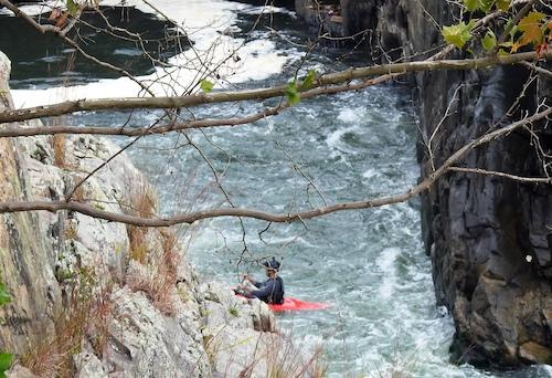
The Potomac Gorge is a playground for experienced kayakers/Joel Cohen
While the corridor effect enhances the ability of native flora and fauna to survive by helping to maintain a suitable population and habitat size, the same protection and growing conditions are also usurped by non-native, invasive plants. These non-natives are nothing new, they have been around a long time, and include garlic mustard, Indian strawberry, Japanese honeysuckle and Japanese stiltgrass, among others. Their locations and growth compete with the numerous but less aggressive rare, threatened and endangered plant species.
The Future
Since its formal opening in 1971, this Canal Park has not just survived, but for its first 50 years flourished as a residence for many remarkable species, which is all the more amazing as we realize that the Canal Park passes through some of the nation’s densest urban living. Now, it is up to those working for the Chesapeake and Ohio Canal National Historical Park to ensure the park is safe and able to meet the needs of it two-legged visitors while being a home for its more permanent residents.
As part of these responsibilities, will the park be able to sustain and increase its connectivity corridor and thus improve the survival likelihood of its rare and endangered biodiversity? While acceptance of such responsibilities is to come, there is one thing that is certain, and that is that a very solid foundation exists should this opportunity be acted upon, but as America’s population and wealth swells, so do the dangers to the national parks.
As has been noted by the late Michael Frome, it no longer is enough “to be concerned with problems of visitors or their facilities, or even with problems of bears, elk, forests or lakes, instead of with the interwoven complex of the entire park. Without deliberate design to preserve, or restore, a park ecosystem, inroads with cumulative damage are inevitable.” Let us hope that with due diligence, such dangers are not inevitable, but instead, the home provided to so many species by a contiguous canal can be ensured for years to come.
Notes on Author
Joel I. Cohen is currently a Visiting Scholar, at the Nicholson School for the Environment, Duke University, where he is working with Dr. Stuart Pimm on the Chesapeake and Ohio Canal National Historical Park and its potential to serve as a wildlife “conservation corridor.”

 Support Essential Coverage of Essential Places


Comments
How does the park connect "areas that otherwise would have been separated" in any way that the much larger, faster moving and continguous Potomac River does not?