Some Great National Park Settings To Consider For Summer...And Others You Shouldn't Even Consider
By Kurt Repanshek
Apologies in advance to my brethren in the travel writing industry, and their editors, but your suggestions for national parks to visit this summer are incredibly ridiculous for the most part and sure to produce a miserable vacation.
Granted, I'm working with a limited sample here, but more than a couple stories concerning the "Best National Parks" to visit this summer included Acadia, Arches, Big Bend, Everglades, Grand Canyon, Great Smoky, Yellowstone, Yosemite, and Zion. My guess is the eye-candy photos of those parks drove their inclusion in these lists.

Why drive all the way to Arches National Park this summer only to find the entrance closed? (Note the bottom comment)/NPS
Don't misunderstand. All those parks are incredibly beautiful. But in the summer many can literally kill you with their heat and humidity, and all (except maybe Big Bend, which is so difficult to get to any time of year) can smother you with their crowds.
Did you hear that the line for hikers anxious to view Zion Canyon from the crest of Angels Landing was four hours long at times during Memorial Day Weekend? Are you familiar with the heat warnings that Grand Canyon and Arches routinely issue in during the summer months? Have you seen the elbow-to-elbow crowds that ring Old Faithful waiting for its eruption?
Parks across the country are expecting near-record, and even record, visitation this summer. And the crowds already are arriving, and not just at the "name brand" jewels in the National Park System crown. Lake Mead National Recreation Area officials in Nevada on Sunday had to close access to Willow Beach for a couple hours "to manage capacity," and campgrounds in Shenandoah National Park in Virginia were filled by midday at times last week. On May 22 the Big Meadows Campground at Shenandoah was full by 10:15 a.m.
So, what should you do this summer? If your calendar is flexible, and not controlled by a school calendar, the options are many. And even with a school calendar, there's often a school break in the fall that you can take advantage of.
Whenever your schedule allows you to head out into the National Park System, consider the following parks for a less stressful and less death-defying vacation.

Surf-casting in solitude at Cape Lookout National Seashore/Kurt Repanshek file
Cape Lookout National Seashore, North Carolina
I love Cape Cod National Seashore, and Cape Hatteras National Seashore has a strong fan base, but Cape Lookout is my favorite national seashore, and one I refer to as a truly “wild” seashore. That’s because its three barrier islands largely have been left undeveloped. The lone exception is the northern tip of North Core Banks, where you have Portsmouth Village. It dates to the mid-1700s and served as what was called a “lightering” port, or a place where cargo from sea-going ships was transferred to smaller vessels to haul to coastal villages in South and North Carolina.
At Cape Lookout, you use what are referred to as 'ferries' to get to the islands, but in many cases they’re relatively small skiffs and boats that can carry a dozen or so people. There are some larger ferries that can haul vehicles onto the islands, but to do that you need a good four-wheel drive and know-how to drive on sand.

Shell collecting at Cape Lookout National Seashore can be incredible after storms/NPS file
Once you get to one of the three barrier islands -- North Core, South Core, and Shackleford Banks -- what is there to do? All feature long expanses of beach with few other souls that are perfect for combing for shells or surf casting. During normal years there are cabin rentals on both North Core and South Core banks, but those at Long Point on North Core are still closed in 2021 due to damage from Hurricane Dorian in 2019.
Now, these are not deluxe cabins, but really little more than glorified plywood shacks with bunkbeds (for your own bedding) and simple bathrooms. But they're close to the beach, have decks and BBQ grills, and plenty of fresh sea air. If you like to fish, you'll like the outdoor sinks for cleaning your catch.
South Core Banks also holds the seashore's lighthouse; climb the circular stairs to the top and the view is sweeping and impressive. Visit Shackleford Banks and you can watch the banker horses that call it home.
And if you're truly self-sufficient and experienced at sea kayaking, you can explore the seashore by boat and camp within the dunes.
Theodore Roosevelt National Park, North Dakota
True, it can take some effort to get to this park. When Theodore Roosevelt visited back in the 1880s, he rode the train as far west as it went in the Dakota Territory before getting off in Medora, which today serves as the park's southern gateway.
But Roosevelt came for a reason -- to transform himself from a New York City dandy into a self-sufficient man in his father's image. (And to kill a bison, but that's another story.) Roosevelt found everything he desired in this rumpled and rugged landscape.
"There were all kinds of things that I was afraid of at first, ranging from grizzly bears to mean horses and gunfighters," he noted in a diary entry in 1883. "But by acting as if I was not afraid, I gradually ceased to be afraid."

Theodore Roosevelt was drawn to the badlands of the landscape that now honors him as a national park/Kurt Repanshek file
Of the intriguing landscape Roosevelt wrote, "The Bad Lands grade all the way from those that are almost rolling in character to those that are so fantastically broken in form and so bizarre in color as to seem hardly properly to belong to this earth," wrote the future president.
There are two units in the park -- South and North -- and each has a campground where you can pitch your tent or park your RV and marvel at the stars overhead. (As of this writing, all individual sites at Cottonwood Campground in the South Unit will be available only on a first come, first served basis.)
Stay at the North Unit and you're not far from the River Bend Overlook with its sweeping view of the Little Missouri and the stone shelter CCC crews built back inthe 1930s.
Theodore Roosevelt is a great park to visit if you want a better understanding of Roosevelt's younger years, to view the same landscape he did, or to study its unique geology.
An easy side trip is to visit Fort Union Trading Post National Historic Site to the north of Theodore Roosevelt National Park.
Wind Cave National Park, South Dakota
Wind Cave is one of the oldest units of the National Park System, designated in 1903, when it became the country’s eighth national park. It was named for a small crevice in a hillside through which winds have been clocked at over 70 mph. Aboveground, the rolling, pine-studded surface of the Black Hills is beautiful, with several hundred bison, countless pronghorn antelope, and roving bands of elk.
At Wind Cave you’ll find one the longest caves in the world. Last I heard, it was the seventh-longest cave in the world, with more than 150 miles of explored cave.
While the Lakota tribe considers Wind Cave sacred, there has been no evidence that they ever entered it. But Europeans didn’t hesitate. In the 1930s, Civilian Conservation Corps crews built the elevators down into the cave, installed electricity, and built stairways by draping tire inner tubes filled with concrete over their shoulders and carrying them deep into the cave for pours.
At Wind Cave, in addition to the Natural Entrance Tour, you can explore other sections via the Garden of Eden Tour (recommended for those with little time), the Fairgrounds Tour (the most strenuous at Wind Cave, and showing off the most cave features of all the park’s tours), the Candlelight Tour (also strenuous and with some off-trail travel, limited to visitors 8 and older), and the Wild Cave Tour (an adventure for those who don’t mind squirming around on hands, elbows and knees, and over 16 years old).
It’s thought that the underground passages at Wind Cave are actually connected with those at Jewell Cave National Monument roughly a 30-minute drive away. That’s not entirely surprising when you consider that only about 3 percent of Jewel Cave’s passages have been explored, and only about 10 percent of Wind Cave.

Wind Cave National Park is famous for its cave, but there's also an incredible story about its bison herd/NPS file
Aboveground there are some nice hiking trails at Wind Cave, or you can drive around the entire 35,000-acre park via U.S. 385, South Dakota 87, and park Route 5 in about an hour. As you cruise the park, you can't help but notice the bison. As famous as the park is for its underworld, the surface played a key role in the survival of bison as a species in North America. It was here in 1913 that 14 bison from the New York Zoological Society were released to help grow numbers of bison in the wild.
There is no lodging inside Wind Cave (there are options at nearby Hot Springs, S.D., outside the south entrance or Rapid City, S.D., to the north of the park). But it has what I consider one of the finest campgrounds in the park system.
Jewel Cave National Monument, Badlands National Park, Wind Cave National Park, and Mount Rushmore National Memorial are all within an hour's drive from Rapid City. They alone will easily justify your spending a week’s vacation exploring these parks. Toss in the Crazy Horse Memorial and Custer State Park and 10 days or more wouldn’t be too short for an exploration of this landscape, both above and below ground level.

Wheeler Peak, rising to 13,064 feet, is the high point of Great Basin/NPS file
Great Basin National Park, Nevada
Though this is a park that a former congressman from Utah said wasn't worth more than one visit in a lifetime, his view isn't shared by all. In 2019, the park attracted 131,802 visitors, and during last year's covid-shortened season another 120,248 made the trek to eastern Nevada. And yes, those are accurate numbers that point to the lack of crowding Great Basin enjoys.
Under the "Who knew?" category for Great Basin, the park since 2015 has partnered with the Nevada Northern Railway to bring passengers out into the desert so they can "gaze up to the heavens using telescopes and the naked eye. The Star Train has now become the Nevada Northern Railway's most popular event."
But Great Basin has a lot more going on than simply dark skies. From the 13,064-foot summit of Wheeler Peak, to the sage-covered foothills, this park is a great place to sample the stunning diversity of the larger Great Basin region. Come and partake of the solitude of the wilderness, walk among ancient bristlecone pines, bask in the darkest of night skies, and explore mysterious subterranean passages.
Great Basin started out life in the National Park System as Lehman Caves National Monument by presidential proclamation on January 24, 1922. Congress turned it into a national park on October 27, 1986, expanding it to include a huge chunk of surrounding national forest and BLM lands.
Great Basin's gateway town is Baker, Nevada. Once upon a time there was almost nothing there. But now, as more and more visitors discover Great Basin, changes are becoming more and more apparent. There is a campground with RV hookups. A couple of small stores and eateries have popped up along with some limited lodging. Where it was once possible to easily find a vacant campsite, it’s becoming a challenge.
The park's biggest claim to fame, PR-wise, came in late 2014, when a 132-year-old Winchester rifle was found leaning up against a well-weathered juniper in the park's backcountry. While the rifle's serial number was readable, an investigation never determined who might have owned the gun or why it was left in the outback. What the folks at the Buffalo Bill Center of the West in Cody, Wyoming, where the rifle was shipped for some restoration, do know is that, “The Winchester Model 1873 alone may be the most iconic western firearm of all time. This is especially true of its marketing slogan, ‘The Gun that Won the West.’ With all it’s been through, this particular gun has certainly carried on that legend.”
You can see the rifle in the park's visitor center, but don't forget to explore the cave system at Great Basin or head out onto the landscape.
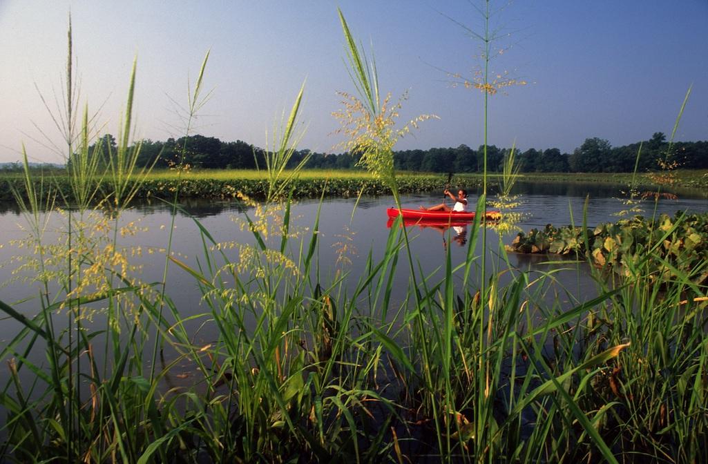
There are miles and miles and more miles of water to paddle along the Captain John Smith Chesapeake National Historic Trail/NPS file
Captain John Smith Chesapeake National Historic Trail, Virginia
Native American history, Black history, sea-faring communities, and great paddling all exist in and around this national historic trail.
There currently is work under way to map and identify sites and landscapes in the watershed region significant to African American history and culture.
“Mapping African American historic places within the Chesapeake watershed is a critical first step in making sure that these places are protected and that their stories are told," Katherine Malone-France, the chief preservation officer of the National Trust, noted last fall when the project was announced. "We look forward to identifying the places that are deeply meaningful to both their communities and our shared national heritage.”
As home to some of America’s first colonies, the Chesapeake Bay watershed region is already known to have a significant meaning to African American culture. Many major tobacco plantations were located there, as were many stops on the Underground Railroad. It was the place where Harriet Tubman and both Frederick Douglass and his first wife were enslaved. It includes many battlegrounds of the Civil War, as well as places of notable activism in the 1960s Civil Rights Movement. Generations of Black Americans have made their living from the waters of the Bay and have also used special places along the Bay and throughout the region for recreation.
Werowocomoco is a site with deep Native American ties. It's believed to have been the center of the Powhatan Chiefdom when Captain John Smith reached the new world in 1607
The site was acquired by the NPS in June of 2016, to be managed as a part of the Captain John Smith Chesapeake National Historic Trail. While not yet open to the public, Werowocomoco is currently being studied, stewarded, and protected by the NPS in collaboration with seven tribal partners: the Rappahannock, Upper Mattaponi, Mattaponi, Pamunkey, Nansemond, Chickahominy Eastern Division, and Chickahominy tribes.
There are countless opportunities across some 2,000 miles of shoreline for paddlers here. Check out the 'Paddling Pirates' of the Chesapeake Paddlers Association and you'll be able to join a group for an evening paddle.
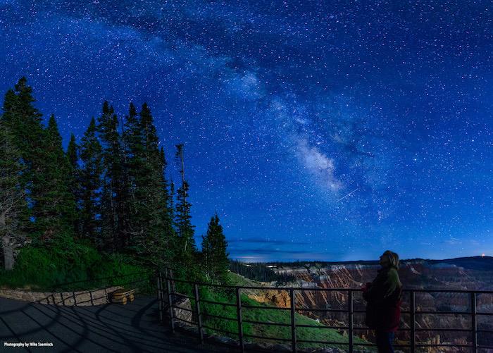
Cedar Breaks National Monument is an International Dark Sky Park/NPS
Cedar Breaks National Monument, Utah
Colorful rock amphitheater? Check. Colorful wildflowers? Check. Cool elevation? Check. Ancient trees? Check. Few crowds? Check.
Cedar Breaks National Monument is one of those largely overlooked units of the National Park System. Maybe that's because it doesn't span tens of thousands of acres, and doesn't have a charmingly rustic lodge to end the day in.
But this park in the high country of southern Utah is a gem in the rough. A great cleft in the Markagunt Plateau has revealed the reds, whites, mauves, and browns that color the foundation of the plateau. Within the amphitheater are rock sentinels similar to the hoodoos found in nearby Bryce Canyon Natonal Park. And if you like staying out after dark, know that Cedar Breaks has been designated as an International Dark Sky Park that serves as a sanctuary of natural darkness and for the opportunity it provides visitors to enjoy the night sky.
As for crowds, while Zion National Park saw 3,591,254 visitors in 2020, Cedar Breaks saw 845,867, and even fewer showed up in 2019 (579,861) before covid fever sent Americans outdoors en masse. Zion, meanwhile, saw 4,488,268 squeeze into the park that year.
Once upon a time not too many years ago (2017) the monument was rated by USA Today as "one of the top ten places to experience fall colors" in the United States. According to the park staff, the Alpine Pond Nature Trail is the hike to take for fall color at Cedar Breaks. Rated as "easy to moderate in difficulty," it's a two-mile double-loop route through forests and meadows. The lower trail offers excellent views of the "breaks," the eroded badlands where the edge of the plateau breaks away to a lower area, while the upper trail takes you past meadows, through a spruce-fir-aspen forest, and past ancient deposits of volcanic materials.
Half-way through the loop, a natural, spring-fed pond offers a quiet location for a break. A cut-off trail at the pond allows you to make this hike a one-mile loop. A small stand of bristlecone pines can also be viewed from this trail.
Here's a short video to entice you to Cedar Breaks:
Glacier Bay National Park and Preserve, Alaska
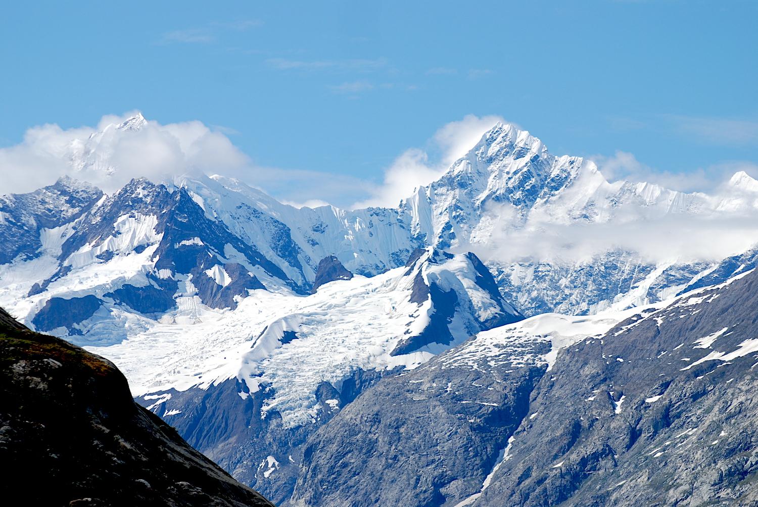
No doubt the effort and cost it takes to reach Glacier Bay (top photo) plays a role in the low visitor numbers the park records, but if you can make the trip, it's well worth it.
The park's 3.3 million acres offer the adventuresome opportunities to trek through temperate rain forests, climb snow- and ice-covered mountains, paddle hundreds of miles, and experience the ruggedness of a landscape that John Muir described as "a magnificent picture of nature's power and industry..."
By and large, most visitors to Glacier Bay arrive via cruise ship, stay on it, spend less than a day in the park, and are gone. For those who fly into Gustavus for a visit, those who stay at the Glacier Bay Lodge typically stay for two-three days, while those who check into a lodge, B&B, or cabin in Gustavus generally stay 4-5 days.

The Johns Hopkins Glacier is one of the park's tidewater glaciers/Kurt Repanshek file
Find a room in the park lodge and you are a short walk from Bartlett Cove where whales sometimes swim. There are short hikes into the forest, and the Xunaa Shuká Hít -- roughly translated as "Huna Ancestor's House" -- offers a view into the life of the Tlingit culture. The clan house also serves as a gathering place where tribal members can reconnect with their treasured homeland through ceremonies, workshops, camps, tribal meetings and other events.
And, of course, there are glaciers that will fill your camera's viewfinder. Seven of the park's glaciers run right down to the water, and you can pause before some of them to watch bergs calve off or search for harbor seals resting on ice flows.
Through this landscape you can travel by cruise ship, small tour boat, kayak or canoe, or overland with pack on your back. It can be demanding -- humpback and killer whales frequent the main bay and its fingers of inlets, brown and black bears roam its forests and beaches, self-reliance is foremost -- but the rewards are many for those up to the task.

Take the cruise up Glacier Bay and you'll likely see a tufted puffin/NPS file
If you book a room at the lodge and want a closeup view of glaciers, buy a ticket for the Baranoff Wind for a day-long, 150-mile round trip cruise up to the end of Glacier Bay and back. A ranger-naturalist will take you in tow and, throughout the journey, point out whales, brown bears, mountain goats, tufted and horned puffins and, of course, glaciers. My wife and I saw so many bird species on that cruise that we ran out of space to write them down.
Like to fish? Head over to the mouth of the Bartlett River, which in late summer runs with pink, sockeye, and silver salmon. If you were hoping for something with a little bit more fight, sign onto a guided fishing charter and try your luck for halibut.
There you have it, a quick sampling of some incredible park destinations for summer that will overwhelm you with spectacular vistas, not crowds.
- Apostle Islands National Lakeshore
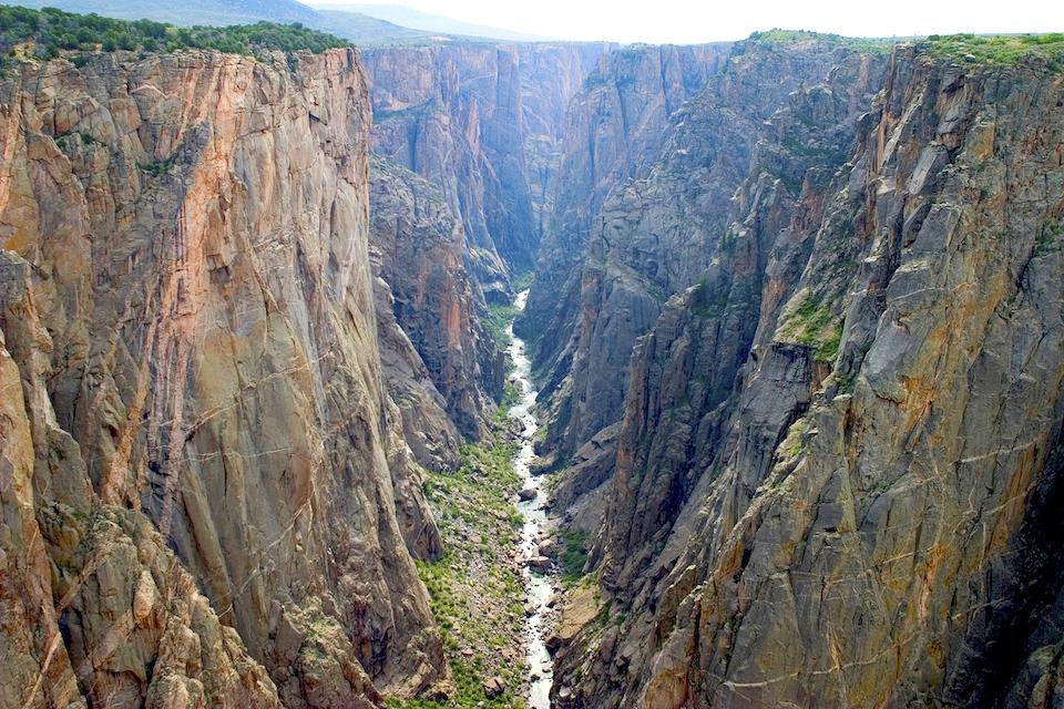
- Black Canyon of the Gunnison National Park
- Cape Lookout National Seashore
- Captain John Smith Chesapeake National Historic Trail
- Cedar Breaks National Monument
- Cumberland Island National Seashore
- Glacier Bay National Park and Preserve
- Great Basin National Park
- Great Sand Dunes National Park and Preserve
- Isle Royale National Park
- Lassen Volcanic National Park
- Natural Bridges National Monument
- North Cascades National Park
- Sleeping Bear Dunes National Lakeshore
- Theodore Roosevelt National Park
- Voyageurs National Park
- Wind Cave National Park
Add comment
Support National Parks Traveler
Your support for the National Parks Traveler comes at a time when news organizations are finding it hard, if not impossible, to stay in business. Traveler's work is vital. For nearly two decades we've provided essential coverage of national parks and protected areas. With the Trump administration’s determination to downsize the federal government, and Interior Secretary Doug Burgum’s approach to public lands focused on energy exploration, it’s clear the Traveler will have much to cover in the months and years ahead. We know of no other news organization that provides such broad coverage of national parks and protected areas on a daily basis. Your support is greatly appreciated.
EIN: 26-2378789
A copy of National Parks Traveler's financial statements may be obtained by sending a stamped, self-addressed envelope to: National Parks Traveler, P.O. Box 980452, Park City, Utah 84098. National Parks Traveler was formed in the state of Utah for the purpose of informing and educating about national parks and protected areas.
Residents of the following states may obtain a copy of our financial and additional information as stated below:
- Florida: A COPY OF THE OFFICIAL REGISTRATION AND FINANCIAL INFORMATION FOR NATIONAL PARKS TRAVELER, (REGISTRATION NO. CH 51659), MAY BE OBTAINED FROM THE DIVISION OF CONSUMER SERVICES BY CALLING 800-435-7352 OR VISITING THEIR WEBSITE. REGISTRATION DOES NOT IMPLY ENDORSEMENT, APPROVAL, OR RECOMMENDATION BY THE STATE.
- Georgia: A full and fair description of the programs and financial statement summary of National Parks Traveler is available upon request at the office and phone number indicated above.
- Maryland: Documents and information submitted under the Maryland Solicitations Act are also available, for the cost of postage and copies, from the Secretary of State, State House, Annapolis, MD 21401 (410-974-5534).
- North Carolina: Financial information about this organization and a copy of its license are available from the State Solicitation Licensing Branch at 888-830-4989 or 919-807-2214. The license is not an endorsement by the State.
- Pennsylvania: The official registration and financial information of National Parks Traveler may be obtained from the Pennsylvania Department of State by calling 800-732-0999. Registration does not imply endorsement.
- Virginia: Financial statements are available from the Virginia Department of Agriculture and Consumer Services, 102 Governor Street, Richmond, Virginia 23219.
- Washington: National Parks Traveler is registered with Washington State’s Charities Program as required by law and additional information is available by calling 800-332-4483 or visiting www.sos.wa.gov/charities, or on file at Charities Division, Office of the Secretary of State, State of Washington, Olympia, WA 98504.

 Support Essential Coverage of Essential Places




Comments
There's no escaping the crowds, even at the "less-crowded" parks. The are 4-hour entry traffic jams on weekends at Great Sand Dunes, 2-hour backups at Rocky Mountain NP under the new entry reservation system! Want to compromise and go even "lower-tier"? Black Canyon of the Gunnison was cited above, but it's not worthy of more than an hour detour, stopping for an overlook. There's simply no comparison to the Grand Canyon, which I have hiked to the bottom of twice, and will tough the crowds to visit again. Yosemite Valley has no equal on earth. Nothing compares to Yellowstone. There is no alternative to Arches, which can now has hours-long entry waits in every month of the year.
The bottom line is that human population has exceeded the capacity of our parks. We should charge more to foreigners, like almost every other country does, and give reservation priority to Americans.
We need more campgrounds and large parking lots in low-impact areas with better shuttle service to the trailheads/scenic spots. Zion's overwhelmed shuttle service, crippled by the weight of 5M visitors is a failure; Zion canyon servers at least twice its capacity, and it is not the model of how to do it.