First Look At The Proposed Pituamkek National Park Reserve
By Jennifer Bain
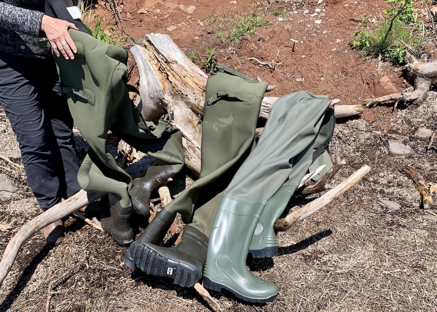
The mosquitoes pull out all the stops to welcome us as we arrive alongside Hog Island in a fisheries patrol-style vessel and take turns donning hip waders to make our way through the ocean lagoon to the rocky shore. We’re the only humans around and as we take a rare tour of this densely forested island, the overly abundant resident mosquito population follows and feasts.
Who can blame them? It feels like a celebration is in order. The sun is shining on Prince Edward Island after an unexpected two-day June downpour and negotiations are well underway to create an establishment agreement that will turn this cherished Mi’kmaq place into Pituamkek National Park Reserve.
Blake Bernard from the Lennox Island First Nation is the captain today and as a Pituamkek Pathfinder, he’s part of a team that oversees the management and stewardship of natural resources and cultural heritage. He deposits us at the Iron Rock site, home to Pituamkek’s rare geological feature, and something I’ve only read about and seen photos of until now.
“What you’re standing on now is Iron Rock, the only igneous outcrop on P.E.I.,” explains Helen Kristmanson, who serves as the Pituamkek Project Manager for L’nuey (the P.E.I. Mi’kmaq rights-based organization) and is the team archaeologist.
“Where we’re standing was once at the center of a massive continent called Pangaea and around 250 million years ago it was split apart. A fissure would have opened up here and lava spewed up and created this outcrop.”

The Iron Rock site is Prince Edward Island's only igneous outcrop/Jennifer Bain
The striking Iron Rock — which is an intrusive igneous rock called dolerite — is dark grey-black and rough and almost bubbly. Only a little bit is visible but the outcrop apparently runs under Hog Island and along the ocean floor through Malpeque Bay.
Located in northwestern P.E.I. (Epekwitk), near the Lennox Island First Nation, this chain of islands is known in English as Hog Island and the Sandhills. In the Mi’kmaq language it’s called Pituamkek (pronounced Bee-doo-um-gek) or “At the Long Sand Dune.” These shores and forests have been home to the Mi’kmaq people for more than 4,000 years and the islands form one of Eastern Canada's most ecologically significant coastal dune ecosystems.
Pituamkek stretches for 50 kilometres (30 miles) and forms a protective barrier to the north of Malpeque and Cascumpec Bays, which have rich fisheries. The islands help protect communities from the waves and storm impacts of the Gulf of St. Lawrence and, given the accelerating effects of climate change, deserve protection.

An aerial view of Pituamkek shows Hog Island (behind) and some of the Sandhills (foreground)/Epekwitk Assembly of Councils
Fraser McCallum — a Parks Canada communications and consultations officer with the Protected Areas Establishment and Conservation Directorate — shares a 12-page, photo-rich color booklet about the proposed national park reserve.
Why here, the government literature asks? Because Pituamkek is home to archaeological sites, sacred sites and an ongoing Mi’kmaq land-use tradition.
“The area constitutes a vital living link between Mi’kmaq culture, its history and the environment,” the booklet states. “For this reason, the Mi’kmaq First Nations of Prince Edward Island have a strong and enduring connection with the Pituamkek area and have recognized it as a Mi’kmaq Heritage Landscape.”

The exact boundaries of the proposed Pituamkek National Park Reserve are being negotiated/Parks Canada
Turning Pituamkek into a national park reserve would:
• Protect the ecological integrity of the wildlife habitat, plant and marine life (which includes numerous threatened or endangered plants and animals, including the Little Brown Bat, Northern Long-Eared Bat, Piping Plover and Gulf of St. Lawrence Aster).
• Ensure First Nations’ communities can preserve and celebrate their ancestral and present connections to the land.
• Blend science and traditional knowledge to protect and celebrate a diversity of flora, fauna and landscape features.
• Help provide First Nations’ communities with opportunities for visitor experiences, which include the presentation of natural and cultural heritage.

The mosquitoes can be intense in Pituamkek/Jennifer Bain
The potential visitor experience is top of mind as I fend off the mosquitoes after a 45-minute boat ride, walk the rocky shoreline, scramble around a large fallen tree and prepare to climb a short, steep hill to enter the dense forest. The Traveler is the first media outlet to visit. Only filmmakers have been granted access until now.
Even if a dock is eventually built so people don’t need hip waders, or an area is cleared for an outhouse and interpretive signs, this feels like it will always be a low impact, guided experience for sure-footed, adventurous spirits. Maybe it will start off just as a boat tour.
The tide is high today, which makes it easy to land the boat fairly close to shore, but means there isn’t much beach and my photos of a partially submerged Iron Rock aren’t as dramatic as when the whole outcrop is exposed.
From where we stand, we can start to see sand dunes across the lagoon.

We needed hip waders to get from our boat to Hog Island/Jennifer Bain
I’ve never witnessed the birth of a national park before and have been granted a special guided boat trip to Pituamkek, accompanied by two Pathfinders (Bernard and Luke Arsenault), Kristmanson, McCallum, Luke Arbuckle (a Parks Canada project officer for Pituamkek) and Jesse Francis (the L’nuey-Parks Canada manager of partnership initiatives).
In government lingo, Pituamkek is referred to as a proposed national park reserve and not a proposed national park. That happens under the Canada National Parks Act when “an area or a portion of an area proposed for a park is subject to a claim in respect of aboriginal rights that has been accepted for negotiation by the Government of Canada.”
Pituamkek is an unusual case because it was the First Nations community that first approached the government for protection — not the other way around — and then kept working on the proposal despite being initially rebuffed.

Archaeologist Helen Kristmanson and Parks Canada's Luke Arbuckle scour the shore and shallow water for things of interest/Jennifer Bain
The story officially begins in 2006 when representatives from the Mi’kmaq communities of P.E.I., Parks Canada and the Canadian Museum of Civilization (now the Canadian Museum of History) conducted a foot survey of Hog Island and the Sandhills and discovered several archaeological sites. Detailed archaeological work here has helped paint an increasingly detailed picture of the lives of the Mi’kmaq.
In 2008, the province and the Mi’kmaq First Nations asked the federal environment minister to consider protecting the area. The next year, a tripartite group of representatives from the federal, provincial and Mi’kmaq governments began talks to find ways to protect the region, while the Nature Conservancy of Canada began acquiring land on Cascumpec and Conway islands for conservation.
For the nine years, between 2010 and 2018, multiple organizations continued collaborating and laying the groundwork for the park reserve.

There's no sign that Pituamkek is being considered for national protection — just a sign saying visitors must secure written permission from the Lennox Island First Nation/Jennifer Bain
In August 2019, a historic tripartite announcement from the federal government, provincial government and Epekwitk Mi’kmaq formally launched a feasibility assessment for the proposed national park reserve. The next month L’nuey, the Epekwitk Mi’kmaq Rights Initiative, was launched to lead discussions and negotiations related to the feasibility study.
The pandemic delayed public consultations but the proposal eventually earned “almost unanimous support.”
Most recently, a memorandum of understanding (MOU) to formally work towards establishing the park reserve was signed Jan. 19 by Minister of Environment and Climate Change and Minister responsible for Parks Canada Steven Guilbeault and Epekwitk Assembly of Councils co-chairs Chief Darlene Bernard and Chief Junior Gould.
Among the things to be negotiated are the park reserve’s boundaries, co-operative management structure and tourism offerings.

The Traveler visited Pituamkek with people from Parks Canada, L'nuey and the Lennox Island First Nation/Jennifer Bain
“What areas should people not be encouraged to visit? What areas are suitable for low impact?” wonders Francis. “All the parties agree that the character of the place, and the ecological and cultural features are really important, and that conservation is the starting point for discussion.
“Maximizing the benefit to the community of something like this is one of the factors that weighs in,” he continues. “Each national park in Canada is an example that balances conservation and visitation.”
When Pituamkek moves from dream to reality, it will be the first national park reserve to contribute to Justin Trudeau’s Liberal government's commitment to create 10 new national parks by 2025. But politics isn’t on anyone’s mind as we make the most of the short time we have for exploration.

The ocean around Pituamkek is rich with marine life/Jennifer Bain
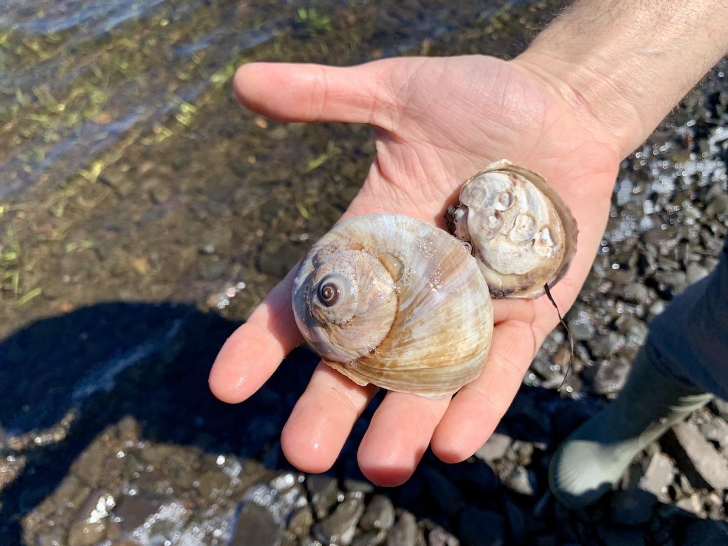
We walk the shore, eyes cast downward, admiring sea greens, shells and moon snails and searching for anything of significance.
Kristmanson is clearly in her element in this coastal wilderness. Her archaeological work here has been detailed in “Pitawelkek: A 2000 year old archaeological site in Malpeque Bay” published in the Fall/Winter 2019 issue of The Island Magazine. (Pitawelkek, another Mi’kmaq name for the area, has since been replaced by Pituamkek. What was once called Georges Island is now more commonly called Hog Island.)
The Iron Rock site is on Hog Island. A short walk away is a shell-bearing site (also known as a shell midden) that is full of shellfish refuse and was occupied from the Woodland Period to the post-contact era. “The oysters and clams are cooked and become part of the living floor of the campsite,” Kristmanson explains.
For "at least two or three thousand years," she says, ancestral Mi’kmaq families spent the early spring to fall here where they took a variety of fish species, hunted walrus and seal and harvested shellfish.
“Among the wigwams once positioned behind the shell refuse were campfires where they shaped and sharpened stone, some of which was sourced at a distance,” Kristmanson says. “Scatters of pottery sherds and the presence of an unfinished clay coil fragment show that here they made clay pottery vessels for the storage and preparation of food. Shadows in the soil and the spatial distribution of heavy stones point to possible smoking racks, fire spits and dwellings at the campsite.”

Only an expert would realize the shells in the earth here are a "shell midden" and sign of an ancient Mi'kmaq presence/Jennifer Bain
After pushing through the bush, everyone helps pull back a blue geotextile covering at an active excavation site that's divided by stakes, pins and yellow string in grids. “Things tend to migrate and younger artifacts can trickle through into older deposits and try to trick you,” Kristmanson says, adding there’s “little or no evidence of European influence.”
“From an archaeological perspective it contributes to our knowledge of pre-contact shell midden sites in the Woodland Period of the Maritime Provinces in terms of their diet, material culture, subsistence strategies, raw material procurement and use, and settlement patterns, for example,” she says.
Kristmanson and the Pituamkek Pathfinders will excavate into the fall and then focus on post-excavation processes like cleaning and cataloguing artifacts, identification, analysis and writing up the findings. After that, they’ll continue to work at the Pituamkek site, piecing together the past and are beginning to archaeologically survey adjacent areas to identify and document archaeological sites.

Archaeologist Helen Kristmanson stands by an area of the excavation site where all the back dirt is screened through mesh/Jennifer Bain
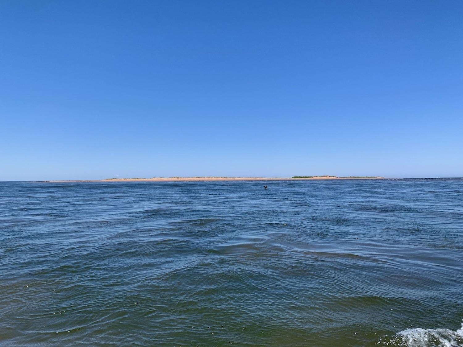
Our time on Hog Island is limited to about 90 minutes so we can continue by boat for views of the sandhills. We share binoculars to view one stretch of parabolic dunes that is packed with cormorants. Endangerd piping plovers apparently nest here but can't be spotted from this distance.
“What do you think?” asks Bernard, whose mom Darlene is the Lennox Island First Nation chief.
“This is home as far as the eye can see.”

Our boat couldn't get close to the sandhills so we admired them from afar/Jennifer Bain
The sun is shining but the ocean is choppy. Bernard lightheartedly predicts that we're all going to get seasick and says it's too rough to hug the shore.
We head out to deeper water where the ride is smoother but the sandhills remain a mere speck on the horizon. Some day I hope to be among the first people to officially visit when these barrier islands hopefully get federal protection and start a new chapter as a national park reserve.
It takes more than an hour to make our way back to the Bideford Wharf — just past the one at Lennox Island. We finally tuck into our packed lunches and snacks, and make one unexpected stop to retrieve a hat that blows into the sea.

Blake Bernard, left, and Luke Arsenault are Pituamkek Pathfinders and Lennox Island First Nation members charged with being stewards for the area/Jennifer Bain
After more than 15 years of doing archaeology at Pituamkek, Kristmanson remains captivated by the beauty of Malpeque Bay and the sandhills, but stresses that it's the people who make the place special. "It is a pleasure and privilege to work with the Epekwitk Mi’kmaq, especially the Pituamkek Pathfinders, in the archaeological study of their heritage,” she shares.
There's no set timeline for the complex negotiations behind the establishment agreement, and no hint yet about how the area will be both preserved and presented.
Pituamkek, everyone agrees, is special in so many ways. I'm eager to watch this story unfold, and blessed to be able to get out to Pituamkek for a few precious hours and start to make connections with the land.


 Support Essential Coverage of Essential Places


Add comment