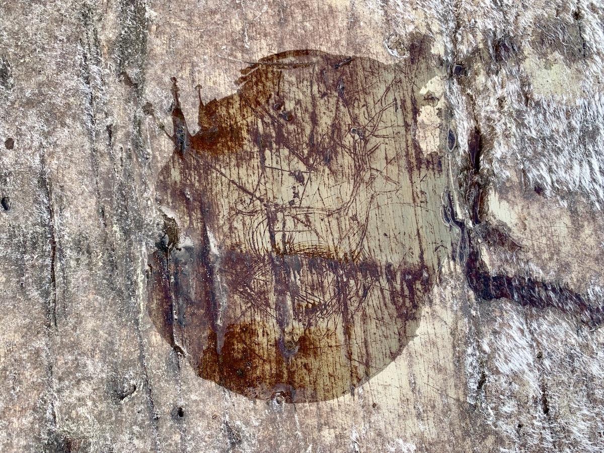
One of the Mi'kmaq petroglyphs carved into the rock on the shore of Kejimkujik Lake/Jennifer Bain
Barefoot, we carefully step onto a slate outcrop along the shore of Kejimkujik Lake and start looking for ancient Mi’kmaq images carved in the soft rock.
One by one, these precious petroglyphs reveal themselves, sometimes only when water has been splashed over the rocks so the fading images pop. The one that’s likely a caribou is easy to find. So is the one that’s clearly a European sailboat. A man with a fancy hat and body shield — well that one is strangely cartoon-like and especially captivating but likely a French soldier. Somewhere on this outcrop there is an image of bear, but the rocks are also marred by graffiti and so no one has spotted it in ages.
“The petroglyphs get a lot of attention,” allows Alex Hancock, an interpreter here at Kejimkujik National Park and National Historic Site in Nova Scotia. “A lot of people come here to see them and have experiences with them. There’s still a lot we don’t know about them.”
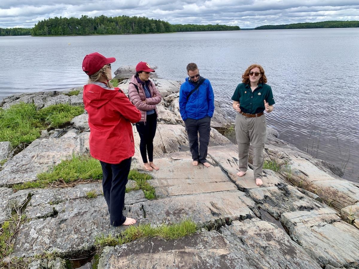
Parks Canada interpreter Alex Hancock, right, guides travel writers to a Keji petroglyph site/Jennifer Bain
Kejimkujik — pronounced kedge-i-mmm-coo-jik and known locally as Keji — is the only place in the Parks Canada portfolio that has a full dual designation as a national park and a national historic site. The only inland national park in Atlantic Canada protects a cultural landscape that celebrates the long presence of the Mi’kmaq and their seasonal camps, burial grounds, fish weirs, hunting territories, canoe routes, portages, trails and rock carvings.
Some 500 petroglyphs are found here, forming one of the largest concentrations in eastern North America. Engraved on soft rock outcrops along the shores of the park’s main lake, they portray Mi’kmaq life and spirituality.
“These are places of power, landmarks on the shore, rendezvous points, and more importantly, Sacred Places,” reads background material tucked away in a binder kept at the visitor center reception desk.
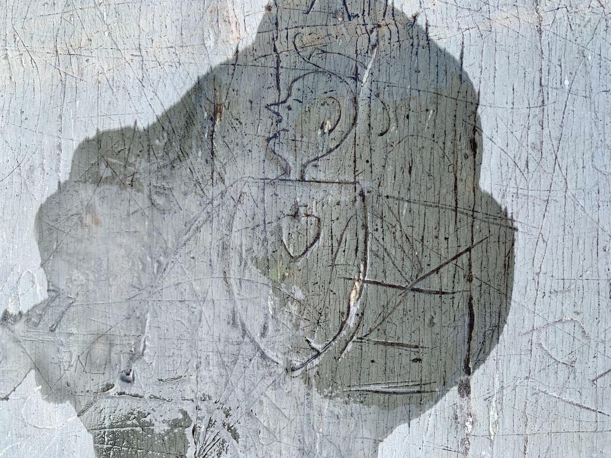
This Keji petroglyph is believed to depict a French soldier/Jennifer Bain
The soft rocks containing the petroglyphs are considered “an irreplaceable part of Mi’kmaq history.” And since these faint images are fragile and extremely vulnerable, all of Keji’s petroglyph locations have been designated as restricted areas and can only be visited with a Parks Canada guide.
In the summer there are daily tours, some on foot, some by canoe.
“Restricted Area. Mi’Kmaq Sacred Site,” reads a warning sign in the forest on the way to the site we visit. “Please Respect by not entering area.”
Leslie Lowe is on petroglyph patrol today and keeps a watchful distance. He apparently carries a loudspeaker to warn canoeists and kayakers who come too close to shore, usually inadvertently. The reason we must remove our shoes, Hancock explains as we sit on benches designed just for this purpose, is to ensure that any tiny pebbles embedded in our treads don’t scrape against the rocks. Care must also be taken with our watches and rings.

A monument near one of Keji's petroglyph sites speaks to the Mi'kmaq cultural landscape at the park/Jennifer Bain
As the petroglyph material in the visitor center binder explains, “the initial appearance of these images would have been as white lines starkly contrasting with the dark slate. As these images weathered, they would have faded to the original colour, blending with the myriad natural cracks and scratches which cover the rock surface.”
In other words, as Hancock puts it, "the rock is kind of a blessing and a curse. The petroglyphs are slowly eroding and becoming less visible.”
The petroglyphs paint a picture of early Mi’kmaq life. Human figures are in 84 of them. Several show a highly stylized, non-European aesthetic. At least 61 depict the distinctive peaked hat worn by Mi'kmaq women. Fishing scenes are naturally popular, and among 28 canoe images are some with people hunting small whales. Hunting scenes show caribou, moose and herons, while animal images include bear, moose, caribou, deer, snake, eels, fish, birds and dogs. There are both Catholic and traditional spiritual images, including horned serpents.
Of course we only see a handful of these things at this one spot. And while the Mi’kmaq have lived on the land that’s now Nova Scotia for more than 10,000 years, Hancock says the petroglyphs we can see are 300 to 500 years old and this is one of just four main sites.
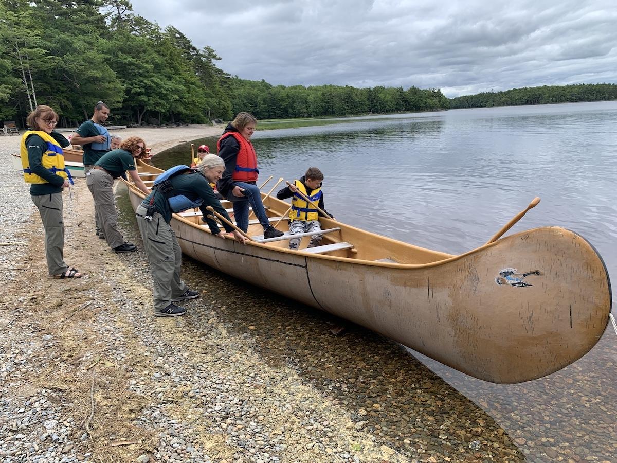
Parks Canada staff prepare the "Big Canoe" on National Indigenous Peoples Day at Kejimkujik Lake/Jennifer Bain
It wasn't planned but today is June 21 and National Indigenous Peoples Day. Busloads of school children have arrived to explore the park whose name comes from the Mi’kmaw word Kejimkuji’jk, which means “little fairies.” They’ll soon be escorted in small groups to the petroglyphs and invited to paddle a 38-foot big canoe on Kejimkujik Lake, which was once known as Fairy Lake and is still home to Fairy Bay.
Keji protects interconnected waterway as well as Acadian forest, and its loyal following comes to canoe, camp and connect with nature. Two hours southwest of Halifax, near the province's Yarmouth and Acadian Shores region and in the UNESCO Southwest Nova Biosphere Reserve, the park celebrated for its “gentle wilderness” is also Nova Scotia's only Dark Sky Preserve. Some visitors drive another hour south to do coastal hikes in a small, separate area known as Kejimkujik National Park Seaside that was added in the late 1980s.
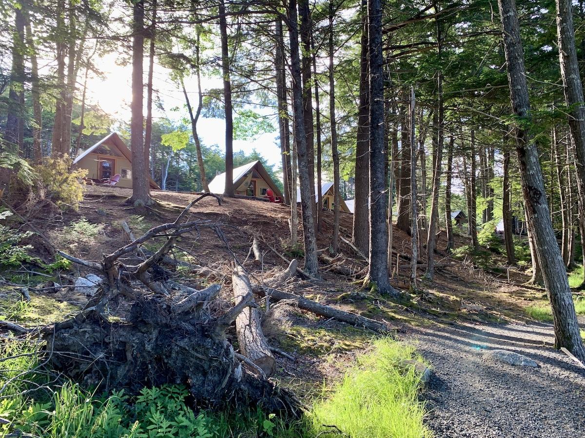
A view through the trees of Jeremy's Bay Campground at oTENTiks/Jennifer Bain
My Keji base for two nights is an oTENTik — a cross between a tent and a cabin meant to lure urbanites who like comfort and being around other people — in Jeremy’s Bay Campground.
There is much to see, like the phone booth that stands alone in the forest, and the inclusive rainbow crosswalk that incorporates the 11 colors of the Progress Pride Flag to show support for all members of two-spirit, lesbian, gay, bisexual, transgender, queer, questioning, intersex, asexual, agender and beyond (2SLGBTQIA+) communities.
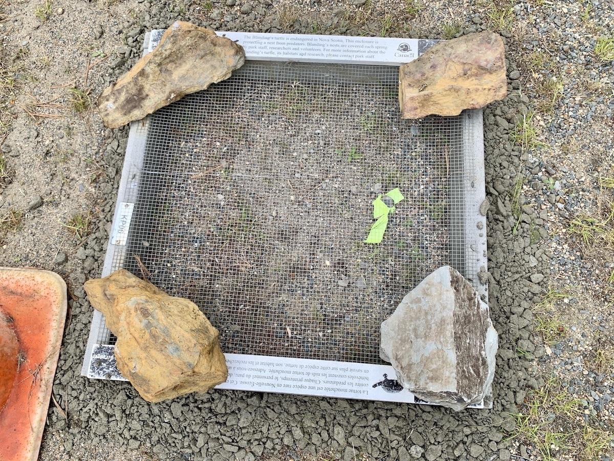
Parks Canada takes steps to protect turtle nests along Keji's roads/Jennifer Bain
Along another stretch of park road, I spot an exclosure that protects the eggs that Blanding’s turtles have laid on the shoulder. I take a guided hike of the Hemlocks and Hardwoods Trail with nature legacy ecologist Matt Smith and learn what's being done about Hemlock Woolly Adelgid, an invasive insect from Asia that's harming the old-growth hemlocks.
Rain and clouds dash any hope of seeing the night sky from this Dark Sky Preserve, but I do learn from Tony Schellinck, a member of the Royal Astronomical Society of Canada who volunteers in the park, that binoculars are a fine starting point when you don’t have a telescope. The park rents dark-sky kits — with binoculars, a headlamp with a red light, a night sky guide and a star finder — for just $5 ($3.80 USD) and directs people to a "sky circle" built near the Jeremy’s Bay Campground.

Whynot Adventure's Keirstan Hargrave points out a loon nest platform meant to help the iconic birds cope with water level changes/Jennifer Bain
By day, a canoe ride down the Mersey River with Keirstan Hargave from Keji-based outfitter Whynot Adventure, reveals how the murky brown water here is known as “Mersey tea” and is caused by water that seeps through the bogs and is stained by organic compounds.
There isn't enough time to really get to know Keji, but there is time to geek out on its infrastructure investments.

One of Keji's new, gender-free washroom facilities with individual, lockable bathrooms and showers/Jennifer Bain
Ten new inclusive washroom and shower buildings at Jeremy’s Bay Campground are green and efficient, and connected to new drinking water and wastewater treatment facilities. The non-gendered design — with a common hallway and five individual rooms, each with a toilet, sink and grooming area behind a lockable door — is the way of the future. Three shower rooms also have lockable doors, plus there are accessible/family options exist for both toilet rooms and shower rooms. A photovoltaic (PV) solar array will offset the campground's energy consumption.
After a quick stop at the visitor center to see one of Mi'kmaq builder Todd Labrador's birch bark canoes, my last stop is the climate-resilient permanent pedestrian bridge that recently replaced the floating pedestrian bridge at the Mill Falls day-use area. It may look like an ordinary, albeit new, bridge but it features technology and abutment designs that take into account climate change adaptation planning, and can withstand dramatic changes in storm water flow as well as wind loading.

A new climate-resilient, permanent pedestrian bridge over the tea-colored Mersey River/Jennifer Bain
For visitors, the bridge allows for more dependable four-season access to several trails, including the new Ukme’k shared-use trail.
Ukme’k trail, which means “twisted” in Mi’kmaq, winds along the forested banks of the Mersey River to an ancient canoe route known to the Mi'kmaq as Oqomkikiaq. To lure mountain bikers, the trail is full of technical features like rock crossings, berms, rollers and other obstacles or design elements that add challenge or improve trail flow. It's 6.3-kilometres (3.9-miles) long and rated as difficult.
A gentle walk along the river for final photos of the largest waterfall in the park is more my speed, for a final look at Keji's unusual Mersey tea-colored water.
While You're In The Area

The Fort Anne Heritage Tapestry explores Acadian culture, the 1755 Deportation, military battles between the French and British and more/Jennifer Bain
If you’re on a Parks Canada binge, there are two national historic sites within an hour’s drive of Kejimkujik.
Fort Anne National Historic Site gets to boast that it’s the oldest national historic site operated by Parks Canada. It celebrated its centennial in 2017.
Military buffs love the well-preserved earthen star-shaped fort that’s an example of Vauban-style fortifications. The fort played an important role in early European colonization, settlement and government in Acadie and Nova Scotia in the 17th and 18th centuries.
I lingered over the Fort Anne Heritage Tapestry that depicts more than 400 years of history in the Annapolis Royal area with visual stories about arrival and settlement, peaceful alliances and military conflict, social change and community pride.
Designed by Kiyoko Grenier-Sago, the four-panel tapestry was stitched by more than 100 volunteers. Measuring 5.5 metres (18 feet) across and 2.5 metres (8 feet) high, the tapestry was unveiled in 1995. It used 95 shades of wool including 16 shades of green.

A costumed interpreter at Port-Royal National Historic Site stays in character throughout a tour/Jennifer Bain
Just 10 minutes from Fort Anne, Port-Royal National Historic Site gets to boast that it was the Canadian government’s first large-scale reconstruction project.
It was actually Harriette Taber Richardson from Cambridge, Mass. who spent summers in the area, pushed for the reconstruction and helped raise funds for it. Parks Canada rebuilt the “Habitation” in 1939 in what’s considered a milestone in the preservation movement.
The Port-Royal Habitation is a reconstruction of one of North America’s oldest European settlements. French colonists, including Samuel de Champlain, lived in this fortified compound from 1605 to 1613 and forged ties with the Mi’kmaq.
I like how costumed guides greet visitors in character and treat us as if we’re arriving to work and need to see the forge, bakery, sleeping quarters and common room where the French and Mi’kmaq had festive dinners.

 Support Essential Coverage of Essential Places


Add comment