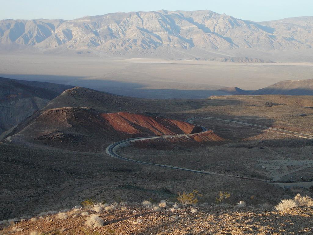
Most of Death Valley National Park remained closed Wednesday/NPS
A number of visitors to Death Valley National Park who ignored warnings to avoid travel in the park had to be rescued after their rigs bogged down in the mud and muck left from last week's torrential rainstorm. Those who got stuck apparently used navigational apps that routed them onto primitive backcountry dirt roads in a bid to avoid paved road closures, a park release said.
"Park rangers have responded to aid stranded motorists. Some had all four tires on their vehicle flat," Wednesday's release said. "Park staff have been diverted from flood operations to start re-searching backcountry roads, add additional closures signs, and respond to stranded visitors. No injuries have been reported."
At 3.3 million acres, Death Valley is roughly the size of Connecticut, and there are nearly 60 roads that enter the park. Many of those routes, however, are rarely-traveled 4x4 roads, and some of those provided the access that got the travelers in trouble.
Backcountry dirt road travel is strongly discouraged in the summer under normal conditions, as there is increased risk of being stranded in a remote location in extreme heat, the release said. According to the National Weather Service, temperatures in Death Valley have ranged from 114-117 degrees Fahrenheit in the past days, and are forecast to continue in the 111-114-degree range. At this time, all dirt roads that have been assessed have had damage, and some are unpassable, the park reporrted. Not all roads have been assessed for current conditions due to the scale of the flooding impacts.
“We urge visitors to stay off dirt roads, even if apps are directing them there,” said Death Valley Superintendent Mike Reynolds. “While we are working with various map platforms to report these issues, please be smarter than your smart phones.”
Park staff could not immediately be reached to say how many travelers needed to be rescued. One reportedly got stuck in the Chloride Cliffs area not far from Beatty, Nevada.
A three-hour rainstorm last Friday dumped 1.46 inches of rain on Death Valley, causing widespread flooding that tore up roads, blew out water systems, and shut down the park. The National Weather Service classified the storm as a once-in-a-thousand-year event.
A small portion of the national park was able to reopen Wednesday, though most of Death Valley remained closed to the public due to road access issues and ongoing cleanup. Park staff said California 190 was open from the Trona/Wildrose Junction in the Panament Valley west past the Father Crowley Overlook and out of the park. From Trona/Wildrose Junction east the road remained closed and was not expected to open before August 19.
This partial opening allows for access to limited areas, including:
- Panamint Springs Resort (a private inholding)
- Father Crowley Overlook
- Lee Flat
The most highly visited areas of the park, including Furnace Creek Visitor Center, Badwater Basin, Zabriskie Point, Dantes View, Mesquite Sand Dunes, and additional paved roads remain closed due to extensive flood debris and damage.

A short section of California 190 past the Father Crowley Overlook (pictured) reopened in Death Valley on Wednesday/NPS
Areas of the park remained wet and muddy Wednesday, and staff said it was important to give these areas time to dry out. Walking onto wet playas can leave footprint scars for years to come, and driving on muddy dirt roads can cause deep ruts that add to the damage and time to repair these areas, the park release said.
Monsoonal rains typically reach into the Southwest during the summer months, bringing much-needed moisture to the region. According to the weather service, the monsoon season runs from June 15 through September. In recent summers it has been been fairly muted -- the 2020 monsoon season was one of the driest on record, according to the service -- while this year's monsoons have generated significant flooding in places such as Death Valley, Joshua Tree National Park, and Mojave National Preserve, which also has recorded significant road damage from recent storms.

 Support Essential Coverage of Essential Places


Add comment