
Map of Sunrise-area trails, Mount Rainier National Park / NPS
The Sunrise area of Mount Rainier National Park is about a two-hour drive from my home in central Washington state and is one of my favorite areas of the park in which to hike. In a previous article, I wrote about exploring the less-trafficked Silver Forest Trail at Sunrise. For my most recent visit, I hiked the Sourdough Ridge trail to the Dege Peak spur trail, a more popular, almost-four-mile (6.4-km) roundtrip route with 360-degree views at trail’s end.
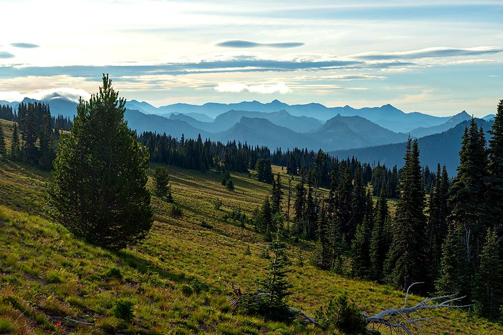
A look at the map of Sunrise trails reveals many of them branch out from the fork of a single trailhead behind the restroom building and picnic area: Fremont Lookout, Sourdough Ridge, Burroughs Mountain, Dege Peak. To hike to Dege Peak (pronounced Deh-gay), turn right at that fork. The first half mile (0.8 km) along Sourdough Ridge trail is probably the steepest (although the last 200 feet/60.96 meters up to Dege Peak is a little steep, too). Once you hike up to the log sign pointing toward Dege Peak, it will be a mix of rolling ups and downs from there as Sourdough trail alternates between hugging the mountains’ sides and running atop a narrow ridge spine with clear views of meadows, basins, and mountain scenery below and beyond, including distant Mount Adams on one side of the ridge spine and Glacier Peak on the other side. If you’re hiking with children, you might want to hold their hand along the narrower portions of the trail. Watch your step over the rocky areas and take it slow and easy if you have any issues with heights.
Heading up to that fork in the trail, Sunrise area, Mount Rainier National Park / Rebecca Latson

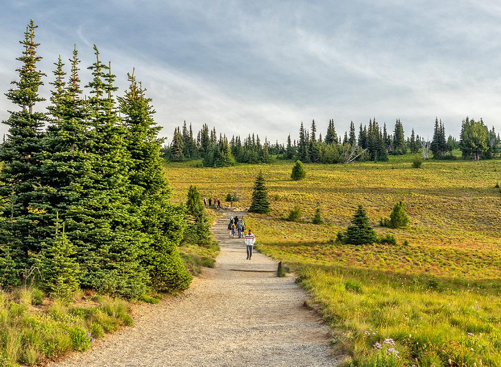
Looking back toward the start of the hike, Sunrise area, Mount Rainier National Park / Rebecca Latson
Considered a moderate hike, the trail is primarily well-maintained packed dirt which can churn up quite a bit of dust from hikers’ feet during the summer’s dry heat (late July – early September), which is the best time to access this route free of snow and ice patches. If you can manage the residual snow and ice, you’ll be greeted with abundant wildflowers along the trail and down in the meadows. I attempted the hike to Dege Peak when the Sunrise area first opened around July 1, but couldn’t traverse all the snow and ice in spots, so returned in mid-August with no obstacles. During this recent visit, scarlet paintbrush still bloomed in spots while purple mountain aster was on the way out and pasqueflower bobbed their “bedheaded” seed tops in the breeze.
Landscape along Sourdough trail, Sunrise area, Mount Rainier National Park / Rebecca Latson

Pasqueflower seedheads, Sunrise area, Mount Rainier National Park / Rebecca Latson
Regardless of the trail hiked out there, always remember water, sunscreen, a snack and maybe even bug spray for Dege Peak, as I’ve read other hikers’ accounts of pesky bugs atop the peak. Oh, also remember to wear a brimmed hat. An early-morning hike along this easterly-pointing trail ensures fewer crowds but you’ll be greeted by a blinding sun in the eyes. Same thing may be said for hiking in the afternoon, except the bright sunlight now blinds your eyes as you head west back toward the parking area.

Heading east along the Sourdough Ridge trail toward Dege Peak, Sunrise area, Mount Rainier National Park / Rebecca Latson
After approximately 1.5 miles (2.4 km), you’ll have the choice of taking the spur trail to Dege Peak summit or continuing for 1.2 more miles (1.9 km) to Sunrise Point and the parking lot along that hairpin turn in the road to Sunrise.
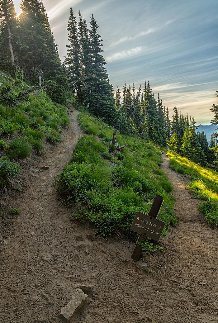
A choice of trails, Sunrise area, Mount Rainier National Park / Rebecca Latson
The last 200 feet/60.96 meters of the trail becomes steep, narrow, and a little rocky, but the views are all-encompassing.

I spy with my little eye, hikers atop Dege Peak, Sunrise area, Mount Rainier National Park / Rebecca Latson
Toward the south, you’ll see Mount Adams in the distance.
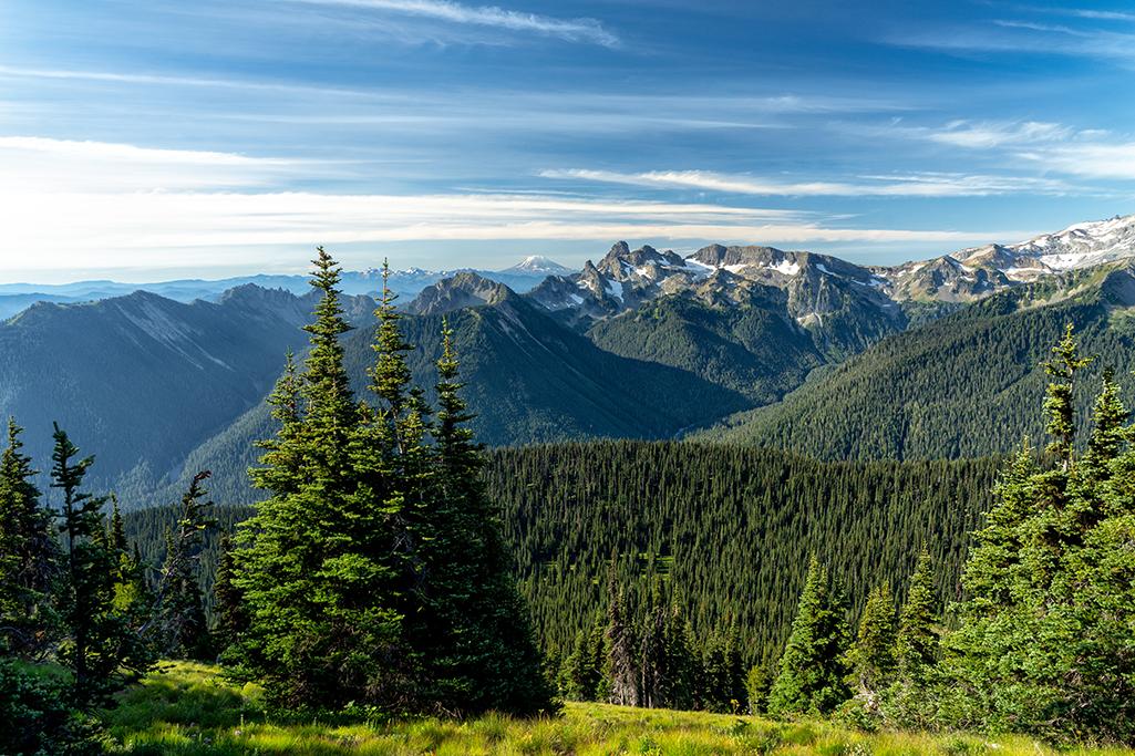
A view of Mount Adams, Dege Peak trail, Sunrise area, Mount Rainier National Park / Rebecca Latson
Clover Lake, Sunrise Lake, and Sunrise Point parking area greet your eastern views and you might also spot a marmot up there or at least hear its shrill whistle.

Sunrise Lake, Sunrise Point, and landscape beyond seen from the Dege Peak trail, Sunrise area, Mount Rainier National Park / Rebecca Latson
To the west, you’ll trace the sinuous road leading to the Sunrise parking lot and Visitor Center over which “The Mountain” towers.

Park road, parking area beyond, and "The Mountain" views from Dege Peak trail, Sunrise area, Mount Rainier National Park / Rebecca Latson
Depending upon your hiking speed as well as how often you stop to admire the views, you should budget maybe three hours roundtrip. There are no restrooms except near the trailhead at the Sunrise parking area, so go before you go. If you are a photographer, remember to pack along your tripod for a sunrise or sunset shot from the peak.
Aside from the steeper parts of this hike, of which there are few, it’s a relatively easy walk. I embarked upon this trail long after sunrise, but I do believe my next hike to Dege Peak might just be a sunrise one.


