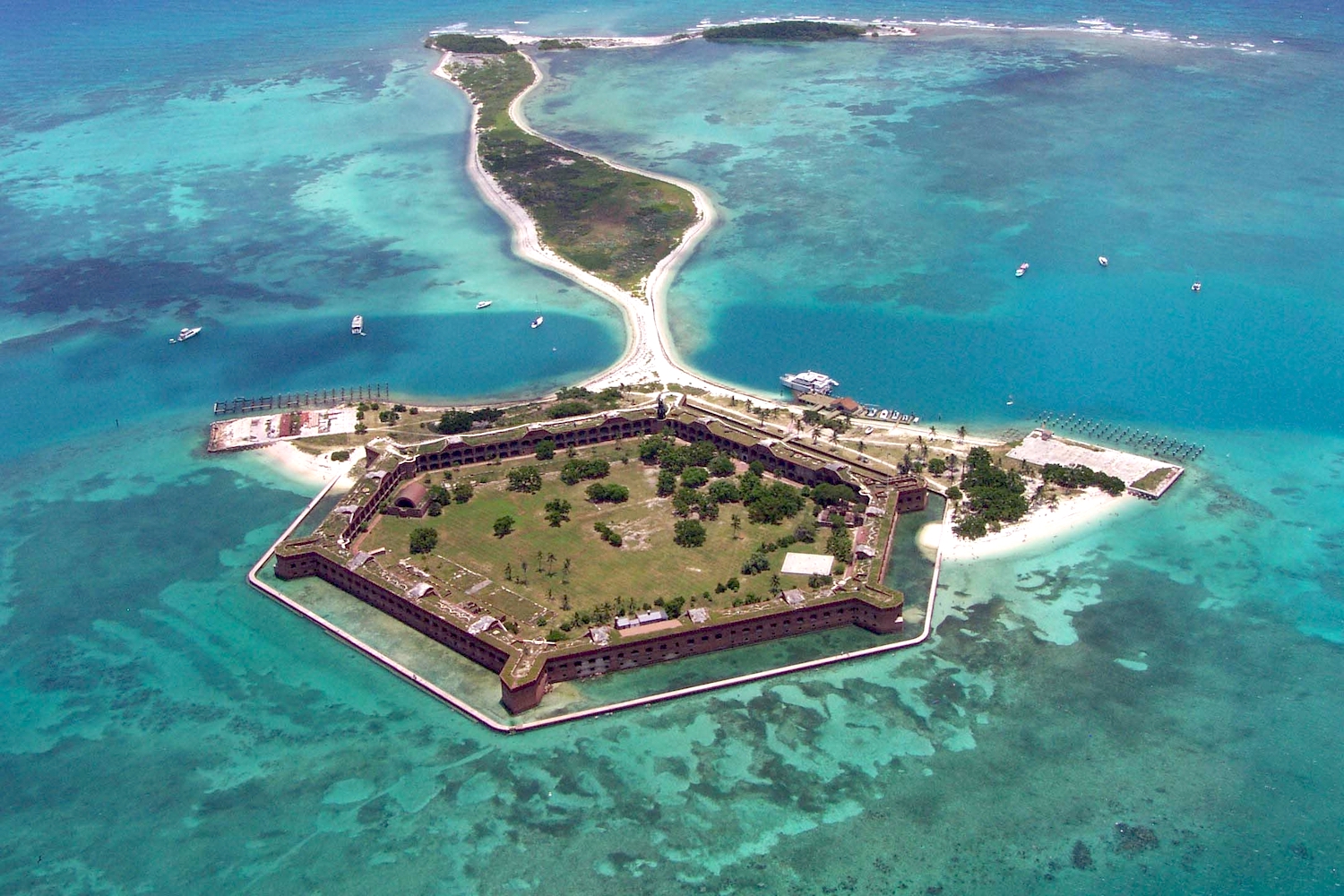
Visitors to Dry Tortugas National Park can see coral reefs, sea turtles, sharks, tropical reef fishes, remnants of shipwrecks, and Fort Jefferson. But the park, located about 70 miles west of Key West, Florida, in the Gulf of Mexico, may submerge this century given projections for sea-level rise.
Across the country, national park units are grappling with the likelihood that a portion of their land could become inundated and their habitats significantly altered by sea-level rise in the not-too-distant future. Expanding oceans caused by warming waters and melting glaciers and ice sheets – stemming from greenhouse gas emissions increasing atmospheric temperatures — are driving sea-level rise.
“Human-caused climate change has raised sea level 33 cm (13 inches) at Golden Gate National Recreation Area, San Francisco, since 1954 and 42 cm (17 inches) near the Statue of Liberty National Monument, New York, since 1856,” said Patrick Gonzalez in an email.
Now executive director of the Institute for Parks, People, and Biodiversity at UC Berkeley, Gonzalez was a climate change scientist with the National Park Service from 2010-2021 and assistant director for the White House Office of Science and Technology Policy from 2021-2022. He also was a lead author on four reports of the Intergovernmental Panel on Climate Change, the United Nations’ lead advisory body on climate change science.
Dry Tortugas could be inundated with approximately 9.4 inches water by 2050 and two feet by 2100 under mid-range scenarios that assume social, economic, and technological trends do not shift significantly from the current path, said Maria Caffrey, a climatologist working with Gro Intelligence. The private-sector firm has calculated sea-level rise at national parks throughout the country, based on information in the IPCC’s 2021 report.
Caffrey previously was principal investigator on the 2018 study, Sea Level and Storm Surge Projections for the National Park Service. The Trump administration wanted all references to human-caused climate change deleted from the report. When Caffrey refused, her contract with NPS was not renewed. Ultimately, the report was issued with all references reinstated.
“Continued climate change could raise sea level on the Pacific Coast enough to inundate most suitable habitat for northern elephant seals in Point Reyes National Seashore by 2100. Research shows that sea level due to human-caused climate change threatens the Atlantic Coast even more, potentially inundating half of Everglades National Park by 2100,” Gonzalez said.
Gro Intelligence similarly found that about 44.4 percent of Everglades National Park might be inundated by 2100. But changes could come even sooner.
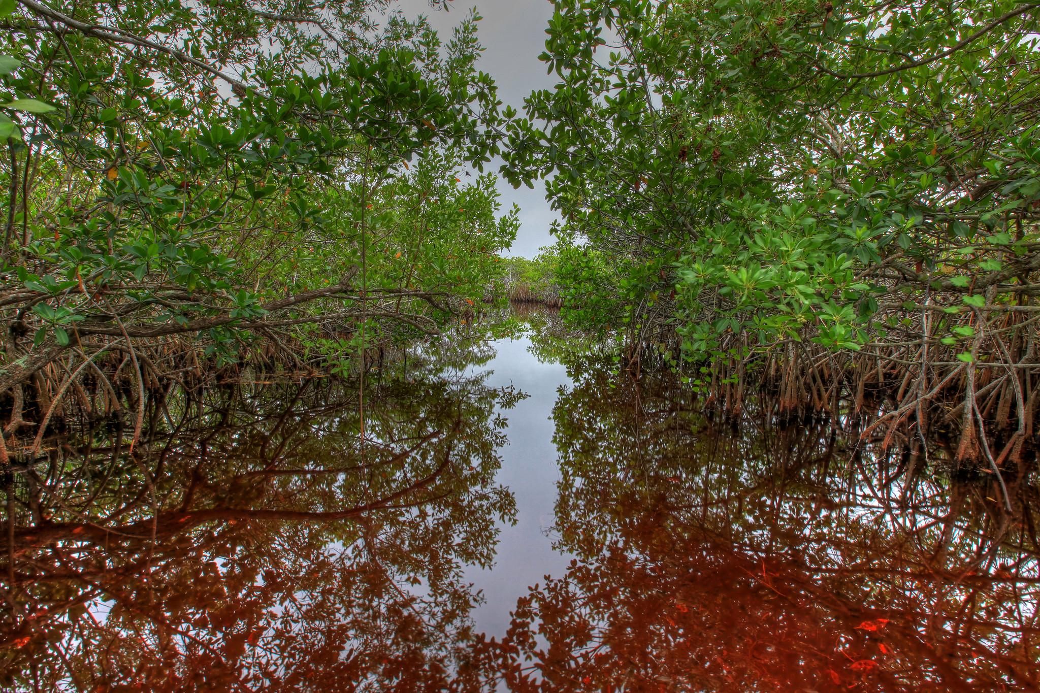
By 2050, the mangroves “are expected to be overtaken” by sea levels, said John Kominoski, lead principal investigator of the Florida Coastal Everglades Long Term Ecological Research Program funded by the National Science Foundation.

Mangroves, which play important ecological roles along Florida Bay in Everglades National Park, could be lost to sea-level rise/NPS file
The death of the mangroves will mean a loss of the ecosystem benefits the trees and shrubs provide, including protecting the coastline against erosion, providing habitat for juvenile fish, sponges, and birds, trapping sediment, storing carbon, and keeping the water clean. Dead mangroves emit greenhouse gases, too, including methane, that contribute to climate change and a warming planet.
“Where mangroves die back from stress - like elevated water that inundates their roots - these globally relevant stores of ‘blue carbon’ may transform from sinks to sources of carbon,“ Kominoski said.
Another area likely to be inundated by sea-level rise are parks and monuments in Washington, D.C. Gro Intelligence’s data show that the Franklin Delano Roosevelt Memorial in West Potomac Park between the Lincoln and Jefferson Memorials will be covered with about one foot of water by 2050. This forecast is similar to findings by Gonzalez.
Sea level will likely raise “halfway to your knee near the Jefferson Memorial,” he said.
In response, the Park Service just approved a nearly $113 million contract to rehabilitate the failing seawalls around a portion of the Tidal Basin and along the Potomac River through West Potomac Park
Age, rising sea levels, and poor drainage have taken a toll on the Tidal Basin and West Potomac Park seawalls. Portions of the seawalls have settled as much as five feet since their initial construction from the late 1800s to the early 1900s. As a result of this settlement and sea level rise, water flows over portions of the seawalls twice a day during normal tidal conditions. Despite various repairs over the decades, the seawalls are no longer structurally sound and threaten visitor safety and the historic setting, including the iconic cherry trees around the Tidal Basin.

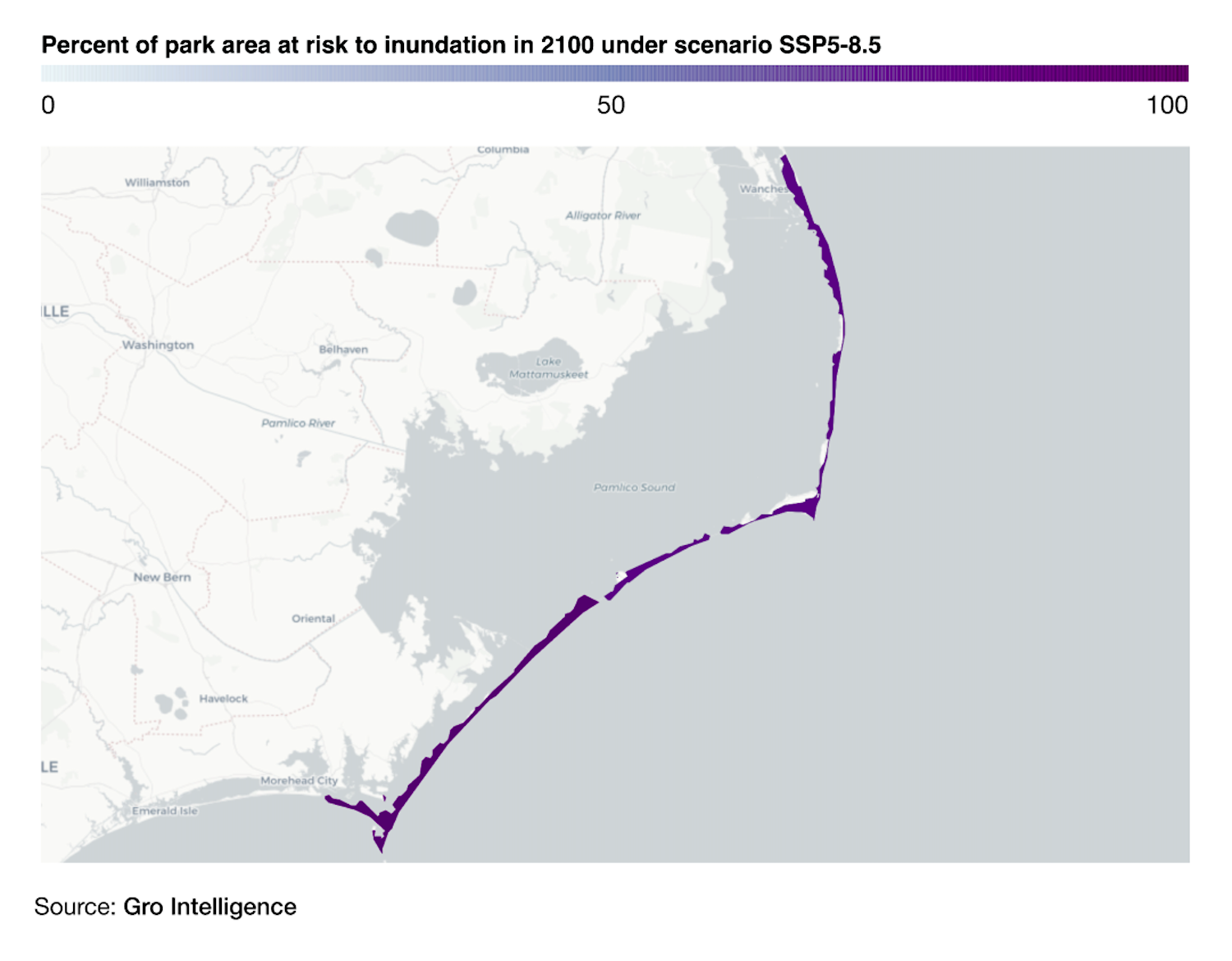
Most of Cape Hatteras National Seashore could be underwater by 2100/Gro Intelligence
In North Carolina, the coastline is “extremely vulnerable” to projected sea-level rise due to its low elevation and subsidence (sinking) of land in the northern coastal plain, according to the National Oceanic and Atmospheric Administration.
Cape Hatteras National Seashore sits on a barrier island — a wave-constructed landform parallel to the coast that erodes and accretes depending on many factors, including tide impact, wave energy, weather, and sediment supply. One side faces the ocean, and the other fronts an inlet between the barrier island and the shoreline.
“We are a thin ribbon of sand in the middle of the ocean,” said David Hallac, the national seashore’s superintendent.
From 1972-2022, the ocean rose 5.42 mm per year — equivalent, overall, to 1.78 feet — at the Oregon Inlet on the Outer Banks where Cape Hatteras is located, according to NOAA.
“This is a high rate of sea-level rise,” said Hallac. “We should expect 10-14 inches of sea-level rise by 2050,” and a 10-fold increase in flooding.
Gro Intelligence estimates that almost 75 percent of Cape Hatteras will be inundated by 2100.
Some efforts the United States has taken to control the dynamic movements of the barrier island have had unintended consequences.
For example, the Civil Conservation Corps and NPS in the 1930s built dunes to keep the ocean from reaching the park’s roads. The artificially high dunes prevented the ocean’s waves from bringing in more sand and allowing the islands to self-renew.
Now, “we have erosion occurring from both sides” at a rate of 10-15 feet per year, said Hallac.
Sea-level rise and storm surge are exacerbating the shoreline migration concerns. Over the last few years about five private homes in Rodanthe, an unincorporated community within the park where the beach erodes more than 20 feet per year, have toppled into the sea. Other homes within the national seashore were relocated inland, costing each homeowner an estimated $40,000-$60,000, said Theresa Matyiko, president and owner of Expert House Movers.
In 1999, due to beach erosion, the Cape Hatteras Lighthouse — the tallest brick lighthouse in the country, standing almost 200 feet — was moved about a half-mile to its present location 1,500 feet from the ocean. Matyiko’s firm handled the relocation.
Homes on Cape Hatteras have been relocated for decades, but business on the barrier islands has picked up the last two years. “Getting rid of the homes is not a long-term solution,“ Matyiko said.

Sea-level rise is expected to topple more houses into the surface at Cape Hatteras National Seashore/NPS file
A recent white paper prepared by the Program for the Study of Developed Shorelines at Western Carolina University found it may be less expensive to buy at market rate the 80 oceanfront homes or structures within 300 feet of the high tide shoreline in Rodanthe at a cost of approximately $43 million than for the beach communities to continue nourishing the beaches with sand for $120 million over the next 15 years.
Beach nourishment “entails removing sediment from another location with sufficiently similar sediment and adding it onto or adjacent to the depleted beach, and it may also include periodic renourishment to replace sediment as it erodes,” said a Congressional Research Service report. Since 1923, federal, state, and local governments have spent an estimated $12.5 billion (2022 inflation adjusted) on beach nourishment projects around the country, including at Fire Island, Assateague Island, and Padre Island national seashores, according to a Western Carolina University study.
“We think from a fiscal or economic perspective it makes more sense to remove vulnerable development than to protect it through nourishment,” said Andrew Coburn, associate director of the Program for the Study of Developed Shorelines.
Coburn calls “nourishment” a euphemism to make the process sound healthy. There are significant environmental impacts to both the area where the sediment is removed from and to the new location where sand is deposited, he said. Short term, there are implications for the marine life and sea turtles that die when they are accidentally scooped into a dredge. Long term, scientists are unclear on the degradation that happens to the sessile organisms – food sources for birds, fish, dolphins – smothered by sand deposits and how long it takes for the organisms to recover.
For the last decade the Program for the Study of Developed Shorelines has provided the National Park Service with a scientific analysis of their physical assets’ location and vulnerability to sea-level rise, flooding, and shoreline change. The Biden administration is seeking additional funding in its FY 2024 budget request to Congress for vulnerability assessments. Additionally, $3.7 million is requested to improve climate risk assessments for cultural resources. For example, sea level rise could overwhelm the Chumash village sites and historic ranch sites at Channel Islands National Seashore off the California coast, according to a paper Gonzalez published in 2020.
Meanwhile, the IPCC expects sea level to continue rising for centuries, but the rate at which it does depends on future greenhouse gas emissions.
“We can cut carbon pollution by walking, biking, and using public transit, instead of driving, adopting a plant-rich, meat-free diet, switching to solar, wind, and other renewable energy, and avoiding the waste of water or electricity. With these practices, we have the power to reduce climate change and help protect our national parks,” said Gonzalez.


 Support Essential Coverage of Essential Places


Comments
You make these simple comments about individuals doing "their part" by becoming vegans when in reality its big corporations who have the politicians in their pockets who are the biggest offenders of climate change & they never get fined because they are lining the pockets of politicians. STOP blaming individual people like it's OUR fault. It's not and nothing we do will stop climate change. Focus on the corporations who aren't following the laws that were specifically put into place for them.
SSP 8.5 is the "Impossible worst case scenario" so any projections made from it are equally unlikely, tales told to frighten children. Just do the math on Statue of Liberty, and it comes out to about 3mm/year, and that is indeed the historic global average. That average has persisted over the last 20, 30 or 50 years and is not accelerating. By that measure, Dry Tortugas (one of my favorite parks) will be 8" lower in the ocean by 2100. NOT two feet, even under less extreme "mid range scenarios." (notice the shift?) The real deception here is assuming that sea level rise is caused by warming temperatures, that the principal driver of temperature is CO2, and that the principle cause of CO2 rise is burning fossil fuels. Only the first of those is provably true. And when the IPCC models are told to calculate temperature change with ONLY manmade CO2 reductions, they calculate somewhere between 0.02 and 0.37 degrees lower temperatures by 2100, depending on how drastic the cuts and how much of the world participates. We can barely measure temperature that accurately. And since we cannot really do much to prevent this natural change in the climate, plans for adaptation are certainly in order. Let's work on that instead of severe and entirely futile changes to "social, economic, and technological trends." "Studies" like this advance a pointless hysteria that leads to non-solutions to a non-problem. Follow the real science.
Climate changes. Also has, always will. Nothing we can do about it. As Snochasr says planning to adapt if necessary is the best call for today
The article is grammatically well-written, pointing out that over the next 94 years what "could" "may" and "might" happen. Just as soon as these computer models accurately predict next weekend's weather I'll take these sort of Nostradamus-esq end of world predictions a little more seriously.
Don't we have an entire Preserve named after a land bridge that the "First Americans" used to get here and which is now under, what, 150' of water?
Reports like this make me feel a sense of urgency to visit these parks before they're gone. I know 2100 is a long way off, but even the near-term effects of climate change, such as extreme wildfires and hurricane seasons, create an imperative to see these places sooner rather than later.
Will - climate change has not created more "extreme" wildfires or hurricanes. But don't let that stop you from visiting the parks. It is well worth it.
I paddle the Everglades and the 10,000 Islands regularly and video what I see because that's the only way my grandchildren will know what it looked like when they're my age.
1,000% correct sir!