"There is a trail that encircles the mountain. It is a trail that leads through primeval forests, close to the mighty glaciers, past waterfalls and dashing torrents, up over ridges, and down into canyons; it leads through a veritable wonderland of beauty and grandeur."
- Roger Toll, 1920, American mountaineer, writer, and Mount Rainier superintendent 1919-1921.

Dotted line outlining the Wonderland Trail around Mount Rainier National Park / NPS Wilderness Trip Planner map
If you read the November 29th article about the National Parks Traveler's Essential Park Guides (and maybe have checked these guides out for yourself), you'll know from time to time that articles taken from these park pages will show up on the Traveler's main feed. This article, for instance - a subpage to the Mount Rainier National Park Page - is one of them. It's all about this national park's Wonderland Trail. Have any of you hiked it all, or in part? I've never hiked it myself, but I do remember seven years ago parking at the Box Canyon area and walking past a group of four people, one of which had a forlorn look on his face. Returning to my small car (a Honda Fit, at the time), that group of four was still there and the man with the forlorn face approached me and asked if I could give him and his friends (and their equipment) a lift to the trailhead for Bench and Snow Lakes. They were nearing the end leg of their Wonderland Trail experience and he had injured his leg. I asked him if he wouldn't rather be taken to the Paradise Inn, which was where I was heading, and they were all adamant about hiking (or attempting to hike) to Snow Lake and their backcountry campsite for the night. The pull of Wonderland Trail was strong in them, still.
Completely encircling Mount Rainier National Park in Washington State is a historic 93-mile (150-km) loop trail with 22,000 feet (6,705.6 m) of elevation gain and loss. An estimated 200–250 hikers complete the Wonderland Trail’s entire circumference annually, taking between 10–14 days, while thousands of others hike sections of the trail, enjoying the stunning views offered along the way.

You can enjoy the view at Reflection Lakes, located along the route of the Wonderland Trail in Mount Rainier National Park / Rebecca Latson
When Mount Rainier was established in 1899, trails already existed, but officials and staff knew they needed a reliable route around which to patrol and protect the entire park. In 1915, just such a trail was completed. Much longer than today’s route, the original 130–140 miles (209–225 km) of trail ran closer to the park’s boundary lines at a lower elevation where area snows melted earlier and park rangers on foot and horseback could more easily access portions of the park while searching for poachers, vandals, and even wildfires.

Indian Henry's patrol cabin along the Wonderland Trail, ca 1930, Mount Rainier National Park / NPS archives
Backcountry patrol cabins, such as the one at Indian Henry’s Hunting Ground built in 1915–1916, were constructed to make life a little easier for those rangers policing this trail’s vast circumference. These cabins were a major part of the park’s fire patrol system, prior to the construction of eight fire lookouts in the park (only four lookouts of which remain today).

A 1921 company brochure, Mount Rainier National Park / NPS archives
First called the Wonderland Trail in 1920, after Toll extolled the stunning sights to be seen and concessionaires began promoting the trail’s virtues as a major destination for park visitors, tourists began exploring the route for themselves, usually partaking in multi-day guided horseback excursions. The Boy Scouts of America and the Mountaineers organizations used this trail for recreational purposes, and scouting troops earned hiking and camping skills in addition to performing service-oriented projects such as repairing or improving parts of the trail and building new sections.
For those of you wishing to hike this trail, preparation and knowing your abilities are key components to a successful, enjoyable completion of this strenuous trek (remember, 22,000 ft/6,705.6 km elevation gain and loss) over uneven terrain.

Wonderland Trail profile, Mount Rainier National Park / NPS file
Wilderness Permit
You need a wilderness permit for overnight camping in the park while hiking the Wonderland Trail. You can reserve a permit at least two days in advance through Recreation.gov, or apply in person on a first-come, first-served basis a maximum of one day in advance of your trip at one of Mount Rainier’s four Wilderness Information Centers:
- The Longmire Wilderness Information Center at Longmire.
- The Paradise Wilderness Information Center (formerly the Climbing Information Center) at Paradise. Note: The Jackson Visitor Center will not process wilderness permits.
- The White River Wilderness Information Center at the White River Entrance. During the winter, self-register at the SR410 entrance arch at the park's north boundary.
- The Carbon River Ranger Station located 2.5 miles (4 km) before the Carbon River Entrance. Note: There is no ranger station at Mowich Lake or Ipsut Creek. The closest ranger station is the Carbon River Ranger Station.
There is a non-refundable $6 fee for all in-person backpacking and climbing permits. Payment is accepted by credit/debit only, no cash. This fee supports the permit and reservation management system.
If applying in the general sale of permits on Recreation.gov, a $6.00 reservation fee is charged there, too. Also, a $20 recreation flat fee is charged for every permit reservation made in advance on Recreation.gov. This fee supports the operation of the Wilderness Information Centers and is not charged for first-come, first-served walk-up permits issued at a park Wilderness Information Center.
Early Access Lottery
Because demand for wilderness camps and high-use climbing routes exceeds capacity during peak periods, an optional early access lottery is available on Recreation.gov. This lottery limits the number of users competing simultaneously for multi-night itineraries, which allows for more complete itineraries overall. Successful applicants are granted early access to reservations, with the earliest access offering the most options to build a complete Wonderland Trail circuit or secure permits for the most desirable dates. A non-refundable fee of $6.00 is charged to apply for the early access lottery. If you have already paid the lottery application fee, that fee will be applied to your online reservation and an additional fee (aside from the $20 recreation flat fee) is not due.
Planning
It goes without saying, planning your Wonderland Trail adventure takes time and preparation. As such, the park provides a variety of resources, with links to maps, road status, a Wilderness Trip Planner and a Wilderness Trip Planner Aid, complete with snow melt-out dates and mileages from one area to another along the trail. There’s also a link to food and fuel caching (there are bears out there, along with other critters who might want to sample your breakfast/lunch/dinner ingredients).
Camping
Eighteen trailside wilderness camps and three non-wilderness camps dot the Wonderland Trail. Be aware, not all camps have group sites. You can see which camping areas have group sites with the Wilderness Trip Planner Aid link above. Parties with 6-12 people will need a camp that has a group site. Most hikers consider Longmire to be the primary starting point for this trail, but if you are thinking of camping at Longmire, think again. There is no wilderness or non-wilderness camping there.
Hiking from Longmire in a clockwise direction, Wonderland Trail camps are:
- Pyramid Creek- (no group site) 3,765 feet
- Devil's Dream- 5,060 feet
- South Puyallup River- 4,000 feet
- Klapatche Park- (no group site) 5,515 feet
- North Puyallup River- 3,750 feet
- Golden Lakes- 5,130 feet
- South Mowich River- 2,605 feet
- *Mowich Lake Campground- 4,929 feet
- Ipsut Creek Campground- 2,330 feet
- Carbon River- 3,195 feet
- Dick Creek- (no group site) 4,185 feet
- Mystic Camp- 5,570 feet
- Granite Creek- 5,765
- Sunrise Camp- 6,245
- *White River Campground- 4,280 feet
- Summerland- 5,940 feet
- Indian Bar- 5,120 feet
- Nickel Creek- 3,385 feet
- Maple Creek- 2,815 feet
- Paradise River- 3,805 feet
- *Cougar Rock Campground- 3,180 feet
(Cougar Rock must be reserved through Recreation.gov.)
* Denotes non-wilderness campground
There are two wilderness camps on the alternate route of the Wonderland Trail through Spray Park:
- Eagle's Roost- (no group site) 4,885 feet
- Cataract Valley- 4,620 feet
Mount Rainier’s website has a Trails and Backcountry Camp Conditions page to which you can refer when planning your Wonderland Trail itinerary.
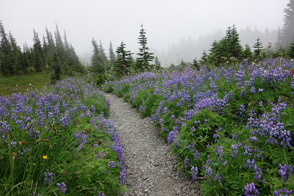
Lupine along the Wonderland Trail, Mount Rainier National Park / NPS file


