
Amy and Dave Freeman paddle away from Partridge Falls on the Pigeon River. It's the last portage on the river before reaching the Grand Portage National Monument/Bryan Hansel
It's a 200-mile paddle along Minnesota's Border Route, from Crane Lake on the eastern side of Voyageurs National Park to Grand Portage National Monument on Lake Superior. There are twists and turns as it follows a series of pristine, remote lakes linked by portages along the Minnesota and Ontario border.
The Boundary Waters Canoe Area Wilderness is a popular destination for paddlers who want to experience the tranquility of America's mostvisited wilderness area. It's also one of the legs of the historic North West Company's fur trading routes, giving today's visitors an idea of what life was like here in the 18th century.
Most paddlers attempt the route during the summer months, but Dave and Amy Freeman and I scheduled our paddle in October -- when the deciduous trees are bare, the ice is forming, and snow falls. We would start on Crane Lake in the national park, then paddle the route through BWCA to the halfway point, just north of Ely, where we would resupply, and then finish the route
While leaving and reentering the wilderness usually requires a permit from a U.S. Forest Service office, so few people use the BWCAW in October that the Forest Service waives the permit fees and offers free, self-issuing permits. It created the ideal situation for us and gave us the flexibility to resupply instead of carrying three weeks of food.
We began our journey under a clear blue sky reflected in the placid waters of Crane Lake coupled with unseasonably warm temperatures. I boarded my solo canoe in sandals and shorts, and followed Dave and Amy's canoe as they turned north. The northern section of Crane Lake narrows to a passage less than 150 feet wide, with cliffs surrounding the waterway. The waterways for the rest of the day were narrow and lead to motorized portages.

Northern Lights are a bonus of paddling the Border Route in fall/Bryan Hansel
Before the Boundary Waters was designated as a wilderness area 50 years ago, many of the lakes were connected by portages that were wide enough for motorboats, which rolled along on specially designed carts mounted on railroad tracks. There were even motorized portages, where a motor at the top of the hill pulled a small rail car, loaded with gear and boats, to the top, and then controlled its descent down the other side. There are still a few of these motorized portages on the western side of the Border Route. There was no one at the station in October, so we threw our canoes and packs over our shoulders and humped the gear up the hill and back down the other side.
The routine soon became familiar; paddle to the end of a lake, land, haul your canoe and gear over a rocky and muddy trail to the next lake, rinse and repeat. Then try and find one of the 2,200 campsites, spread over a million acres of wilderness and 1,000 lakes. Across the border in Quetico Provincial Park in Ontario there are another million-plus acres, and another 2,000 campsites and 600 lakes; plenty of room for canoeists to explore.
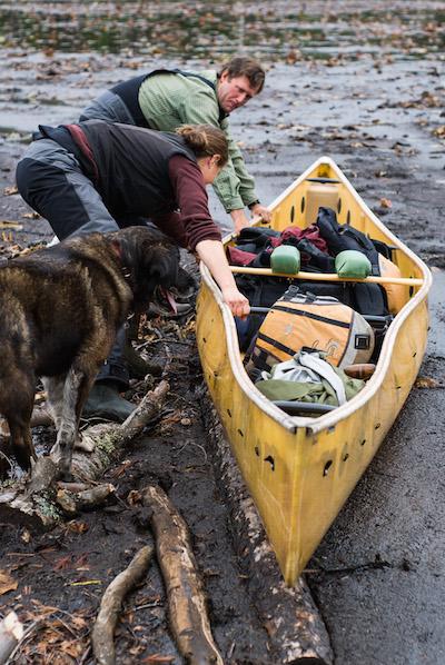
The Freemans pull their canoe across the mud in a dried up shortcut outside of Ely. Their dog Fennel waits to get into the canoe./Bryan Hansel
We spent 10 days on our way to Ely, paddling past granite outcroppings and solving navigational challenges. There are so many pine-, spruce-, and birch-covered islands on these lakes that they ran out of original names. The mapmaker resorted to naming them: Twenty-Five Island, Twenty-Seven Island, and Forty-One Island. We paddled down a lake so convoluted that it earned the name Crooked Lake.
We paddled past overhanging cliffs of granite rich with Ojibwa pictographs of moose, cranes, canoes and handprints. The Ojibwa pictographs (some believed to be more than 400 years old) were painted with red ochre combined with a liquid, perhaps bear fat. When they dried, the paint chemically bonded to the rock, making them last for centuries. We admired their art and felt humbled by all those who came before us on this route.
After our resupply in Ely the weather turned. We camped near one of the largest and oldest white cedars in the BWCAW at Basswood Lake, where we wore our warmest gloves, stocking caps, and down coats. Amy and Dave posed under the cedar, but it is so large that they couldn't hug it even while holding hands. Amy found a one-inch layer of ice near a portage one morning, as the sun cast long shadows across the water.
Fortunately, we arrived at our final challenge before the lakes iced over. To avoid the rapids and waterfalls of the Pigeon River, the old Voyagers portaged along an eight-and-a-halfmile- long trail that leads from these inland lakes to Lake Superior. But, before those Voyageurs could rest and celebrate at their annual gathering in Grand Portage, they carried three 90-pound packs up and down the portage on each trip for six total trips. I only had to carry one canoe, and one pack. After a morning of portage we arrived at Grand Portage National Monument's reconstructed fur trading fort, the wooden posts forming a protective fence towered over our heads.
We glided along on Lake Superior, the traditional finish to the route, and I pondered why people paddle. It's a way to get away from our workaday lives, reset our natural body rhythms to that of the wilderness. It was a time of renewal. Wilderness, and particularly the wilderness in the Boundary Waters, will provide that for you. Paddle here, and you'll emerge ready to tackle anything. And, after paddling the full length of the BWCAW on the Border Route, you'll feel like you just did.

Some days on the Border Route can envelope you in fog/Bryan Hansel


Comments
Great story about a wild slice of the North Woods!
Great piece and photos! Thanks for sharing.
Thank you, Bryan, for bringing back some old but happy memories of many trips to Boundary Waters when I was in high school a thousand and two years ago. It's good to know the place still exists.
October must be a fine time to visit BWCA -- no mosquitoes and no black flies.
Is this feasible... suggestions? Solo w/Alpacka Packraft, park in Duluth. Find transportation to Eli, border route to Lk Superior. Find transportation back to Duluth?
I would like to talk to someone who has done the Eastern 1/2 of the Voyageur's Highway, especially for portage and river info. Any chance of that?
I can be reached at [email protected]
Thanks!
Sounds like a great trip! Thanks for sharing your experiences with the NPT.