The Chimney Rock Loop quickly gets you into a land of giants/Kurt Repanshek
Don't think that because historic Fruita seems to be mentioned in the same breadth with "Capitol Reef National Park" that this park isn't for hikers and backpackers. It is one of the more rugged and demanding parks in the system, one that tests not only how much water you can carry, but at times your route-finding skills.
My wife and I stuck our collective toes into the hiking side of the park recently with a journey into Chimney Rock Canyon. This route begins at the Chimney Rock Viewpoint, a place where many people get out, snap some shots, perhaps try the 3.6-mile Chimney Rock Loop, and move on down the road.
As with nearby Canyonlands National Park, Capitol Reef is an arid park rife with canyons time has cut into the Colorado Plateau. As a result, it can be blazingly hot here during the height of summer, and there can be a risk of flash floods from July-September that make hiking through slot canyons dangerous.

Boulder Mountain, still holding some snow in mid-April, from the Chimney Rock Loop, with the viewpoint parking barely visible/Kurt Repanshek

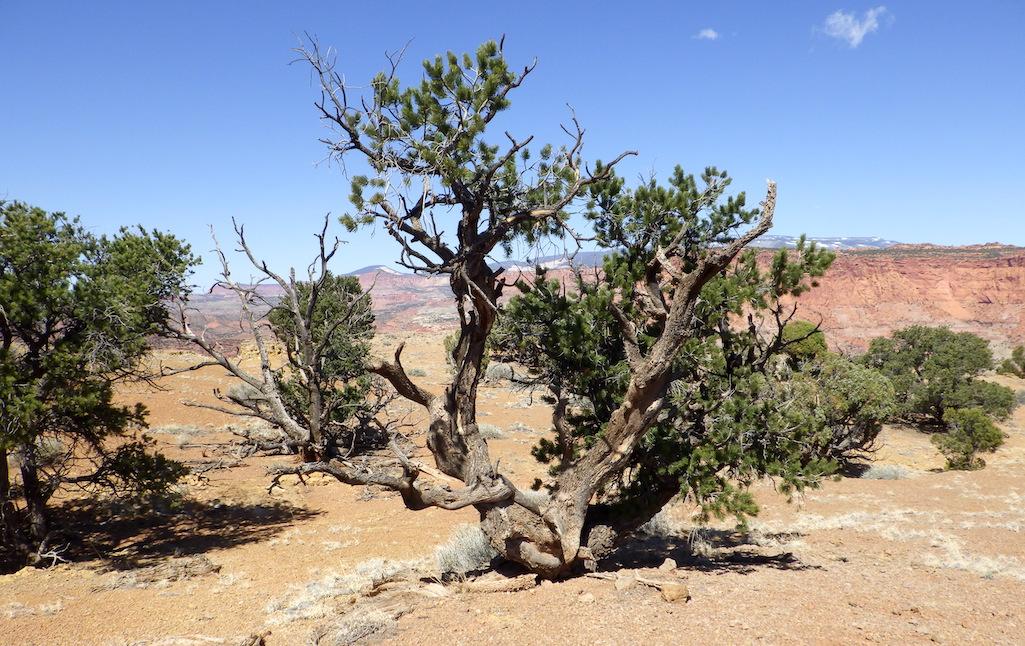
You encounter more trees than fellow hikers on the trail, though never a forest/Kurt Repanshek
Our exploration, however, came in April during National Park Week. The weather was mild, the sky full of sun, and the trail an immediate test of how well we had maintained our condition through the winter months. From the parking lot at the Chimney Rock Viewpoint, the trail begins darting back and forth as it climbs nearly 600 feet to test your lungs and legs while leading you to an overlook just higher than Chimney Rock, where you have views east and west along Utah 24 with Boulder Mountain off to the south.

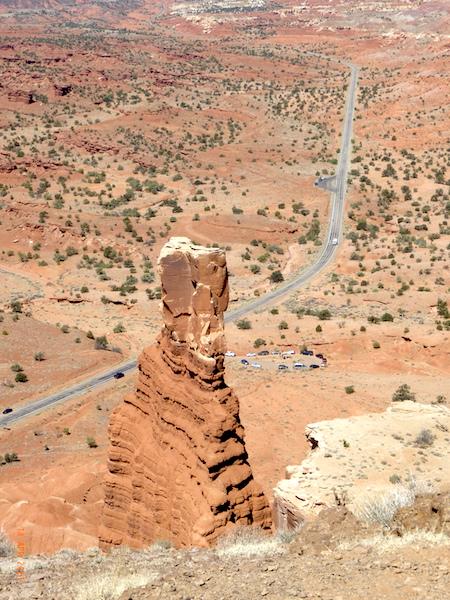
Chimney Rock and Utah 24/Kurt Repanshek
Turn your back to the highway (top photo) and you've got the raw geology of Capitol Reef ... and the Colorado Plateau ... before you. There are varieties of sandstone -- Wingate, Navajo, Entrada and Page -- that help color the landscape with pale whites and buffs to reds, while other formations sift in grays.
From a point roughly halfway around the loop trail we took a right and headed down into Chimney Rock Canyon, a place where the sandy wash is bracketed by towering walls of rock. Boulders the size of trucks and larger are anchored in the wash, evidence of the exfoliation that has occurred not only through the millennia, but even more recently, as there are spots where the boulders blocked the main trail and we had to skirt around them to return to the original route.
If you want solitude -- and who doesn't when hiking? -- this is one of many routes you can follow in Capitol Reef to wrap yourself in your thoughts without being often interrupted. The hike, roughly a six-mile round trip from the viewpoint parking area to the junction with the Spring Canyon trail (Upper and Lower), at times lends a feel of walking through the skyscrapers of Manhattan. But instead of between surrounding by concrete and steel, you're marveling at the power of nature.
Looking at the boulders that dot the sandy wash, at the soaring desert-varnish-striped cliffs, and the slots cut into the landscape leaves you in wonderment about the power of time, rain, and snow.

The landscape in the wash always towers overhead/Kurt Repanshek
For more ambitious trekkers, from the junction with Spring Canyon you can turn left and head up canyon to an exit at Holt Draw, a dirt track on the north side of Utah 24 about a mile beyond the park boundary, or stay straight and head down canyon to a section of the Fremont River along Utah 12 about 3.6 miles east of the park visitor center.
From the Chimney Rock Viewpoint, the hike to Holt Draw is 18.7 miles one way, while the hike to the Fremont River along Utah 12 is 9.7 miles.
For those with time and experience, the park staff recommends that you plan on three-four days to hike both Upper and Lower Spring canyons, while the Upper canyon by itself is a good two-three day trip, and Lower Spring Canyon an overnighter or long day hike.
You can find more specific hiking directions on the park's website.
Resources:
- Plenty of water
- Arrive at Chimney Rock Viewpoint lot before 9 a.m.; it's small and doesn't afford lots of parking.
- Trails Illustrated Map 267, Capitol Reef National Park
- Capitol Reef National Park, The Complete Hiking And Touring Guide by Rick Stinchfield.

 Support Essential Coverage of Essential Places


Comments
Sounds like you folks had a nice - and warm, I would guess - family adventure.