
They say you don’t know how you’ll react when you first lay eyes on the Valley of 1000 Devils. With a slack-jawed moment of stunned silence followed by a prolonged bout of giddy gratitude sums it up for me.
The funny thing is, I thought I knew exactly what was coming as we hiked across Saskatchewan grasslands and past the isolated clay butte nicknamed the “Apple Core” that hides the first glimpse of the badlands. Those who’ve done their research, like me, are suitably dazzled, but those who come in blind are usually stunned by the big reveal.
But we had walked 20 minutes past this gateway vista at the end of the marked trail in Grasslands National Park and along a footpath into the valley.
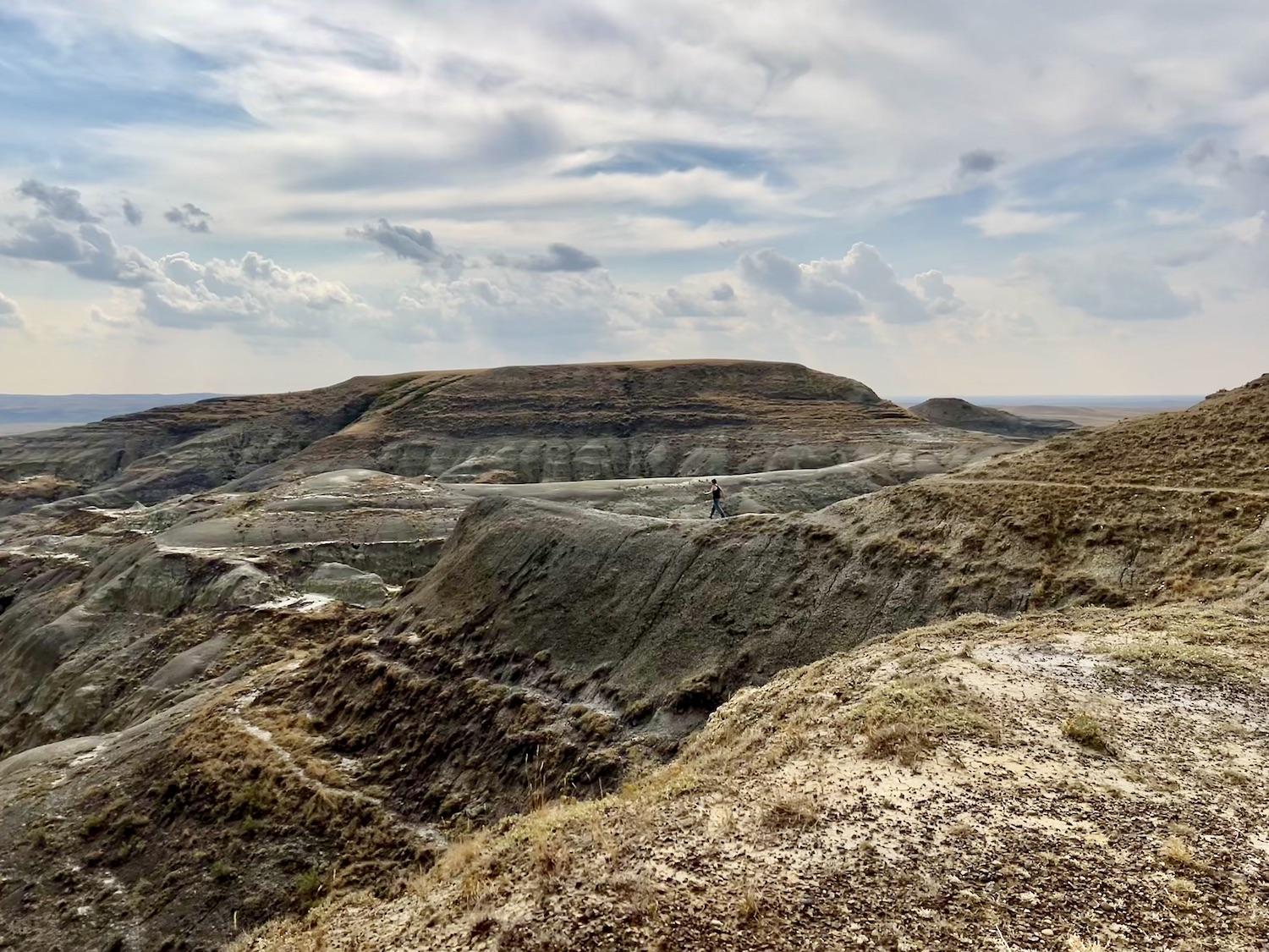
This narrow ridge is what locals call Pride Rock. Walk out it and you're engulfed in the Rock Creek Badlands/Jennifer Bain
Standing on what’s known as “the ledge,” I couldn’t take my eyes off the vast eroded landscape full of rugged coulees, steep-edged valleys and scrubby prairie painted in muted shades of gray, brown and green. I contemplated the dinosaurs that once roamed this land, and the Indigenous Peoples, homesteaders and ranchers who came later to take care of it. And then I cautiously walked out on a narrow ridge of land known as Pride Rock and spent a vertigo-inducing moment looming over the badlands.
So thank you Corelie Keller for leading us to this vista, even if meant hiking the Valley of 1000 Devils Trail twice in one gruelling September day.
That’s right — I did it “wrong” the first time. I awoke to threats of rain and high-tailed it out of my oTENTik at Rock Creek Campground and onto the trail with my sister-in-law. The rain held off, the coyotes howled, the sun broke through the clouds and we almost had the whole prairie to ourselves for three-and-a-half early morning hours.
We were about to drive down the nearby Badlands Parkway, a short route along an escarpment with six interpretive stops, when we bumped into Keller — a Parks Canada heritage presenter who was raised on a ranch minutes from here. As the saying goes, she knows the land here like the back of her hand.

If you come at the "Apple Core" (an isolated butte) from the right, you will be surprised to see it's the gateway to the badlands/Jennifer Bain
How did we like the Valley of 1000 Devils, she wondered? Keller could somehow tell by our reply — enthusiastic but not exuberant — that we only did what was on the map and followed the white markers along a lollipop-shaped route that culminates at the Apple Core viewpoint.
“You didn’t get to the valley, did you?” she said with a grimace and a shake of her head.
“Well, we got to that Apple Core,” we defensively replied.
“You didn’t get to the valley,” she sadly insisted.
Luckily, Keller was about to head out on the trail so we ditched our parkway plans to rectify our morning mistake by doing the Valley of 1000 Devils again in the afternoon — this time adding an extra 40 minutes to the 11.4-kilometre (7-mile) journey.

To get to the badlands, you will first cross the grasslands/Jennifer Bain
It will be worth it, we assured ourselves, replenishing our water and hastily packing lunches.
Established in 1981, Grasslands is Canada’s first and only national park established to represent the endangered mixed-grass prairie. It’s divided into two separate parcels of land known as the West Block and the East Block. They’re a two-hour drive apart.
“The West Block is about living things,” Keller explained, meaning it’s the place to go for plains bison, Greater short-horned lizards, rattlesnakes, Burrowing Owls and a Black-tailed prairie dog colony.
“The East Block is about dead things,” Keller said, meaning it’s full of palaeontological and archaeological remains.

Parts of the original Valley of 1000 Devils Trail are closed to allow ground cover regeneration/Jennifer Bain
Grasslands saw 17,477 visitors in 2019. The West Block is near the village of Val Marie and a much bigger draw. The East Block is smaller and more isolated, but the new Badlands Parkway and the realigned Valley of 1000 Devils trail are making it more appealing.
Until recently, if you wanted to hike the Valley of 1000 Devils, you needed GPS to follow what was an unmarked route forged by backcountry visitors. Then on Aug. 9, 2021 and without fanfare, Parks Canada unveiled a realigned trail with a trailhead sign and upwards of 200 white flags spaced every 100 metres (330 feet) or so. The trail has a 194-metre (636-feet) elevation gain, is rated as difficult and is detailed in the Trailforks database.
But most important is the way it routes people to that lonesome butte at the gateway to the badlands that is unofficially known as the Apple Core. “Every trail user is going to have that singular moment of surprise and wonder,” Colin Schmidt, the park's product development officer and the lead for trails, told me before my visit.
The original trail was essentially a straight line, and parts of it are now closed so the landscape can be returned to a natural state. The new trail dips into the basin of Hellfire Creek as it moves from grasslands to badlands. Since the badlands are significantly hotter than the rest of the park, we wait until September to hike, setting out from the Rock Creek campground and visitor centre hub over the Rock Creek Bridge, through a cattle gate and to the trailhead.

Come October, the cattle fence that leads to three trails will be electrified as cows are turned loose to graze over the winter/Jennifer Bain
What’s in a name? There’s something undeniably pleasurable about saying “Valley of 1000 Devils,” and the story behind the evocative name doesn’t disappoint.
Back in 1963, local rancher Carl Anderson was the reeve (boss) of the rural municipality and took the new administrator’s mom — Erla Burton — for an off-road truck ride to see the badlands.
She got out and was not impressed.
“Who in their right mind would live in a valley of a thousand devils?” Burton famously spat out.
See, if you couldn’t make money off the land in those days, it was useless.
"I bet it would have been different if that truck had air-conditioning," one of the hikers out with Keller quipped. But Anderson loved the anecdote and here we are nearly 60 years later and the name has stuck. “The visitors got quite taken with the name," Schmidt admitted, "so we just decided to adopt it."

Parks Canada's Brenda Peterson, left, and Corelie Keller, lead a fireside chat at Rock Creek Campground/Jennifer Bain
Because it’s a small world, we met Anderson’s daughter Brenda Peterson at a fireside chat in the campground the night before our hikes. Peterson is the park’s interpretation coordinator and plays banjo and vintage washboards. With Keller (a professional musician) on guitar, the women regaled eight of us with grasslands-appropriate tunes, from “Home on the Range” and “Four Strong Winds” to “You Are My Sunshine” and “Night Rider’s Lament.”
“Our way is making sure people connect to the park,” Peterson said, spinning stories about how the grass is the livelihood of the people around here, how prescribed burns rejuvenate the prairie, and how important the wind is in this landscape. “You learn to live with the wind and when there is none, you think there’s something missing.”
More than 10,000 years ago, the glaciers retreated and these prairie grasslands became home to First Nations groups, followed by the Métis, ranchers, farmers and — eventually — Parks Canada and countless visitors.
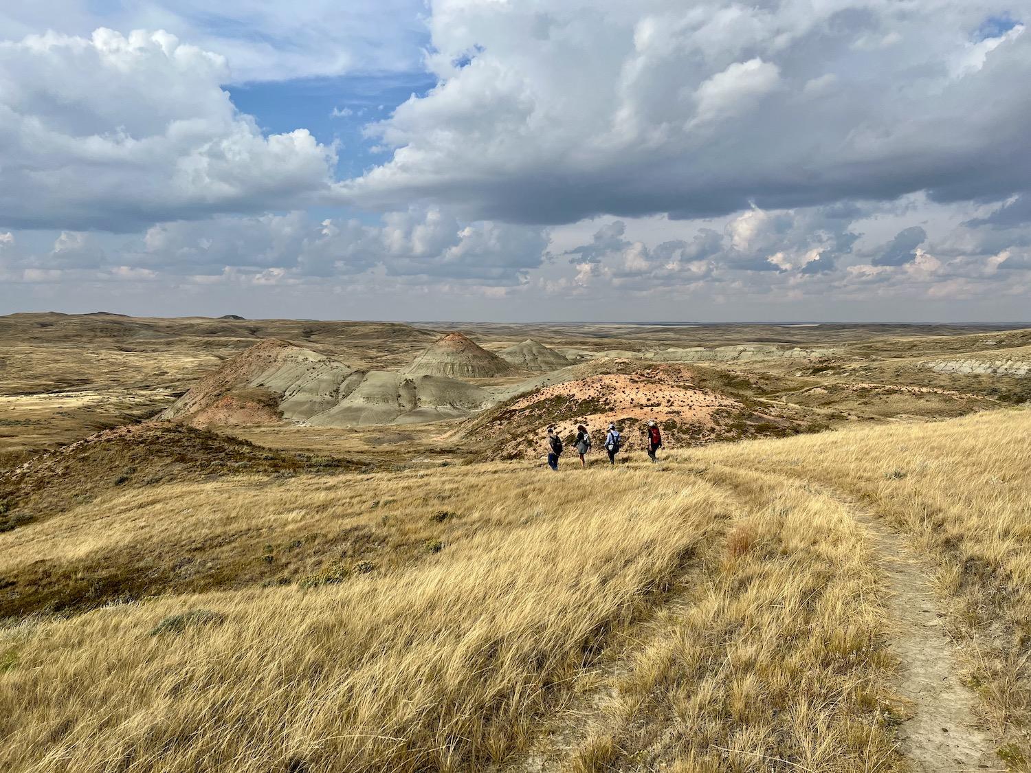
When you get to the Apple Core on the Valley of 1000 Devils, look for this unmarked path into the badlands to get to the ledge and Pride Rock/Jennifer Bain
At the West Block visitor center in Val Marie, I pore over interpretive exhibits that detail how this park is part of one of the world’s largest grasslands systems, extending from southern Saskatchewan to mid-Texas. Extreme temperatures can range from 45C (113F) in the summer to minus 55C (minus 67F) in the winter. The plants and animals that survive here are specially adapted to cope with the harsh prairie elements. Grass plants can survive long dry spells because their root systems extract moisture deep within the soil.
Grasslands are underrepresented in protected areas in North America. This is the only Canadian park to represent the Prairie Grasslands Region, and less than one per cent of its land has ever been broken or cultivated. There are 70 species of grass here, including Western Wheatgrass, Needle-and-thread Grass and the Blue Grama (eyelash grass).
Not only does the park protect 31 species at risk, it's home to about half of the remaining Canadian population of Greater Sage-Grouse. It protects the only two known leks (mating grounds) in Saskatchewan of the endangered bird with a peculiar mating dance. You're supposed to let Parks Canada know if you spot this elusive bird, but unfortunately we aren't so lucky.

It looks like an animal, but it's just a natural formation/Jennifer Bain
There are also thousands of archaeological sites in the park.
From what I read on interpretive panels in the West Block visitor center, triceratops and duckbilled dinosaurs once dominated the landscape and fossilized land and sea creatures have been discovered here. One of Canada’s first recorded dinosaur bone finds happened here in 1874 when George Mercer Dawson was in the area marking the 49th parallel between Canada and the United States.
The East Block has also an exposed K-T Boundary. Also referred to as the Cretaceous-Paleogene (K-Pg) boundary, it's a thin, white, chalky layer in the soil that separates the age of dinosaurs from mammals. Every August, the park holds a five-day event called Fossil Fever and lets small groups accompany paleontologists on a day’s dig. I’ve already penned it into my calendar for 2023.
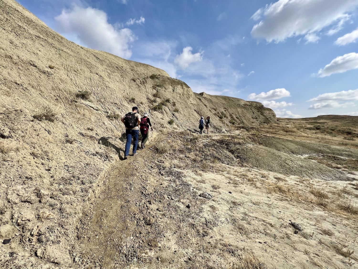
There are some narrow parts of the Valley of 1000 Devils Trail, which Parks Canada lists as a "difficult" trail/Jennifer Bain
Sometimes I over-research trips and get so bogged down by background information that I forget to enjoy the experience. Sometimes I don't do my due diligence and miss things. Sometimes — like on this trip — I do both and try my hardest to drink it all in.
“The sage is blooming — ah, the best smell on earth,” Keller said as we joined her for our second Valley of 1000 Devils hike. “Make sure you look up and enjoy the view. This is what happens after the hike. Everybody is looking down and forgets to look up.”
Here are some of the things I noticed on my two hikes. Each, by the way, took between three and four hours. Some people can speed through in two hours if they walk fast or bike, but the rest of us enjoy our rest stops, photo opps and picnics.
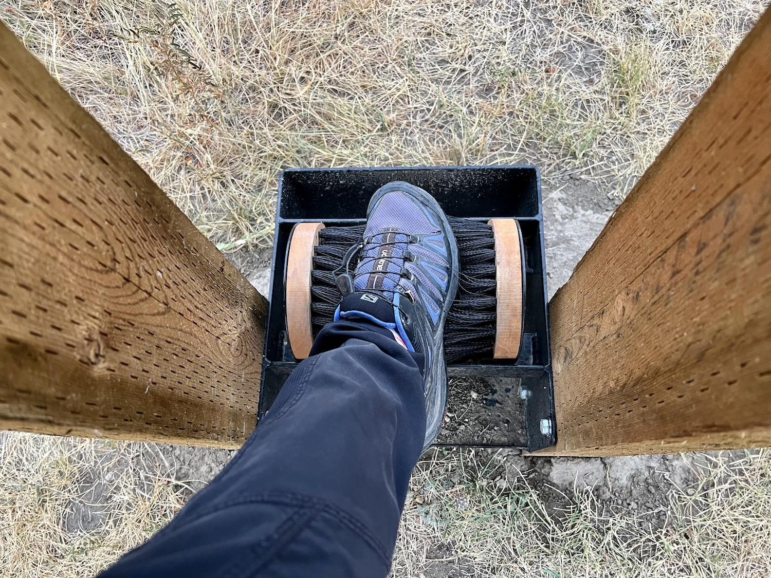
Trail users are encouraged to clean their footwear so they don't track invasive species in or out of the area/Jennifer Bain
Each time we left the campground and opened a cattle gate to get to the trailhead, we wiped our feet on a boot brush so we didn’t track in the seeds of any invasive species, like Leafy Spurge, Absinth Wormwood and Downy Brome. We did the same thing on the way out.
We spotted plenty of cacti and sagebrush but not the elusive Gumbo Evening Primrose, which opens white in the cool of the day and turns pink as it wilts in the heat. We didn't see any raptors or mule deer, but admired a couple of oversized ant hills made from sticks and enjoyed a symphony of crickets that started as the day warmed up.
There were plenty of people on the trail in the afternoon, so sometimes we stopped to swap notes.
Wildlife and cattle apparently like the ease of trails as much as people do, so mostly we saw gobs of coyote scat. Keller told us that every October, the East Block opens for the winter to a herd of 1,200 grazing cows that help keep the ecosystem healthy. That’s actually one reason why carbon flex markers were used to mark the realigned trail — they bend in the wind and when animals brush against them.

There's plenty of wildlife scat, some of it fresh, along the trail/Jennifer Bain
Speaking of those markers, they inadvertently caused my second major mistake.
The map clearly shows the trail is shaped like a lollipop. After hiking down the “stick,” I knew we would reach the “lollipop” loop and want to hang a right for a counterclockwise route to the Apple Core. But my sister-in-law and I had our heads down in the low light of early morning (I was trying not to trip), blindly followed the white markers, and missed a small blue sign with an arrow at the key junction.
Yes, we realized the trail markers suddenly seemed backwards. Most had a green Parks Canada sticker noting the trail name, and some had a second white sticker clocking off each kilometre. But we mistakenly figured they'd run out of stickers at the end of the trail and didn't have the budget for more.
The clockwise route isn’t wrong — it’s just that you see the badlands coming instead of getting that aha moment of finding them hidden behind the Apple Core.
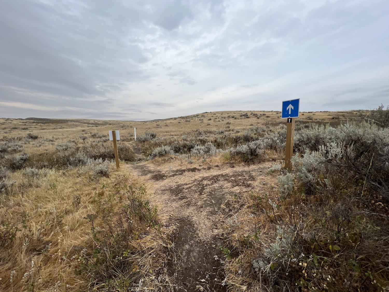
The junction in the Valley of 1000 Devils Trail where you're supposed to hang a right and do the counter-clockwise route. Our heads were down and our eyes on the white markers so we missed it the first time/Jennifer Bain
Keller, of course, led our group the correct counterclockwise way the second time around as we stopped to discuss the signage and show her where we went wrong.
The realigned trail steers people away from patches of bentonite clay (aka dinosaur snot) that get dangerously slick when wet, so we didn't have to worry about that potential pitfall. I was looking forward to hopping or jumping over Hellfire Creek, but discovered it dries up at the end of the summer.
“This is how dry we are,” Keller said, pointing to the parched ground beneath us. “Look at these cracks. Holy smokes.”

Writer Jennifer Bain, right, and her sister-in-law Jennifer Bain enjoy the first views of the badlands/Jennifer Bain
Water and wind continually erode and reshape this terrain, as do the people and animals that pass through it.
When we got to the ledge, taking in the baked clay red landscape and walking cautiously out on Pride Rock, Keller made her own confession. “That point right there is the best photo op in the whole place — if you can get there. I have to crawl. I can’t walk out there.”
This land has never been for the faint-hearted, and I'm grateful to have stumbled through it without getting heatstroke, breaking a bone or having to take cover during a storm. I'm also relieved to hear that the Grasslands team plans to expand the Valley of 1000 Devils trail with another loop that goes into the badlands, so nobody else will miss out like we almost did.
Just one burning question — what will the new loop be named, and can anyone possibly come up with something even more enticing than Valley of 1000 Devils? The bar is high but, given the epic rugged beauty of the badlands, there's plenty to work with.

 Support Essential Coverage of Essential Places
Comments
Yeah those homesteaders and ranchers didn't come to take care of the land, they came to exploit it. They're called colonizers, and they stole the land from indigenous tribes. It's good to acknowledge our history and the issues with it.