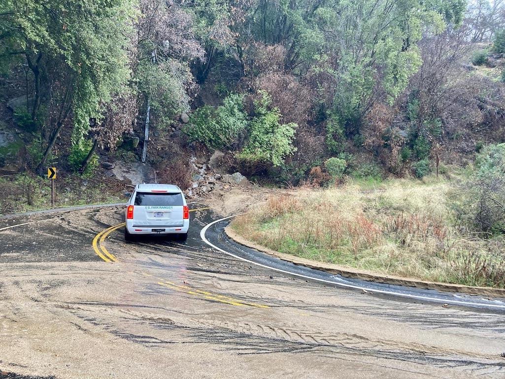
A landslide has closed the Generals Highway about 1 mile above the entrance station/NPS
The ongoing series of storms that has dropped more than 400 percent of the normal amount of rain California might expect has impacted multiple National Park System sites in the state. Here's a glance of some of the impacts and closures:
Castle Mountains National Monument
Flooding has resulted in debris along many roads within the park boundaries. Please use caution when driving on paved roads and watch for road crews at work. Be aware that unimproved and dirt roads may be impassible due to washouts, so plan accordingly.
Channel Islands National Park
Santa Barbara Island Closed
Heavy sea conditions during the most recent storm caused damage to the Santa Barbara Island wharf, associated buildings, and infrastructure. As a result, Santa Barbara Island is temporarily closed to the public until further notice.
The wharf dock was damaged during the recent storm cycle due to the heavy sea state. The Landing Cove Wharf is the only practical public access point to Santa Barbara Island. This temporary closure began January 6.
Golden Gate National Recreation Area
Re-opening:
- Muir Woods National Monument: Re-opening on Wednesday, January 11, at 9am.
- Nike Missile Site: Re-opening on Friday, January 13.
Closed:
- Point Bonita Lighthouse
- Fort Point National Historic Site, Long Avenue and Marine Drive
- Stinson Beach, parking lots and restroom due to storm damage.
Visitor Center & Store Closures:
- Fort Point
Closed due to recent storm activity:
- Tennessee Valley: The trail is closed between the dam and the beach
- Baker Beach: The North Parking Lot and restrooms are closed
- Rancho Corral de Tierra: Bridge washed out that connects Ranch Road to Spine Trail at Ember Ridge
- Rodeo Beach lagoon bridge: High tides may affect bridge access.
- Alcatraz: Parade Ground and Agave Trail remain closed due to flooding.
Pinnacles National Park
Both entrances are currently closed due to extreme flood and wind. The campground remains open to visitors with existing reservations, but all park trails and roads are closed.
Point Reyes National Seashore
The National Weather Service has issued a gale warning through 9 p.m. Thursday for coastal waters between Point Arena & Point Reyes, including Tomales Bay. A gale warning means winds of 34–47 knots (39–54 mph) are imminent or occurring. Inexperienced mariners should seek safe harbor.
The following areas, buildings, areas, trails, and roads are closed until further notice:
- Due to downed trees, flooding, and other storm damage, the following roads are closed to all access (i.e., pedestrian, bicycle, horse, vehicular, etc., except for emergency access) until further notice:
- Drakes Beach Road;
- North Beach;
- Mount Vision Road; and
- Lighthouse Road (e.g., the road between the Chimney Rock Road junction south of A Ranch and the lighthouse).
There may be standing water along many sections of roads that are not closed. It is never safe to drive or walk into flood waters.
The Bear Valley Visitor Center has been affected by power outages during the early January storms. If there is a power outage, staff will remain present from 10 a.m. to 3 p.m. (if it is safe to do so) to answer questions and provide information, but the bookstore, auditorium, and museum exhibit areas will be closed. If the visitor center has power, it is scheduled to be fully open from 9:30 a.m. until 5 p.m., although the hours are subject to change to ensure the safety of staff and visitors.
The Kenneth C. Patrick Visitor Center and Lighthouse Visitor Center are closed until further notice.
The South Beach restrooms are closed until further notice.
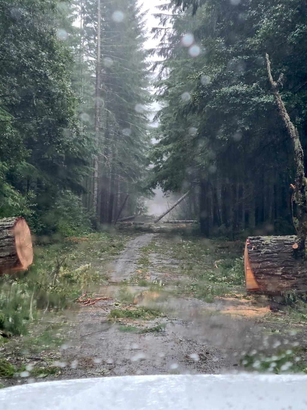
Expect downed trees across trails throughout the forested areas of the park. If you encounter any downed trees, don't create new paths to get around the downed trees; do your best to follow the route of the official trail over, through, or under the downed tree, if it is safe to do so.
Report downed trees to the Bear Valley Visitor Center (415-464-5100 x2 x5) or to the Trail Crew (415-464-5154) or by email. Provide as many details as possible, e.g., exact location of the tree on which trail, type of tree (bay, fir, etc.), whether it is bushy or straight, its size and diameter, whether it is on the ground or elevated, whether equestrians can get around it, etc.

The recent storms have downed a number of trees at Redwood National and State Parks/NPS, Kyle Hampson
Redwood National and State Parks
There are several areas in the park remaining closed due to ongoing storm impacts. Park campgrounds, roads, trails, and visitor centers are impacted. The Prairie Creek area of the park, including the Elk Prairie Campground, is currently closed. Newton B. Drury Scenic Parkway and Prairie Creek Visitor Center are included in this closure. The entire Gold Bluffs Beach area is also closed.
Santa Monica Mountains National Recreation Area
Due to widespread rain and flood conditions, the Paramount Ranch, Cheeseboro, and Zuma Canyon parking lots are currently closed.
Sequoia and Kings Canyon National Parks
Generals Highway Closed between Foothills Visitor Center and Junction with Highway 180.
The highway into Sequoia is closed one mile past the entrance. Sequoia groves are currently only accessible in Grant Grove. Call (559)565-3341 (press 1, 1) for current road condition.
Until further notice, Wuksachi Lodge is closed due to impacts of winter storms on the Generals Highway. More winter storms will impact the area this weekend.
Due to impacts from recent winter storms, all park campgrounds are closed. The Azalea, South Fork, and Potwisha campgrounds will be re-opened when conditions allow.
Heavy rain and resulting flooding have washed out bridges along roads leading to two remote areas in the foothills of Sequoia National Park. It's not currently possible to drive to the South Fork and North Fork areas and trailheads.

 Support Essential Coverage of Essential Places


