Redwood National and State Parks is in northernmost coastal California, about 325 mi/523 km (6-hour drive) north of San Francisco and 329 mi/529.5 km (5.5-hour drive) south of the Portland International Airport. Roughly 50 mi/80.5 km long, the parklands stretch from Crescent City, California (near the Oregon border) in the north to the Redwood Creek watershed south of Orick, California.
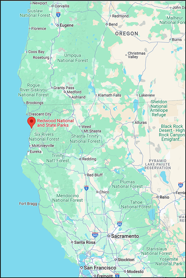
Area map of routes to Redwood National and State Parks / Google Maps screenshot
By Plane
You can fly into six different airports located in Oregon and California, then rent a vehicle to drive into this mosaic of national and state parks. Of the six airports, the three largest are in Portland, Oregon, and Sacramento and San Francisco, California.
- From Portland International Airport (PDX), take I-5 south to Grants Pass, Oregon. Drive US-199 southwest to Crescent City, which is the largest town near this series of parks.
- From Sacramento International Airport (SMF), drive I-5 north to Redding, California, then CA-299 northwest to US-101 north to Crescent City.
- From San Francisco International Airport (SFO), the shortest route is via US-101 to Crescent City.
Regularly-scheduled commercial flights are also available at the following smaller airports:
- Del Norte County Airport/Jack McNamara Field (CEC), in Crescent City, California
- Rogue Valley International-Medford Airport (MFR), in Medford, Oregon
- Arcata-Eureka Airport (ACV) in McKinleyville, California
By Vehicle
If you plan to make a road trip out of this visit, Redwood National and State Parks is oriented in a north-south line along the California coast, between Crescent City and Orick, California (approx. 50 mi/80.5 km apart).
Traveler’s Note: GPS on your vehicle or phone is not always reliable, so chart a route to this series of national and state parks prior to your arrival.
Public Transportation
Redwood Coast Transit (RCT) offers service between and among the communities of Smith River, Crescent City, Gasquet, Klamath, Orick, and Arcata, Calif. For information about routes and fares, or for other inquiries, call RCT at (707) 464-6400 or visit them online at www.redwoodcoasttransit.org.
As the largest city within the parks’ area, Crescent City hosts the largest choice of gas stations and electric vehicle (EV) charging stations. From there to Orick, California, both gas and EV charging stations are few (but available). Use the Plugshare.com search field to display a map of available charging stations.
You will have more grocery choices in Crescent City, as well, although smaller convenience stores line US-101 to Orick.


