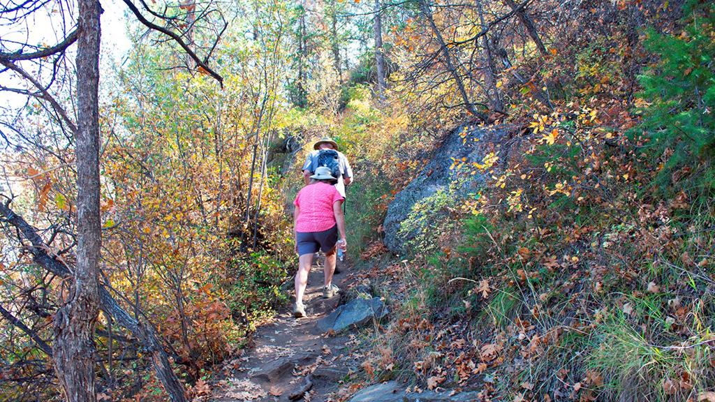
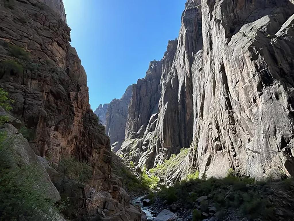
There are hiking trails along both South and North rims at Black Canyon of the Gunnison National Park in Colorado. Most of the hikes are moderately difficult, with a couple of easy nature trails for the wanderer and a couple of strenuous ones to really stretch your legs. If you really want to get away from it all, you can hike the inner canyon … with proper planning.

An autumn day out on Oak Flat Trail, Black Canyon of the Gunnison National Park / NPS file
Many trails pass by steep drop-offs, so be cautious and keep a close watch on children. Carry plenty of water with you since drinking water is not available from late fall through mid-spring.
Limited cattle grazing is permitted on the North Rim. Please keep cattle gates closed should you encounter them.
BE BEAR AWARE. Bears have made amazing efforts to obtain hikers' snacks. A bear that becomes habituated to humans and their food will ultimately need to be destroyed. Keep your backpack within arm’s reach at all times.
Below is a quick overview of each trail. All distances are one-way unless otherwise noted. For more detailed information, click each trail name.
South Rim Trails

Uplands Trail, Black Canyon of the Gunnison National Park / NPS file
Uplands Trail
Distance: 0.9 mile (1.4 km)
This moderately-difficult trail starts at the South Rim Visitor Center links the Rim Rock Trail (near the campground) to the upper Oak Flat Loop Trail near the South Rim Visitor Center.

The view from Warner Point Trail, Black Canyon of the Gunnison National Park / NPS - de Anguera
Warner Point Trail
Distance: 0.75 mile (1.2 km)
This moderately-difficult trail starts at the High Point Overlook and provides views of various mountain ranges, the Black Canyon, and the Gunnison River.

The view along Rim Rock Trail, Black Canyon of the Gunnison National Park / NPS file
Rim Rock Trail
Distance: 1 mile (1.6 km)
This moderately-difficult trail starts at the South Rim Visitor Center and meanders along the canyon rim to the South Rim Campground.

Hiking up a steep portion of Oak Flat Trail, Black Canyon of the Gunnison National Park / NPS file
Oak Flat Trail
Distance Roundtrip: 1.6 miles (2.6 km)
Considered strenuous, this trail offers variety to the hiker who would like to explore below the rim without going all the way to the river. The trail is narrow in places and traverses some steep slopes.
Cedar Point Nature Trail
Distance: .2 mi (.3 km)
This short, moderately sloped trail offers visitors a chance to brush up on local flora with guideposts describing the various plants along the way.
North Rim Trails

Deadhorse Trail, Black Canyon of the Gunnison National Park / NPS file
Deadhorse Trail
Distance: 2.6 miles (4.2 km); If hikers choose to add the loop portion, roundtrip mileage is 6.6 miles (10.6 km).
This moderate hike begins at the Kneeling Camel Overlook and takes hikers into the Black Canyon of the Gunnison Wilderness Area. It offers good views of Deadhorse Gulch and East Portal on the Gunnison River, as well as good birding.

The North Rim Vista Trail takes hikers to an amazing view at Exclamation Point (seen here), or further to Green Mountain, Black Canyon of the Gunnison National Park / NPS file
North Vista Trail
Distance to Exclamation Point: 1.6 miles (2.5 km)
Distance to Green Mountain: 3.6 miles (5.8 km)
This moderate-to-strenuous hike (based on distance) begins at the North Rim Ranger Station. Constructed by the Volunteers for Outdoor Colorado, the North Vista Trail offers some of the best scenic views and birding in the park.

The vista from Chasm View Nature Trail, Black Canyon of the Gunnison National Park / NPS file
Chasm View Nature Trail
Distance: 0.3 mile (0.5 km)
This easy, short loop hike begins at the North Rim Campground and breaks out of the pinyon/juniper forest at the North Chasm View to provide excellent views of Painted Wall and Serpent Point.
Backcountry Hiking

The view upstream along the Gunnison River, Black Canyon of the Gunnison National Park / NPS - Ethan Crump
If you are thinking about really getting away from it all by hiking the inner canyon, you need to do quite a bit of preparation and planning, since you’ll be wandering remote portions of Black Canyon of the Gunnison Wilderness Area. Wilderness routes are not trails; they are unmarked, very steep with loose rock, and physically demanding.
A permit is required for all inner canyon wilderness use (both day and overnight trips).
According to park staff:
North Rim Permits
- Free: distributed on a first-come, first-served basis
- Limited number of permits per day
- Limited number of people allowed on each route
- Pinyon Draw (SOB Route): 23 people
- Long Draw: 8 people
- Slide Draw: 11 people
- Must be obtained on the day of your activity (no reservations)
- There is a permit self-registration kiosk with instructions when the ranger station is closed. Be sure to thoroughly complete the permit with accurate and legible information.
- When you have finished your trip, check out with a ranger or, if the building is closed, place your permit in the self-registration box to “check out” of the inner canyon. Warning: inner canyon users without a permit may be cited and/or fined.
South Rim Permits
- Starting in 2025: All day and overnight use of Black Canyon’s South Rim wilderness routes (Warner, Gunnison, and Tomichi) will be available for reservation on Recreation.gov beginning in April 2025 for trips between May 1 and October 31. Read the news release for more information.
- Limited number of permits per day
- Limited number of people allowed on each route
- Gunnison Route: 15
- Tomichi Route: 9
- Warner Route: 23
NEW: Peak season reservations/permits (May 1–October 31): Permits will open in two reservation windows on www.recreation.gov (dates are subject to change in future years).
- On April 1, 2025 at 8:00am MT, reservations will open for May 1–July 31, 2025.
- On July 1, 2025 at 8:00am MT, reservations will open for the remainder of the season: August 1–October 31, 2025.
Off-Season Permit Process (November 1 - April 30)
Permits are available during the off-season for hikers on Tomichi, Gunnison, and Warner routes at the South Rim Visitor Center the day of the trip, either from a ranger during visitor center hours, or by self-registration at the permit box in front of the building. Permits are first-come, first-served.
Climbers and Kayakers
Climbers and kayakers must obtain their permit on the day of their adventure. There are self-registration kiosks with instructions when the visitor center is closed. Be sure to thoroughly complete the permit with accurate and legible information.Red Rock Canyon
For 2025, peak-season permits (May through October) are available only through Recreation.gov. Off-season permits (November - April) are available at the South Rim Visitor Center without a reservation.For questions about permits please email us. Refer back to this website if planning a future trip -- the permit process may change in in future years.
When you have finished your trip, check out is no longer required.
Click here for wilderness regulations information and more details on obtaining a permit.


