There are 125 miles (201 km) of hiking trails at Cuyahoga Valley National Park in Ohio, ranging from level and accessible to a bit more challenging. You can hike year-round, so don’t let a little snow prevent you from stretching your legs on the trail.

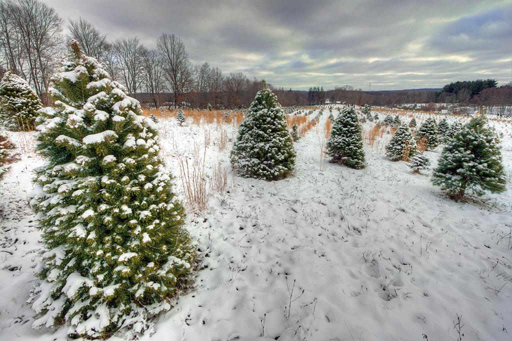
Hiking the Ledges Trail in winter, Cuyahoga Valley National Park / NPS - Bob Trinnes
Featured On The Traveler
Following The Ohio & Erie Canal Towpath
The tracks [of the Cuyahoga Valley Scenic Railroad] closely follow the Ohio & Erie Canal Towpath Trail, a designated National Recreation Trail since 1977. Long before airways, highways, and even railways crisscrossed the country, rivers — our great waterways — were used regularly to transport goods and passengers. In Ohio, the prime destination was Lake Erie, where ferries and larger ships known as “lakers” provided access to East Coast cities and points beyond.
To read more, check out this page.
FYI, There are 10 trailheads which provide parking and access to the Towpath Trail. You can read about them by clicking the links above.
Click here for hiking recommendations and more detailed information about the trails.
For park and trail maps, click here.
Buckeye Trail: Northern Section
| Length (miles) | Hiking Time (hours) | Elevation Change (feet) | Trail Surface | Wheelchair | Trailhead Location(s) |
Egbert Picnic Area to Alexander Road | 6.1 | 3.5 | 90 | hilly and rocky | No | On Gorge Parkway 0.4 miles northwest of Egbert Road in Bedford Reservation (Cleveland Metroparks). |
Alexander Road to Frazee House | 1.5 | .75 | 200 | hilly and rocky | No | On Alexander Road 0.2 miles west of Dunham Road in Walton Hills, OH. |
Frazee House to Station Road Bridge | 2.5 | 1.25 | 8 | firm, flat, crushed limestone | Yes | On Canal Road 3.5 miles south of Rockside Road in Valley View, OH. |
Station Road Bridge to Jaite | 7 | 3.5 | 200 | hilly and rocky | No | Station Road Bridge Trailhead is located off of Riverview Road 0.2 miles south of Chippewa Road (S.R. 82) in Brecksville, OH. |
Jaite to Boston | 5.6 | 3 | 250 | hilly and rocky | No | Red Lock Trailhead is located on Highland Road 1/2 mile east of Riverview Road. (Vaughn Road becomes Highland Road) |
Buckeye Trail: Southern Section
| Length (miles) | Hiking Time (hours) | Elevation Change (feet) | Trail Surface | Wheelchair Accessible | Trailhead Location(s) |
Boston to Pine Lane | 4 | 2 | 240 | hilly and rocky | No | Boston Trailhead is located on Boston Mills Road 0.2 miles east of Riverview Road in Boston, OH. |
Pine Lane to Everett Covered Bridge | 4.1 | 2 | 150 | hilly and rocky near Pine Lane, firm flat the rest of the trail | No | Pine Lane Trailhead is on State Route 303, 1/2 mile east of Akron-Peninsula Road in Peninsula, OH. |
Everett Covered Bridge to Botzum Trailhead/Train Station (via Towpath and Buckeye Trails) | 3 | 2 | 160 | hilly and rocky on northern part of trail, firm flat the rest of the trail | No | Everett Covered Bridge Trailhead is located on Everett Road 1/2 mile west of Riverview Road near Everett, OH. |
Valley Trail: Northern Section
| Length (miles) | Time (hours) | Elevation Change (feet) | Trail Surface | Wheelchair Accessible | Trailhead location |
Frazee House to Station Road Bridge | 3 | Hiking: 1.25 | 8 | firm flat, crushed limestone | Yes | On Canal Road 3.5 miles south of Rockside Road in Valley View, OH. |
Valley Trail: Southern Section
| Length (miles) | Time (hours) | Elevation Change (feet) | Trail Surface | Wheelchair Accessible | Trailhead Location |
Brecksville Reservation to Boston | 6.9 | Riding: 2.5 | 400 | hilly, dirt | No | On Cleveland Metro Parkway 1/2 mile southeast of Valley Parkway in Brecksville, OH. |
Boston Trailhead to Wetmore Trailhead | 9.25 | Riding: 3.5 | 400 | hilly, dirt | No | Boston Trailhead is located on Boston Mills Road 0.2 miles east of Riverview Road in Boston, OH. |
Wetmore Trailhead to Everett Covered Bridge | 2.75 | Hiking: 1.5 | 40 | rolling hills, dirt | No | On Wetmore Road 0.6 miles east of Akron Peninsula Road in Cuyahoga Falls, OH. Wetmore Trailhead parking lot is primarily for horse trailers. More parking for hikers is available at Pine Hollow, 5465 Quick Road. |
Old Carriage Trail
| Length (miles) | Time (hours) | Elevation Change (feet) | Trail Surface | Wheelchair Accessible | Trailhead Location |
Old Carriage Trail | 5.25 | Hiking: 2.5 | 180 | hilly, rocky | No | Red Lock Trailhead is located on Highland Road 1/2 mile east of Riverview Road. (Vaughn Road becomes Highland Road.) |
Brandywine Falls Area Trails
| Length (miles) | Hiking Time (hours) | Elevation Change (feet) | Trail Surface | Wheelchair Accessible | Trailhead Location(s) |
Stanford Trail | 1.5 | 1.25 | 190 | hilly, rocky | No | Stanford Trailhead is located on Stanford Road 1/2 mile north of Boston Mills Road in Boston, OH. |
Brandywine Gorge Loop | 1.4 | 1 | 160 | hilly, rocky | Wheelchair accessible to the first boardwalk overlook. A spur off the main boardwalk has numerous steps. | Brandywine Falls Trailhead is located on Brandywine Road 1.7 miles north of Hines Hill Road. |
Ledges Area Trails
| Distance (miles) | Hiking Time (hours) | Elevation Change (feet) | Trail Surface | Wheelchair Accessible | Trailhead Location(s) |
Ledges Trail | 2.2 | 1.5 | 80 | rocky, some steps | No | Ledges Trailhead is located on Kendall Park Road 1 mile west of Akron Cleveland Road or 2.2 miles east of Akron Peninsula Road (Truxell Road turns into Kendall Park Road.) in Boston Heights, OH. |
Pine Grove Trail | 2.2 | 1.25 | 105 | flat, dirt | No | Pine Grove Trailhead is located on Kendall Park Road 1.3 miles west of Akron Cleveland Road or 2 miles east of Akron Peninsula Road (Truxell Road turns into Kendall Park Road.) in Boston Heights, OH. |
Forest Point Trail | 0.5 | 0.5 | Minimal | flat, dirt | No | Forest Point Trailhead begins at Octagon Shelter on Kendall Park Road 1.3 miles west of Akron Cleveland Road or 2 miles east of Akron Peninsula Road (Truxell Road turns into Kendall Park Road.) in Boston Heights, OH. |
Haskell Run Trail | 0.5 | 0.5 | 70 | a big hill, rocky | No | Haskell Run Trailhead is located behind Happy Days Lodge on State Route 303, 2 miles east of Peninsula and 1/2 mile west of State Route 8 in Boston Heights, OH. |
Boston Run Trail | 3.4 | Hiking: 2 | 80 | hilly, rocky | No | Boston Run Trailhead is located in the overflow parking lot of Happy Days Lodge on State Route 303, 2 miles east of Peninsula and 1/2 mile west of State Route 8 in Boston Heights, OH. |
Kendall Lake Area Trails
| Length (miles) | Hiking Time (hours) | Elevation Change (feet) | Trail Surface | Wheelchair Accessible | Trailhead Location(s) |
Cross Country Trail | 2.5 | Hiking: 1.5 | 160 | rolling hills, dirt | No | Kendall Lake Trailhead is located on Kendall Park Road 1.6 miles west of Akron Cleveland Road and 1.5 miles east of Akron Peninsula Road (Truxell Road turns into Kendall Park Road.) In Boston Heights, OH. |
Lake Trail | 1 | 0.75 | Minimal | flat, dirt (some stairs) | No | (see above) |
Salt Run Trail | 3.25 | 2 | 160 | rocky, hilly | No | (see above) |
Tree Farm Trail
The view along the Tree Farm Trail, Cuyahoga Valley National Park / NPS - Bob Trinnes
Yes, you can hike a loop trail around what was once an evergreen tree farm.
| Length (miles) | Time (hours) | Elevation Change (feet) | Trail Surface | Wheelchair Accessible | Trailhead Location |
Tree Farm Trail | 2.75 | Hiking: 1.5 | 80 | flat, dirt | No | Horesehoe Pond Trailhead is on Major Road 0.7 miles west of Riverview Road in Peninsula, OH. |
Oak Hill and Plateau Trails
| Length (miles) | Time (hours) | Elevation Change (feet) | Trail Surface | Wheelchair Accessible | Trailhead Location(s) |
Oak Hill | 1.4 | Hiking: 0.75 | 50 | dirt, flat | No | Oak Hill Trailhead is on Oak Hill Road 0.9 miles south of Major Road in Peninsula, OH. |
Plateau Trail | 4.6 | Hiking: 2.5 | 200 | dirt, flat (one big hill) | No | (see above) |
Wetmore Area Trails
| Distance (miles) | Time (hours) | Elevation Change (feet) | Trail Surface | Wheelchair Accessible | Trailhead Location(s) |
Wetmore Trail | 4.6 | Hiking: 2.5 | 250 feet | rolling hills, dirt | No | Wetmore Trailhead is on Wetmore Road 0.6 miles east of Akron Peninsula Road in Cuyahoga Falls, OH. Wetmore Trailhead parking lot is primarily for horse trailers. More parking for hikers is available at Pine Hollow, 5465 Quick Road. |
Langes Run Trail | 3.3 | Hiking: 2.5 | 190 | rolling hills, dirt | No | (see above) |
Butlers Trail | 0.7 | Hiking: 0.3 | 150 | rolling hills, dirt | No | (see above) |
Tabletop Trail | 0.7 | Hiking: 0.5 | 100 | rolling hills, dirt | No | (see above) |
Everett Area Trails
| Distance (miles) | Time (hours) | Elevation Change (feet) | Trail Surface | Wheelchair Accessible | Trailhead Location |
Riding Run Loop | 5.6 | Hiking: 3 | 260 | hilly, dirt | no | Everett Covered Bridge Trailhead is located on Everett Road 1/2 mile west of Riverview Road near Everett, OH. |
Furnace Run Loop | 1.9 | Hiking: 1 | 240 | hilly, dirt | no | (see above) |
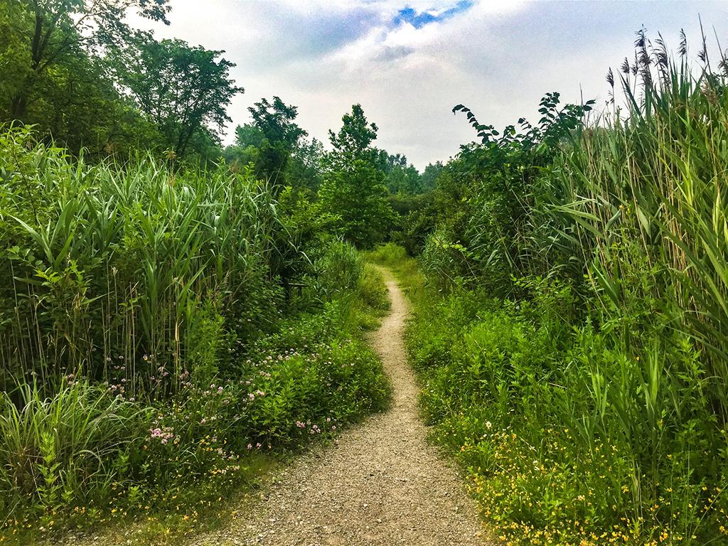
A trail through the tall grass in the Boston Area, Cuyahoga Valley National Park / NPS - Victoria Stauffenberg


