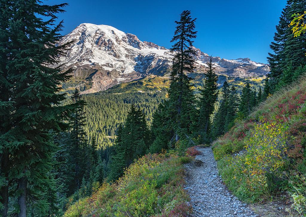
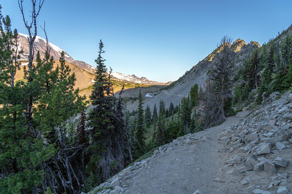
A plethora of hiking trails for any skill level may be found in all three life zones (forest, subalpine, alpine) of Mount Rainier National Park in Washington State. Most of these trails have some view of “The Mountain,” but other trails highlight waterfalls, wildflower-blanketed meadows, the cool green solitude of mossy forest interiors, and overlooks with views of the vast landscape around and beyond.
Hikes Featured On The Traveler

The trail to Fremont Mountain fire tower, Mount Rainier National Park / Rebecca Latson
Fremont Lookout Trail
The Fremont Lookout Trail at the Sunrise area of Mount Rainier National Park in Washington State is an extremely popular hike, and one I’ve been wanting to experience myself for the past six years. I finally hiked the trail during a perfect August day.
To read more of this hike, head to this page.
Silver Forest Trail
Depending upon the time of day you visit the Sunrise area of Mount Rainier National Park in Washington State, you may encounter heavy crowds on popular hikes such as the Fremont Lookout, Dege Peak, and Burroughs Mountain trails. If you are looking for a less-congested spot to wander, where you can listen to birdsong, admire meadows filled with colorful wildflowers, spot a ground squirrel, or even a fox while enjoying eye-popping views of Mount Rainier along a fairly level, well-maintained trail, then the Silver Forest Trail is just for you.
To read more of this hike, head to this page.
Sourdough Ridge To Dege Peak
The Sunrise area of Mount Rainier National Park is about a two-hour drive from my home in central Washington State and is one of my favorite areas of the park in which to hike. In a previous article, I wrote about exploring the less-trafficked Silver Forest Trail at Sunrise. For my most recent visit, I hiked the Sourdough Ridge trail to the Dege Peak spur trail, a more popular, almost-four-mile (6.4 km) roundtrip route with 360-degree views at trail’s end.
To read more of this hike, head to this page.
Park staff divides day hike trails between various locations within the park. Below is a quick rundown of day hikes you can enjoy.
Click on each area to see the trail map.
Longmire Area
Easy Trails
Twin Firs Loop Trail
Length: 0.4 mi/0.6 km
This trail takes the hiker through an outstanding example of lowland old-growth forest. The trail winds past huge specimens of the Northwest's "big three" evergreens—Douglas fir, western red cedar, and western hemlock--among other species.

The cool, green, shadowed Twin Firs Trail, Mount Rainier National Park / Rebecca Latson
Trail of the Shadows
Length (roundtrip): 0.7 mi/1.13 km
A self-guiding loop around Longmire Meadow explores the early history of the Longmire Springs Resort.
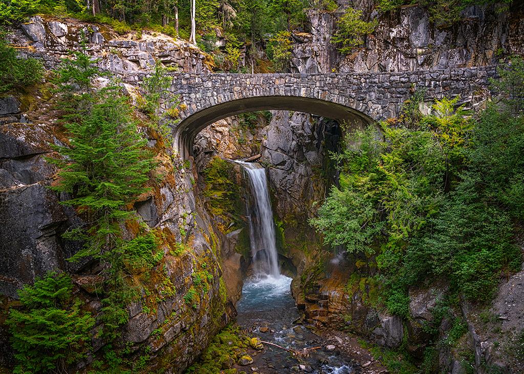
Christine Falls
Drive 4.5 mi/7.2 km east of Longmire and use the pullout just beyond the stone bridge. The trail descends 100 ft/328 m to a view of Christine Falls framed by the bridge. From here, you can access trails requiring moderate levels of exertion. This is an extremely popular area and the parking area is tiny.

Christine Falls, Mount Rainier National Park / Rebecca Latson
Moderate Trails
Kautz Creek
Length (roundtrip): 2 mi/3.22 km
The first mile of this trail is level. (The trail beyond the bridge continues 4 ½ steep miles to Indian Henrys; carry a map, extra water, and food.)
Carter Falls / Madcap Falls
Length (roundtrip): 2.2 mi/3.54 km; 500 ft/1,640 m elevation gain
Rampart Ridge
Length: 4.6 mi/7.4 km loop, 1,339 ft/4,393 m elevation gain.
Beginning from the Trail of the Shadows, this is a steep loop trail traveling through forests with vistas from the ridge top. Also known as "The Ramparts," this ridge is the remnant of an ancient lava flow which originated at the summit of Mount Rainier.
Strenuous Trails
Comet Falls and Van Trump Park
Length (roundtrip): 5.6 m/ 9 km; 2,200 ft/7,217.8 m elevation gain.
Located 4.4 mi/7.1 km uphill from Longmire, this steep trail passes Comet Falls (1.8 mi/2.9 km). Beware: this is not an early season hike due to steep snow slopes. Please stay on the trail to protect the fragile meadows. Mildred Point is an additional 1 mi/1.61 km beyond Van Trump Park, plus 800 ft/2,625 m elevation gain. Mildred Point offers great views of the Kautz Glacier. Please stay on the trail to protect fragile meadows.
Wonderland Trail to Indian Henrys
Length (one-way): 6.7 mi/10.8 km; 2,700 ft/8,858.3 m elevation gain.
The trail begins near the Longmire Wilderness Information Center and passes Carter, Madcap, and Narada Falls. At Narada Falls, the trail ends just above the falls and continues near the restrooms.
Eagle Peak Saddle
Length (roundtrip): 7.2 mi/11.59 km
A steep trail through old growth forest with great views. The trailhead is located 50 yards (45.7 m) past the Nisqually River Suspension Bridge in Longmire. Beyond the saddle, an unmaintained route leads to the peak. This is not an early season hike due to steep snow slopes. Use extreme caution beyond the maintained trail.
Ohanapecosh Area
Easy Trails
Hot Springs Nature Trail
Length: 0.4 mi/0.6 km; less than 100 ft/328 m elevation gain.
A short, self-guiding loop starting behind the Ohanapecosh Visitor Center and ending in “B” loop of the campground.
Grove of the Patriarchs
CLOSED due to damage to the suspension bridge from the 2021 flood. The bridge provides the only safe access to the island that is surrounded by the swift, cold Ohanapecosh River.

The Grove of the Patriarchs Trail is currently closed due to damage sustained to the suspension bridge over the Ohanapecosh River, Mount Rainier National Park / Rebecca Latson
Moderate Trails
Silver Falls Trail(s)
- (From Ohanapecosh Campground)
Length (roundtrip): 2.7 mi/4.3 km; 300 ft/91.4 m elevation gain.
This loop trail starts from “B” loop of the Ohanapecosh Campground. At the falls, cross the bridge and follow the signs back to the campground. - (From Stevens Canyon Road)
Length (roundtrip): 1 mi/1.61 km; 300 ft/91.4 m elevation change.
Trailhead is just northwest of the Stevens Canyon Entrance Station (across the road from the trailhead for Grove of the Patriarchs). - (From Route 123)
Length (roundtrip): 0.6 mi/0.97 km; 300 ft/91.4 m elevation change.
Drive 1.6 mi/2.57 km north from the Ohanapecosh Campground on State Route 123. Park at the pullout on the west side of the road. Hike 0.3 mi/0.43 km down the steep trail to the junction with the loop trail, turn right at the junction, and continue 75 yards/68.58 m to the falls. Please note: Fatalities have occurred near the falls! For your safety, stay behind the fences and on the trail at all times.
Eastside Trail
Length (one-way): 11.5 mi/18.5 km; 1,000 ft/304.8 m elevation change.
Although this trail extends from the Ohanapecosh Campground to Chinook Pass, day hikers often enjoy the portion of the trail just north of the Grove of the Patriarchs. Begin at the Grove of the Patriarchs parking area on the Stevens Canyon Road. At the trail junction 0.4 mi/0.64 km in from the parking area, go left and continue as far as you like.
Strenuous Trails
Laughingwater Creek Trail
Length (roundtrip): 12 mi/19.3 km to Three Lakes Camp; 2,700 ft/822.96 m elevation gain.
The trailhead is located on Route 123, 50 yards/45.7 m past Laughingwater Creek bridge (park on the west side of road; the trail starts on the east side).
Shriner Peak Trail (not shown on map)
Length (roundtrip): 8.4 mi/ 13.52 km; 3,434 ft/1,046.7 m elevation gain
To access this trail, drive 3.5 mi/5.6 km north of the Stevens Canyon Road junction on Route 123 (park at the pullout on the west side of the road; the trail starts on the east side). The trail winds up the ridge through an old burn area so be sure to bring sunscreen and plenty of water.
Cowlitz Divide Trail
Length (roundtrip): 8.5 mi/13.68 km; 2,440 ft/743.7 m elevation gain.
Access this trail via Silver Falls trail or by driving 0.6 mi/0.97 km west of Stevens Canyon Entrance (parking and trailhead are on the north side of the road). Trail ends 1 mi/1.61 km past Ollalie Creek Camp, at the junction with the Wonderland Trail.
Paradise Area
A network of trails web the Paradise area near both the Henry M. Jackson Memorial Visitor Center and Paradise Inn. Many of these trails are paved for the first 0.25 – 1 mile (0.4 – 1.62 km), but those paved routes are also somewhat-to-very steep.
Easy Trails
Nisqually Vista Trail
Length (roundtrip): 1.2 mi/1.9 km; 200 ft/60.96 m elevation gain
The trailhead is located at the northwest end of the lower parking lot. From this trail, you’ll have a nice view of the Nisqually Glacier.
Skyline Trail to Myrtle Falls
Length (roundtrip): 1 mi/1.61 km; 100 ft/30.5 m elevation gain.
The trailhead is located on the north side of the upper parking lot, next to the visitor center. The trails is paved and suitable for strollers and wheelchairs with help, but steep steps down to the falls viewpoint prohibit anything wheeled.

The trail to Myrtle Falls in the Paradise Area, Mount Rainier National Park / Rebecca Latson
Moderate Trails
Deadhorse Creek Trail and Moraine Trail
Length (roundtrip): 2.5 mi/4 km; 400 ft/121.9 m elevation gain.
The trailhead is located at the northwest end of the lower parking lot. For excellent views, continue up the Deadhorse Creek Trail to Glacier Vista and return via the Skyline Trail.
Alta Vista via the Alta Vista and Skyline Trails
Length (roundtrip): 1.75 mi/2.82 km; 600 ft/182.9 m elevation gain.
Begin at the trailhead located at the entrance to the lower parking lot, or at the trailhead on the north side of the upper parking lot, next to the visitor center.
Lakes Trail Loop, via Reflection Lake
Length (roundtrip): 5 mi/8 km; 1,300 ft/396.2 m elevation gain.
The loop intersects the road or the Skyline Trail at several points at or near Paradise and Reflection Lakes. Consider parking at Reflection Lakes and hiking up to Paradise, then returning downhill to your vehicle.
Bench and Snow Lakes
Length (roundtrip): 2.5 mi/4 km; 700 ft/213.4 m elevation gain.
The trailhead is located on the south side of the road, 1.5 mi/2.4 km east of Reflection Lakes. The trail is a succession of gradual ups and downs as it crosses a series of low ridges. The path first reaches Bench Lake after 0.75 mi/1.2 km, then continues another 0.5 mi/0.8 km to Snow Lake. The lakes may not melt out until late July.

Looking back toward the mountain along the Bench and Snow Lakes Trail, Mount Rainier National Park / Rebecca Latson
Strenuous Trails
Pinnacle Peak
Length (roundtrip): 3 mi/4.83 km; 1,150 ft/350.5 m elevation gain.
The trailhead is located southeast of Paradise, across the road from Reflection Lakes. The higher you climb, the better the views of the mountain.

Looking downtrail toward "The Mountain" along Pinnacle Peak Trail, Mount Rainier National Park / Rebecca Latson
Panorama Point via the Skyline and Golden Gate Trails
Length (roundtrip): 4 mi/6.4 km; 1,700 ft/518.2 m elevation gain.
The trailhead is located on the north side of the upper parking lot, next to the visitor center. Alternatively, you may take the Deadhorse Creek Trail from the north end of the lower parking lot, and intersect the Skyline Trail near Glacier Vista.

The view from Panorama Point, Mount Rainier National Park / Rebecca Latson
Skyline Loop, via the High Skyline Trail
Length (roundtrip): 5.5 mi/8.85 km; 1,700 ft/518.2 m elevation gain.
The trailhead is located on the north side of the upper parking lot, next to the visitor center. A pit toilet at Panorama Point is available during the summer only.

The Skyline Trail toward Panorama Point, Mount Rainier National Park / Rebecca Latson
Sunrise Area
Easy Trails
Sunrise Nature Trail
Length: 1.5 mi/2.4 km; 300 ft/91 m elevation gain. The trailhead is at the upper end of the picnic area. Self-guiding loop with views of Mount Rainier and the Cascades.

A view of "The Mountain" and White River from Silver Forest Trail, Mount Rainier National Park / Rebecca Latson
Moderate Hikes
Shadow Lake Trail
Length (roundtrip): 3 mi/4.8 km
Trailhead at the Sunrise parking area. Views of the White River Valley and Mount Rainier on route to Shadow Lake. Return to Sunrise via the steeper trail to Frozen Lake and Sourdough Ridge or follow the old roadway back to Sunrise.
Naches Peak Loop Trail
Length: 3.5 mi/5.6 km; 500 ft/152.4 m elevation gain.
Trailhead at Chinook Pass/Tipsoo Lake. Explore the subalpine flower fields and breathtaking views of Mount Rainier. Late summer and fall bring an abundant supply of huckleberries. Half of the hike is on the Pacific Crest National Scenic Trail. Pets are not permitted on the west half of the loop trail which is inside Mount Rainier National Park.

A view along the Naches Peak Loop Trail, Mount Rainier National Park / Rebecca Latson
Sourdough Ridge Trail:
(West to Frozen Lake)
Length (roundtrip): 3 mi/4.8 km; 500 ft/152.4 m elevation gain.
Follow the nature trail to the left, then head west on the Sourdough Ridge Trail. Return to Sunrise via the Wonderland Trail and the old Campground Trail. Fragile vegetation in Frozen Lake area: Please stay on the trail!

The Sourdough Ridge Trail to Frozen Lake, Mount Rainier National Park / Rebecca Latson

The view from the Dege Peak Trail via Sourdough Ridge Trail, Mount Rainier National Park / Rebecca Latson
Emmons Moraine Trail
Length (roundtrip): 3 mi/4.8 km; 700 ft/213.4 m elevation gain.
Begins in “D” loop of the White River Campground. Follow the Glacier Basin Trail for one mile (1.61 km); take the left fork and hike along the moraine.
Strenuous
Glacier Basin Trail
Length (roundtrip): 6.5 mi/9.66 km; 1,700 ft/518.2 m elevation gain. Begins in “D” loop of the White River Campground.
Sunrise Rim Trail
Length (roundtrip): 5.2 mi/8.4 km; 1,000 ft/304.8 m elevation gain. Follow the Sunrise Rim Trail to Shadow Lake continuing to Glacier Overlook and 1st Burroughs Mountain.

The view along Sunrise Rim Trail, Mount Rainier National Park / Rebecca Latson
Burroughs Mountain Trail

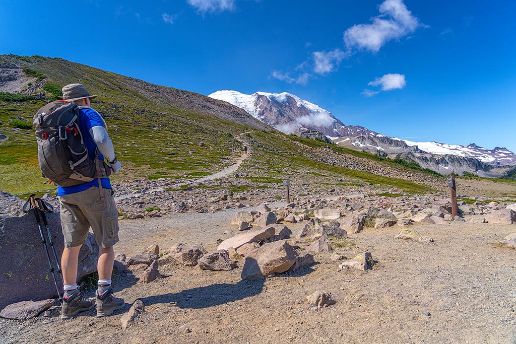
Hikers on the trail to Burroughs Mountain, Mount Rainier National Park / Rebecca Latson
- (1st Burroughs Mtn.)
Length (roundtrip): 4.8 mi/7.7 km; 900 ft/274.3 m elevation gain - (2nd Burroughs Mtn.)
Length (roundtrip): 6 mi/9.66 km; 1,200 ft/365.76 m elevation gain.
Start at the upper end of the picnic area. Follow the Sourdough Ridge Trail to the junction at Frozen Lake, then climb up the Burroughs Mtn. Trail. Return via the Sunrise Rim Trail. Caution: Hazardous travel on icy slopes until late in the season!
Upper Palisades Lake Trail
Length (roundtrip): 7 mi/11.3 km; 1,800 ft/548.6 m elevation gain.
Begins at Sunrise Point. Follow the Palisades Lake Trail past Clover Lake to Upper Palisades Lake. No views of Mount Rainier.
Berkeley Park
Length (roundtrip): 7 mi/11.3 km; 1,200 ft/365.76 m elevation gain. Take the Sourdough Ridge Trail to the junction at Frozen Lake, then follow a section of the Northern Loop Trail down into Berkeley Park.

Decisions, decisions, which trail to take, Mount Rainier National Park / Rebecca Latson
Carbon River And Mowich Area
Carbon River Area Trails
Easy Trails
Rain Forest Loop Trail
Length (roundtrip): 0.25 mi/0.4 km loop.
Discover nurse logs and other rainforest characteristics along the self-guided loop trail.
Old Mine Trail
Length (roundtrip): 2.9 mi/4.7 km; 100 ft/30.48 m elevation gain.
Follow the road 1.2 mi/1.93 km, then take a steeper, 0.25-mi/0.4-km spur trail to a gated mine entrance.
Moderate Trails
Green Lake Trail
Length (roundtrip): 10 mi/16.1 km; 1,000 ft/304.8 m elevation gain.
One mile/1.61 km past the turnoff, a spur trail leads to Ranger Falls.
Chenuis Falls
Length (roundtrip): 7.8 mi/12.6 km.
Check trail conditions first; the footlog is subject to washout.

A hiker on the Chenius Falls Trail, Mount Rainier National Park / NPS - K. Loving
Strenuous Trails
West Boundary Trail
Length (roundtrip): 6 mi/9.66 km; 2,800 ft/853.44 m elevation gain.
Departing from the back of the Rain Forest Loop Trail, this trail accesses a high ridgeline via waterfalls and forested slopes.
Carbon Glacier Trail (Wonderland Trail)
Length (roundtrip): 17.5 mi/12.1 km; 1,200 ft/365.76 m elevation gain.
Sections of this trail have been rerouted; watch for detour signs.
Mowich Area Trails
Moderate Trails
Tolmie Peak Trail
Length (roundtrip): 5.6 mi/9 km 1,010 ft/307.85 m elevation gain.
The trail begins at the last bend in the road on the Mowich Lake Road, 5.5 mi/8.85 km from the park boundary. Please stay on the main trail near Eunice Lake to protect the fragile environment. The trail will take you to the Tolmie Peak fire lookout, built in 1933 by the Civilian Conservation Corps.

The Tolmie Peak fire lookout, Mount Rainier National Park / NPS file
Spray Park Trail
Length (roundtrip): 6 mi/9.66 km; 1,300 ft/396.2 m elevation gain.
The trail begins on the west side of the Mowich Lake Campground. Take the 0.25 mi/0.4 km spur to Spray Falls, a 300-ft/91.4-m cascading waterfall.
Before you take out for a day of hiking Mount Rainier’s trails, remember to bring plenty of water and snacks with you – preferably salty snacks to replace the salt lost when you sweat. Wear sturdy shoes or boots and stick to the trail to avoid tromping on fragile meadows. It takes a very long time for meadowland to repair, once damaged.
Mount Rainier’s website has a Trails and Backcountry Camp Conditions page to which you can refer when planning your hiking itinerary.


