There are great options for hiking in Shenandoah, from cruising along the Appalachian Trail, or darting off the A.T. to make some swings down into the park's officially designated wilderness, or making a checklist of waterfall hikes.
Shenandoah contains more than 500 miles (805 km) of trails, a good-sized number for a park surrounded in all directions by humanity. And those trail miles roll out in both long and short bites.
The longest trail in the park would be the A.T., which runs the ridgelines for 101 miles (163 km). The shortest very possibly is the Blackrock Summit Trail, which is an eight-tenths of a mile (1.3 km) roundtrip hike from Blackrock Summit parking.

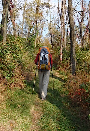
The Appalachian Trail runs 101 miles through the park. Bob Mishak photo.
While the A.T. runs end-to-end through the park, that doesn't mean you can't break the 101 miles (163 km) up into meanderings spanning anywhere from a few hours to a few days. Study the park's maps or pick up a guidebook to Shenandoah's trails and you'll see more than a few options.
Conveniently, most trailheads are along the Skyline Drive. And for ease of breaking down the park by hiking trail, the Shenandoah staff has developed a series of printable trail maps.
Trails featured on the Traveler:
Mennonite Women Backpacking and Bears Falling in Shenandoah National Park
Fall is a spectacular season to hike in Shenandoah National Park. Reds, golds, greens and browns are dappling the hillsides, deer are on the move, and, if your timing is excellent, bears are falling from the trees and Mennonite women are backpacking along the Appalachian Trail.
Lewis Falls Trail In Shenandoah National Park
Fall might not be everyone's preferred season for hiking, but in Shenandoah National Park it can be one of the best seasons. Not only are crowds down to a small trickle, but the naked forests can make it easier to spot remnants of old homesteads.
Of course, if a waterfall is your desired payoff, a fall hike is not the best of time to see a real gusher. But sometimes, as they say, it's not the destination but the journey that matters. and the relatively short hike down to Lewis Falls is a nice morning's or afternoon's activity.
Dark Hollow Falls And Beyond At Shenandoah National Park
There are many nice hikes in Shenandoah National Park, some that ramble on for miles, some that run just a short way to a wonderful payoff. Dark Hollow Falls is one such payoff, but the hike is just a mile-and-a-half roundtrip, rather short if you were looking for a good leg stretcher. You can, however, easily extend that hike by more than a few miles by weaving in some other trails and fire roads.
Tack on a short piece of the Rose River Fire Road, and another of the Stony Mountain Trail, and finally a leg of the Rapidan Fire Road, and you'll have a nice hike of about 6 miles that will entail several hours. Plus, you'll have some great solitude in the mountains, as these are not mainstream hiking corridors in the park.
Here's a look at other park trails, courtesy of the Shenandoah staff:
North District
Dickey Ridge Area
Dickey Ridge Trail - 2.7 miles (4.3 km) round trip, fairly easy, has overgrown fields and small stream.
Fox Hollow Trail - 1.2-mile (1.9 km) circuit, fairly easy, features homesites and a cemetary. Pets are not allowed on this trail. Guidebook available at visitor centers and at trailhead.
Snead Farm Trail - 1.4 miles (2.3 km) round trip, easy, features an old orchard and barn. From the south end of the picnic area, cross Skyline Drive and follow the gravel fire road.
Mathews Arm and Elk Wallow Area
Overall Run Falls - 6.5 miles (10.5 km) round trip from amphitheater parking lot to a viewpoint of the 93' waterfall; moderately difficult. Take the Traces Trail from amphitheater parking lot to Tuscarora Trail to Overall Run Trail.
Knob Mountain - 5-mile (8 km) circuit along a stream. Take Knob Mountain Trail near wastewater treatment plant to left on the Cutoff Trail, then left on the Elkwallow Trail.
Little Devils Stairs - From the Boundary: From Sperryville, follow US 211 E/522 N for 2 miles (3.2 km), turn left on Rt. 622 (Gid Brown Hollow Road). After 2 miles (3.2 km) turn left on Rt. 614 which turns to gravel and ends at the park’s boundary trailhead in 5.2 miles (8.4 km). Take the Little Devils Stairs Trail to the Keyser Run Fire Road for a 5.5-mile (8.9 km) strenuous circuit with rock scrambling. Trail crosses stream many times up a narrow rocky gorge. Do not attempt after heavy rain. From Skyline Drive: 7.7-mile (12.4 km) circuit from parking at Mile 19.4. Take Keyser Run Fire Road to Little Devils Stairs Trail. Round trip hike is 4.8 miles (7.7) straight down the gorge and back; strenuous.
Central District
Panorama Area
Marys Rock from Panorama upper parking area - 3.7 miles (6 km) round trip to an outstanding view, difficult.
Marys Rock from Meadow Spring Parking - 2.8 miles (4.5 km) round trip to an outstanding view, moderately difficult.
Hazel Mountain - parking at Meadow Spring area. A network of trails through woods, streams, and cascades, as well as evidence of old homesites. Tailor to your ability and interest.
Skyland Area
Millers Head - 1.6 miles (2.6) round trip, fairly easy hike from parking area beyond the stables to a spectacular view, with moderately steep sections on return.

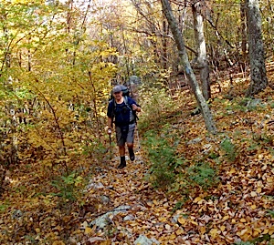
The Browns Mountain Trail spurs off of the A.T. and runs down into Shenandoah's Big Run Wilderness. Kurt Repanshek photo.
Limberlost Trail - 1.3 mile (2.1 km) circuit stroll, especially beautiful when the mountain laurel blooms. This trail is often enjoyed by persons with mobility challenges. The trail was originally constructed to meet ADA accessibility standards; however, the requirements have recently been revised. Shenandoah is working on upgrading Limberlost to meet the new standards. In the meantime, use this description of the trail to determine if it is appropriate for your use: This circuit hike of 1.3 miles (2.1 km) is for people of all ages and has a 5-foot-wide (1.5 meters) crushed greenstone walkway on a gentle grade with frequent benches, a boardwalk, and a bridge. The trail passes through forest and a stand of mountain laurel - stunningly beautiful when it blooms in June. Pets not allowed.
Stony Man Trail - 1.6-mile (2.6 km) circuit, fairly easy hike from parking area to spectacular view. Guidebook available at visitor center and trailhead. Pets not allowed.
Little Stony Man - 0.9-mile (1.4 km) round trip from the parking area, fairly easy hike with views. Some steep sections.
White Oak Canyon Area
Whiteoak Parking Area Skyline Drive (mile 42.6) to Upper Falls – 4.6 miles (7.4) round trip to upper falls, the highest of the Whiteoak cascades at 86 feet (26 m). Return trip is very steep. Consider your physical condition and available time before continuing past the upper falls. Add an additional 2.7 miles (4.3 km) round trip (1100 feet / 335 meters elevation change) to lower falls and return.
Cedar Run/Whiteoak Circuit (mile 45.6) – very strenuous 8.2-mile (13.2 km) circuit hike. From Hawksbill Gap, take Cedar Run-Link-Whiteoak-Whiteoak Fire Road-Horse Trail. Multiple waterfalls and cascades. Be sure to bring water.
Whiteoak Canyon from Boundary Trailhead – 2 miles round trip to lower falls; steep and challenging 6 miles (1100 feet / 335 meters elevation change) round trip to upper falls. Return before crossing the large metal bridge above the upper falls.
Old Rag is Shenandoah's most popular and most dangerous hike. The number of blogs and websites about this hike attest to its popularity. The number of search and rescue missions each year attest to its danger. There's no doubt that the scramble is great fun and the views are spectacular. A day on Old Rag is one of Shenandoah's premier experiences. We want to be sure that your experience is not marred by an accident or health issue that could be prevented with good planning.
Traveler’s Note: From March 1 to November 30, visitors to Old Rag Mountain, including hikers on the Saddle, Ridge, and Ridge Access trails, will need to obtain an Old Rag day-use ticket in advance, in addition to a Park entrance pass. Find out more information on our Old Rag day-use ticket FAQ page.
Hawksbill Mountain Area
Hawksbill Summit from:
* parking area at mile 45.6 - 1.7 miles (2.7 km) round trip, fairly steep hike to spectacular view.
* parking area at mile 45.6 - 2.9 mile (4.7 km) circuit, moderate hike with beautiful views much of the way, and a spectacular view at the top.

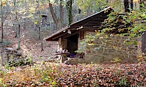
Plan your trip right and you could spend the night in a hut along the A.T. Kurt Repanshek photo.
* parking area at mile 46.7 - 2.1 miles (3.4 km) round trip, easy to moderate hike to a gorgeous view.
Rose River Loop Trail - 4-mile (6.4 km) circuit from Fishers Gap, moderate, shady trail with streams, cascades, and a waterfall.
Big Meadows Area
Dark Hollow Falls Trail – 1.4 miles (2.25 km) round trip; very steep; 70-foot (21 m) waterfall. Pets are not allowed.
Story of the Forest Trail – 1.8-mile (2.9) easy circuit that passes through forest and connects with paved walkway. From Byrd Visitor Center exit turn right, follow sidewalk to trail entrance. At paved walkway turn left to return to visitor center, or to avoid pavement, retrace steps. Pets are not allowed.
Lewis Falls Trail – 3.3-mile circuit from amphitheater to observation point, or 2 miles round trip from Skyline Drive. 81’ waterfall. Moderate with steep rocky areas; one stream crossing. Return via Appalachian Trail.
Rapidan Camp Area
Rapidan Camp via Mill Prong Trail - 4 miles (6.4 km) round trip from Milam Gap Parking, moderate, steep at places, 3 stream crossings.
Rapidan Camp via Mill and Laurel Prongs, AT - 7.4-mile (12 km) circuit, moderate (but long), along streams with cascades.
Lewis Mountain Area
Bearfence Rock Scramble - 1.2-mile (1.9 km) circuit hike to a spectacular 360° view. Short, but challenging hike with a rock scramble––do not attempt when rocks are wet. Pets are not allowed on this trail.
Pocosin Mission - 1.9-mile (3.1 km), easy round trip hike via the fire road to the ruins of an Episcopal mission. Artifacts are protected by law–leave them as you find them.
South River Falls - 2.6-mile (4.2 km) moderately strenuous round-trip hike from picnic area to observation point of an 83-foot waterfall. To return by a different route, take the fire road and AT back up to make a 3.3-mile (5.3 km) circuit. Add an additional 1.4-mile (2.25 km) spur to reach the base of the falls.
South District
Loft Mountain Area
Frazier Discovery Trail – 1.3-mile (2.1km) circuit from the trailhead. Moderately easy hike to beautiful views. Guidebook available. Pets are not allowed on this trail.
Doyles River – 2.7 miles (4 km) round trip to upper falls (28 feet / 8.5 m); 3.2 miles (5.1 km) to lower falls (63 feet / 19 m). From parking area at mile 81.1, cross Skyline Drive and take blue-blazed Doyles River Trail. Moderate.
Big Run Loop – 5.8-mile (9.3 km) circuit from overlook along Big Run Loop Trail and A.T.; views and wildflowers. Moderate.
Browns Gap – 6.5-mile (10.5) moderately difficult circuit. 3 waterfalls. From parking area cross Skyline Drive and take Browns Gap Fire Road. Go right on Doyles River Trail, right on Jones Run, and right on A.T.
Jones Run Falls – 3.4 miles (5.5 km) round trip. 42-foot (13-meter) falls. Moderate.
Riprap Area
Blackrock Summit - from Blackrock Summit parking, an easy one-mile (1.6 km) circuit hike (.8 mile / 1.3 km round trip) with outstanding views and interesting geology.
Riprap Trail - 3.4 miles (5.5 km) moderate round trip from parking area to Chimney Rock, or a 9.8-mile (16 km) circuit with steep sections connecting with Wildcat Ridge Trail and the Appalachian Trail.
Turk Mountain - fairly easy, shady 2.2-mile (3.5 km) round trip hike to a view.


