
Google Maps has become a useful electronic option to paper maps for many people, and one feature of that site'"Street View"'allows users to see a ground-level, 360- degree photographic view of many locations around the world. Now that service is adding parts of some national parks, including the Grand Canyon and even one park location that lies beneath the ground.
Like any other technology, Google Maps and Street View have both fans and detractors, but there's no question the site offers some stunning images of both obvious landmarks and some pretty unusual locations.
According to the company's website, "When we first started Street View as an experimental project, we packed several computers into the back of an SUV, stuck cameras, lasers, and a GPS device on top, and drove around collecting our first imagery. We've come a long way since our initial U.S. launch in 2007; today we've expanded our 360-degree panoramic views to include locations on all seven continents."
Google Street View Is Now Going Off The Pavement
Part of that growth of the site has been taking the Street View cameras and mapping software off the pavement and onto the trails of places like Grand Canyon National Park. Google is calling this variation "Street View Trekker," and it was first used at the Canyon.
According to Google, "The Trekker, our latest imagery-gathering apparatus, is a wearable backpack system that allows us to venture to locations only accessible by foot. The ability to take Street View to remote, hard-to-navigate places, such as the Grand Canyon, is a major opportunity to make the beauty and history of locations like these accessible to a global audience."
A hiker who encountered one of these camera crews during a trek miles from a road could be forgiven if he thought he'd been out in the sun too long; the equipment is rather other-worldly in appearance, and collecting the images in the most popular sections of the park required hauling those unusual cameras to the very depths of the Canyon.
Trekker Crews Covered Popular Destinations in the Park
The process of gathering the photos is explained by the Google staff: "It took a team of 10 Googlers and 5 Trekkers about 3 full days to adequately capture the main trails of the Grand Canyon's South Rim. Two Trekker teams hiked down the Bright Angel Trail, camped overnight at Phantom Ranch, and then hiked out the next day along the South Kaibab Trail. Another three Trekker teams remained at the top of the Grand Canyon collecting imagery around the rim as well as the South Rim Trail. Our team also ventured out to collect imagery of Meteor Crater, just outside Grand Canyon National Park."
The resulting images are both excellent and intriguing, and offer a fun way to either scout a trip location in advance, relive a previous visit, or simply enjoy a vicarious trip to one of the special places on our planet. The following brief video summaries the process and the results.
Street View Trekker locations at Grand Canyon currently posted on Google Views include multiple views of the Bright Angel Trail, South Kaibab Trail, the "Black Bridge" across the Colorado River at the bottom of the Canyon, Phantom Ranch, Grand Canyon Village and several overlooks on both the South and North Rim.
For a quick summary of the locations which were photographed at Grand Canyon National Park, go to this link, then point your mouse at any of the small red dots on the map for a small preview of that scene. Click your mouse on that dot, and a full-screen panorama opens and begins to pan. Click your mouse once to make the image stationary, then click and drag again with your mouse to pan the image.
Trekker Images Allow You to "Travel" the Trails
The locations in the park photographed with the Google Trekker equipment, such as the Bright Angel Trail, allow you to visually travel along the route by using your computer mouse and a pair of small white flattened "arrows" in the image. Each click on the "arrow" will zoom you along the trail for a short distance, so until you get the hang of it, I suggest you only try this while you're seated at your computer rather than while standing and viewing the image on a hand-held device!
There are also other scenes from the park on Google which were submitted by individual contributors; those images, called "Photo Spheres," were not captured with the Google Trekker equipment, but with Android devices, digital SLR cameras and similar personally-owned equipment. They offer panoramic views but not the ability to visually "travel" around that location.
You can find those Photo Spheres from Grand Canyon, and some other NPS areas, including a few from Yosemite National Park, by searching for the location from the Google Views home page.
Taking Trekker Underground
Google is gradually expanding the list of national park locations covered with the Street View equipment, including a rather unusual one where the "street view" is actually a trail located beneath the surface of the earth.
In June of this year, Carlsbad Caverns National Park announced that it would "be one of the first caves in the country to be part of a Google Maps Street View special collection. Soon, Google Maps will launch 360-degree photos of the cave on Street View, enabling people to take a virtual tour of Carlsbad Cavern and explore hundreds of points along the Main Corridor and Big Room trails. The images are expected to go live on Google Maps later this year."
According to a park spokesperson, "The Google Maps team visited Carlsbad Caverns National Park in June as part of an effort to photograph national parks across the country. Soon after entering the cave, however, the team realized that this project was going to be unique'and challenging."
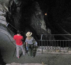
Photography in Carlsbad Caverns posed some special challenges for the Google staff. NPS photo.
"The challenges of working in a cave included dim lighting and lack of a GPS signal, which is used to pinpoint images on a map. For each spot in the cave where images were collected, the Google Maps team snapped four photos, one in each direction, which will be stitched together to create interactive, panoramic images of the cavern."
The Park Superintendent at Carlsbad Caverns, John Benjamin, is retiring this week after a distinguished 45-year career with the National Park Service, and he offered a good perspective on this new technology when he announced the Google project at the park this past summer.
'We are anxious to see the images of the cave and for people to start exploring from home,' said Superintendent Benjamin. 'Hopefully, this will encourage more people to come see what lies underground at Carlsbad Caverns National Park. Photos can pique your interest, but there's nothing like seeing the real thing.'


Comments
How do NPT readers feel about the prospect of encountering a Google Street View camera within Wilderness?
Rod -
A very good question!
This is great!! I hope there will be a "street view" for all of the trails in the NPS one day. It will be excellent to see the trails before I hike them. I can't tell you how many "moderately difficult" trails I hiked that were not accurately described. I have always tried to to talk to other people about their experiences on the trails but everyone has their own opinions. Personally, I wouldn't mind seeing a Google Street view camera in the wilderness. This can only be a positive in my view. Now, I would like to know how to get a job doing this.
Another great idea from Google!
Now we'll all be able to go hiking without all those blisters, shoulders sore from pack straps, mosquito bites, and that yucky sweat dripping down all over us. We can hike and then stop at a virtual campsite where we can pause the computer, take a shower and sleep in our own soft bed before starting out after breakfast the next morning. Do you think they might be able to toss in an attacking grizzly just to liven things up a bit?
Only in America would such terrific innovation take place.