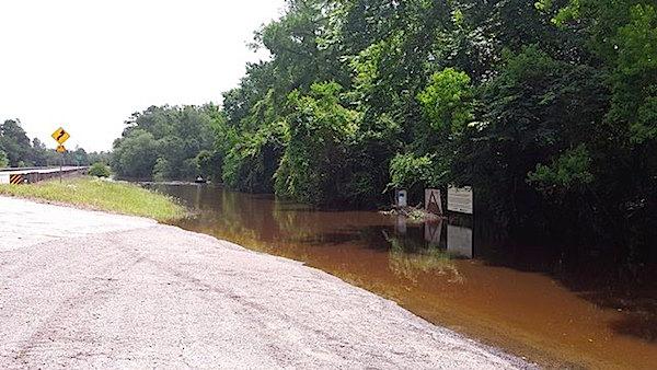
Floodwaters have left many trails in Big Thicket National Preserve unsafe and under water/NPS
Recent storms have quite literally left Big Thicket National Preserve in Texas soaked, and forced the temporary closure of many trails, both on land and in water.
Acting Superintendent Edward Comeau says that due to significant storm activity and record-setting rains, many of the hiking trails and paddling trails throughout the preserve are completely inaccessible and will be closed for approximately a week to ten days. Fallen trees, swollen waterways overflowing their banks and significant standing water throughout the preserve have prevented park staff from safely accessing many of the trails. Of the ten official trails in the preserve, currently only the inner loop of the Sundew Trail, the elevated boardwalk section of the Pitcher Plant trail, and the Big Sandy Trail are open and safe for visitors to explore.
Visitors are reminded that flood waters and saturated soil can create many unsafe conditions. River banks can easily collapse and foot bridges can be weakened due to the waterlogged conditions. Do not walk through moving water. Six inches of moving water can be enough to create a significant hazard. Do not drive on flooded roadways. Just a few inches of flood waters can sweep away you and your vehicle.
In the coming days and weeks, park staff will begin work to remove fallen trees, repair foot bridges, and restore the preserve trail network to safe conditions. You can find updates on trail conditions at the park's website and its Facebook page.
Big Thicket National Preserve is in southeast Texas just north of Beaumont and 75 miles northeast of Houston. The preserve consists of nine land units and six water corridors encompassing more than 112,000 acres scattered across a 3,500-square-mile area. The Big Thicket, often referred to as a 'biological crossroads,' is a transition zone between four distinct vegetation types ' the moist eastern hardwood forest, the southwestern desert, the southeastern swamp, and the central prairies. Species from all of these different vegetation types come together in the thicket, exhibiting a variety of vegetation and wildlife that has received national interest.


Comments
An unfortunate situation for this, and other parks affected by the recent flooding.
Some may wonder why high water makes any difference for a "paddling trail." These routes can be a great way to explore some magnificent bottomland hardwood forests, but when these creeks and bayous are out of their usual channels, and everything is under murky water, every place looks pretty much the same. Landmarks in such flooded forests are hard to pick out, and the current running through a broad area of flooded trees instead of in a defined channel can make handling a canoe or even small powerboat very tricky. These are the times when it's easy to understand the legends about people getting seriously lost and stranded in the Big Thicket.
If anyone needs more reasons to stay out of these flooded woods, here's one more: When I worked there during the early days of this park, we often joked that there were places where we could guarantee seeing "20 pounds of cottonmouth moccasin to the acre" - and when the water is this high, that could apply to a LOT of places in these woods and swamps :-)