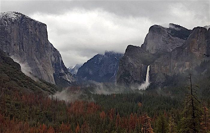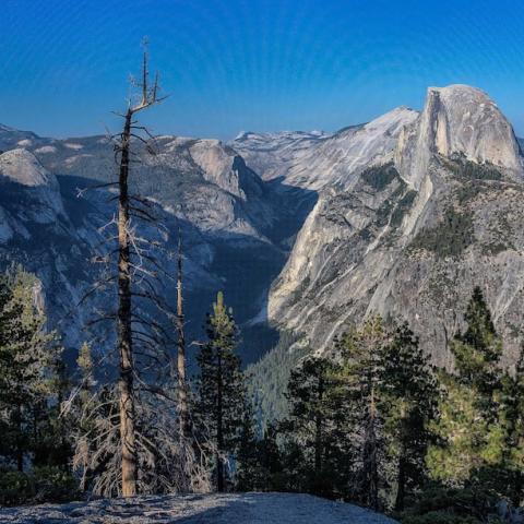
The Yosemite Valley was scheduled to reopen to the public at 8 a.m. Tuesday/NPS
Editor's note: This updates with the Yosemite Valley reopening to the public on Tuesday, lodging and commercial services to resume operations Wednesday.
In the end, the forecast was wrong. While the Merced River did rise above flood stage as it rolled through the Yosemite Valley, predictions of a crest more than 8 feet above flood stage never materialized, leaving Yosemite National Park's main destination drenched but seemingly little worse for the storm.
After checking the valley for damage, park officials announced that the valley could reopen to the public on Tuesday at 8 a.m. but stressed that there would be limited services.
"There is no access to Yosemite Valley via the El Portal Road (Highway 140) due to a rockfall that occurred early this morning. There is no estimated day or time for the road to reopen. The Hetch Hetchy Road is also closed due to a rockfall," park spokesman Scott Gediman said in an email.
Overnight accommodations and commercial services in the Yosemite Valley were to resume on Wednesday, while campground operations would resume Tuesday night.
Early Monday morning the gauge on the Pohono Bridge on the west end of the valley showed the river had peaked at 12.7 feet before starting to drop. Weather forecasts leading into the wet weekend carried predictions that the Merced would crest at more than 18 feet, or 8 feet above flood stage. That never happened as the storm veered to the north.
According to Mr. Gediman, "(A)lthough there was no major flooding in Yosemite Valley, both roads and infrastructure (water systems, sewer systems, etc.) were impacted."
"Park visitors are asked to be aware of hazards, including potential wet and icy road conditions, rockfall, and debris in roadways," he added. "The park has experienced significant rainfall over the past month and ground saturation could lead to hazardous conditions along park roadways."


 Support Essential Coverage of Essential Places


Comments
More BS from Gary. One of the worst in 1200 years? Hardley, In fact the last century has been the wettest for california in the last 7,000 years. Drought is and has been a natural phenomenon that has occurred for millions of years and there is not evidence it is get more frequent or more severe.
http://www.mercurynews.com/2014/01/25/california-drought-past-dry-period...
I really wish you would do some research, before spouting off your mouth, EC. Otherwise, you wouldn't look so consistently ignorant on this subject.. Never have I suggested that droughts were not a factor of previous climates, nor did they not occur. What I did say is that drought severity seems to be taking on an increasing trend, and on a global scale.. You have proven you can't understand that. As stated, we just witnessed that in my region this year, as we had the driest 5 months worth of exceptional drougth recorded. It led to a catastrophic wildfire conflagration event. That's the facts, jack.
https://www.sciencenews.org/article/california-drought-worst-least-1200-...
And the article I posted noted that in the past droughts were as long as 200 years. We've had nothing close in the era of CO2 emmissions. And as the chart I have posted repeatedly shows, droughts have not become more frequent or more sever over the last century.
you obviously don't understand what drought severity means. There are different levels of "droughts" as stated on the Palmer Drought Severity Index. While a "drought" could extend for 200 years, that could mostly mean that during a certain phase, the moisture levels were slightly lower than during more stable eras. The region would still recieve rain, just not as much as during stable eras. What California experienced, what Texas experienced a few years ago, and what the Southeastern US just experienced this year was exceptional drought and was designated as such. Exceptional drought patterns (ie the most severe) are increasing, especially over the last 2 decades.
BS - as this chart shows they are neither increasing in frequency or intensity.
https://en.wikipedia.org/wiki/Droughts_in_the_United_States#/media/File:...
Droughts happen, forest burn when there are droughts. Beyond that, you've got nothing.
That chart only goes to 2011, and skips a portion of this decade. Californias severe drought is not even factored in there. Play on.
http://www.pnas.org/content/112/13/3931.full.pdf