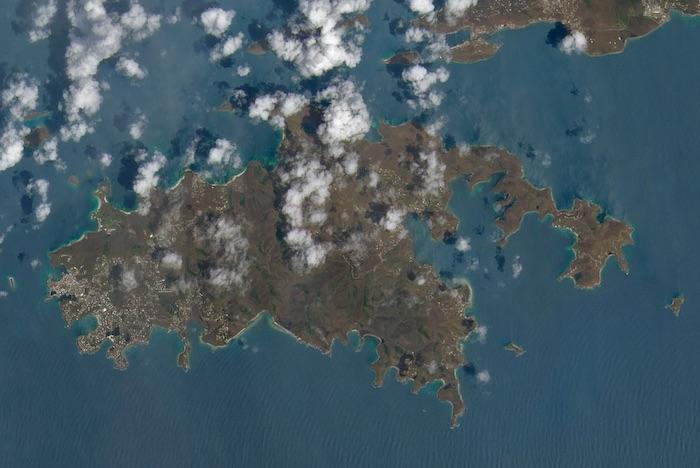
The difference is absolutely shocking. Before Hurricane Irma raked Virgin Islands National Park, the landscape of St. John was lush and green. Afterwards, it appeared brown and barren.
These natural-color images, captured by the Operational Land Imager (OLI) on the Landsat 8 satellite, show some of Irma’s effect on the British and U.S. Virgin Islands. The views were acquired on August 25 and September 10, 2017, before and after the storm passed. They are among the few relatively cloud-free satellite images of the area so far.
The most obvious change is the widespread browning of the landscape. There are a number of possible reasons for this. Lush green tropical vegetation can be ripped away by a storm’s strong winds, leaving the satellite with a view of more bare ground. Also, salt spray whipped up by the hurricane can coat and desiccate leaves while they are still on the trees. -- Kathryn Hansen, NASA Earth Observatory

This photo of St. John in the U.S. Virgin Islands was taken August 25, 2017, by NASA's Earth Observatory
This photo of St. John was taken September 10 by NASA's Earth Observatory


Comments
One of my favorite parks! Trials of the Anthropocene.
So sad. Forty years now since I visited there but, foolishly, I've always thought oif it as a pristine place of beauty that would always be there.
This is so heartbreaking for the people of BVI and their beautiful country. Hoping they find the will and resources to rebuild.
Curious to know what the underground landscape looks like.