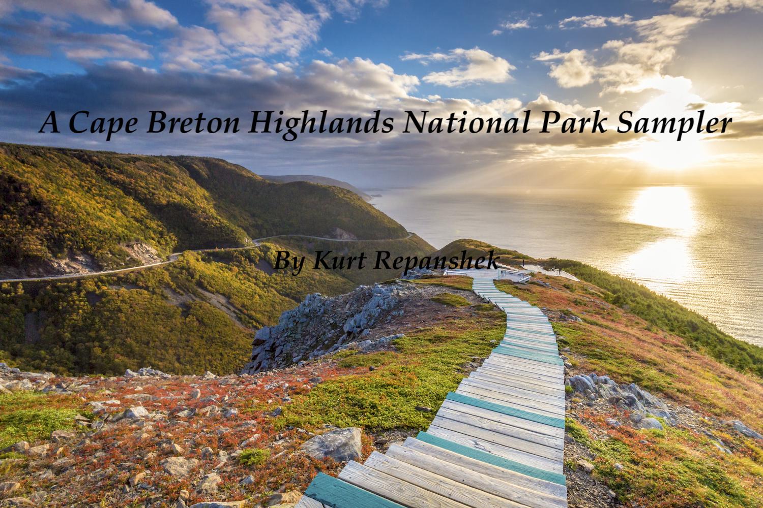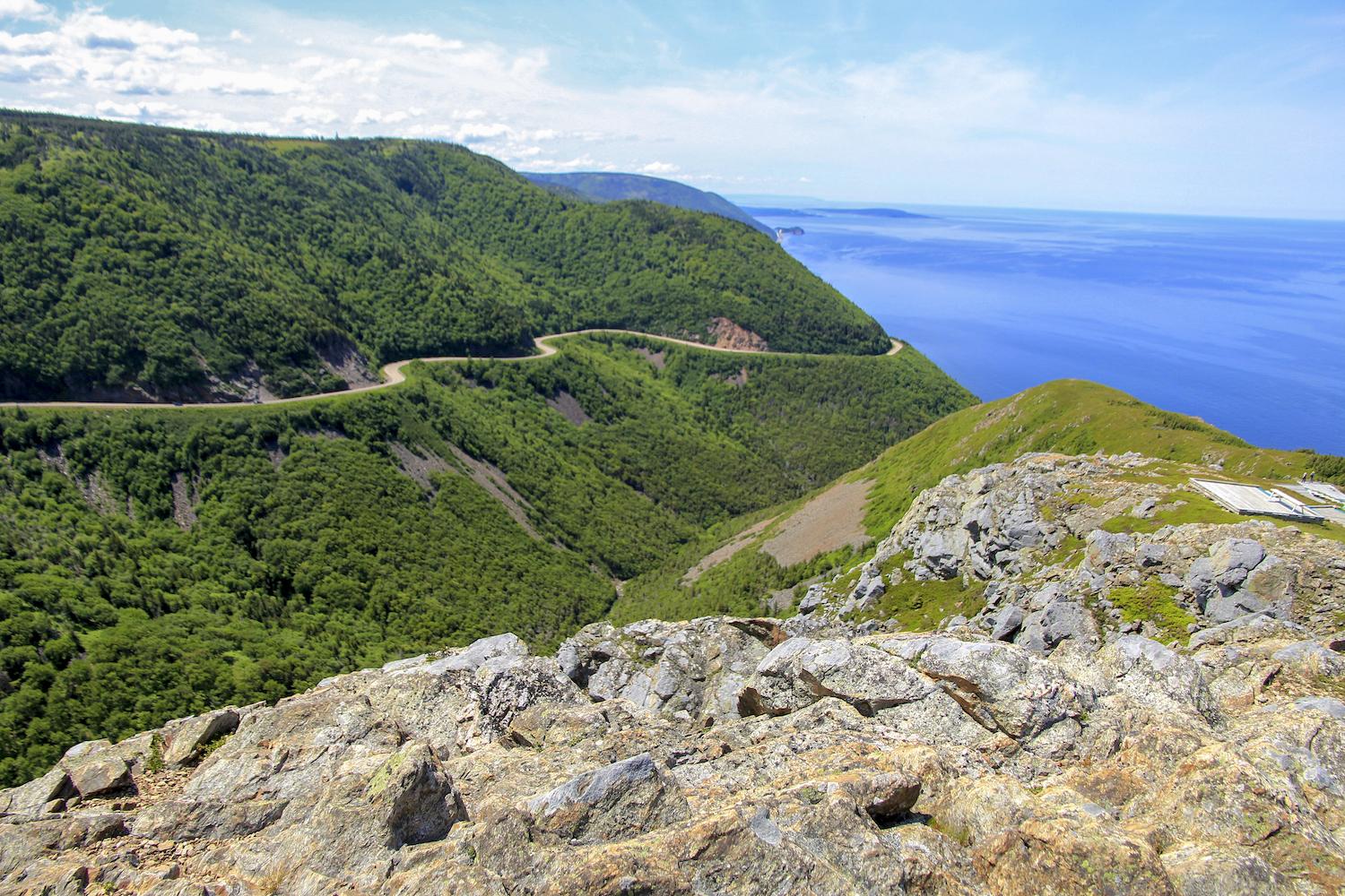
The Skyline Trail that leads to a breathtaking view of the Gulf of St. Lawrence tops most Cape Breton Highlands National Parks visitor's to-do lists/Parks Canada, Adam Cornick
On an island surrounded by ocean, Cape Breton Highlands National Park is an island itself, of rumpled mountains, thick forests, and sprawling highland barrens mostly unbroken by the human footprint. At its heart, the parklands are much as they have always been, not crossed by roads or transmission lines, unmarked by lodges, cut only by streams leaping their way down to the coast, thick with a wondrous mix of boreal and hardwood forests occasionally interrupted by generally treeless barrens where low-to-the-ground shrubs, forbs, and grasses grow.
Set on the northern half of the Nova Scotia's Cape Breton Island, the park has a split personality. The Cabot Trail, a two-lane 186-mile (299-kilometer) scenic highway curls around the park, showing off the Atlantic Ocean to the east and the Gulf of St. Lawrence to the west, but never truly piercing the national park. What the highway wraps is an imposing landscape of mountains dotted with lakes and laced with streams. Moose and bear are among the terrestrial species at home here, overhead you might spot a bald eagle, while in the surrounding ocean waters pilot whales might be cruising by. Salmon still fight their way up the Margaree River to spawn, and osprey and eagles drift overhead, ready to pluck any fish that comes too close the surface.
Cape Breton Island is a wonderfully bucolic place where the landscape has largely been protected, fortuitously, from the hubris of human involvement and the industrial tourism industry. Frankly, the entire island might rightly be designated a national park. The natural landscape here in summer bursts with rose hips and blueberries, crab apples and currants. Cows loll on lush pastures, no doubt pleased to have abundant ocean vistas and breezes.
The human landscape includes ubiquitous stacks of weathered lobster traps, charming homes surrounded by large sweeps of green lawn, and handed down collections of fiddle tunes that are responsible for the Cape Breton sound, which arrived from Scotland in the early 1800s with the highlanders who were exiled from the Isle of Skye. The western coast of Cape Breton seems to be the sweet spot of fiddling, with live music easy to find from the Red Shoe Pub in Mabou that packs them in nightly and the Celtic Music Interpretive Center in Judique where they have lunch-time concerts to the Glenora Distillery north of Mabou and the Baddeck Gathering Ceilidhs in Baddeck with its nightly music.
Venture off the beaten path deep in the Margaree Valley and, if you're lucky, you'll come upon Anne Morrell Robinson's gallery of quilts that have gained her widespread renown. There, within a 1,600-square-foot, two-story showroom, hangs a seasonally-rotating collection of story-telling quilts.

The Cabot Trail wraps Cape Breton Highlands National Park and offers sweeping views of the ocean, but never really penetrates the park's interior/Parks Canada, Alaïs Nevert
But wherever you intend to head on the island, the national park isn't far from mind. Designated in 1936, Cape Breton Highlands protects roughly 366 square miles (950 square kilometers) and includes the highest point in Nova Scotia, 1,755-foot (535 meters) White Hill. Aside from the Cabot Trail, named for the Italian explorer who sailed to North America in 1497 (and might have landed on the island that year), there are no roads that climb into the heart of the park. There are some stops at mostly short hiking trails, but you need to be self-sufficient and skilled to truly head off into the interior.
"Aspy, Franey, Mica Hill, and Branch Pond Look-off trails, and technically Clyburn Valley and Salmon Pools trails, would be the trails that go the furthest into the interior, but none of them really get into the barrens," Eric Magnan, a Parks Canada media contact told me. "However, there is always the option to do non-designated backcountry camping and hiking."
There is just one designated backcountry campground, the Fishing Cove Campground on the west side of the park, just north of the Fishing Cove River. There you'll find just eight sites with gorgeous, sweeping views of the gulf.
It seems that for many a visit to the national park would be incomplete without walking the iconic Skyline Trail, which isn’t so much a trail as it is a corridor, one exceedingly well traveled. Despite a roughly quarter-mile long parking lot, with spaces on both sides, the trail’s popularity requires an overflow lot, which is tended by parking lot attendants during the height of each summer day. These attendants, bilingual to direct you in either French or English, are not averse to recommending that you return later in the afternoon when the bulk of the foot traffic has subsided.
Taking this advice, my wife and I headed out of the parking lot and spent several hours exploring some of the other trails on the west side of the national park.

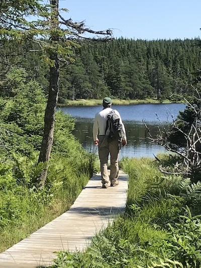
A boardwalk leads you to Benjie's Lake/Marcelle Shoop
Benjies Lake
This short (1.9 miles roundtrip, 3 kilometers), gentle hike leads you up onto a plateau atop French Mountain and through a stretch of boreal forest and barrens to a small lake/big pond at the end of a boardwalk. Moose are said to frequent the area, but we never spotted any. Apparently your odds of seeing one go up in the spring and fall, and earlier in the day. Birds, on the other hand, were flitting everywhere. The trail was officially named on June 13, 1975, though who Benjie might have been has been lost to time.
MacIntosh Brook
Another short hike, running 1.1 miles (1.7 kilometers) roundtrip, this walk follows its namesake brook into the landscape. Your upstream walk is through an old-growth Acadian forest (hemlocks, sugar maples, birch, spruce), so shade is plentiful. The brook meanders placidly for most of the hike, until you get to the payoff, a waterfall that tumbles about 19 feet (6 meters) down a rocky shelf. Heavy traffic over the years has exposed many roots, so watch your footing.
Lone Shieling
Though this is also a short hike, a loop that doesn't quite stretch a half mile (0.6 kilometers), the human and natural history on display justifies you add it to your to-do list. It wasn't until we parked and headed down the trail that we discovered what "Lone Shieling" is. In Scotland, a "shieling" was a structure erected by tenant farmers on the pastures of clan chieftans to find shelter from the elements for themselves and their sheep. One end of the structure was left open for access and to provide light, and during stormy weather the farmer/crofter would stack sod to put up a wall to keep the weather out.
The shieling near the start of this trail, a placard explains, was erected "in accordance with the will of Professor Donald S. MacIntosh, a native of Pleasant Bay, Inverness County, who died on July 20, 1934, and devised to the Province of Nova Scotia one hundred acres of land hereabout, expressing the wish that the government of the province will maintain a small park at the intervale and will build there a small cabin which will be constructed in the same design or plan as the lone shieling on the island of Skye, Scotland."
Beyond the Lone Shieling, the path takes you into a dense forest of sugar maples, some believed to have germinated 350 years ago. According to Parks Canada, the 4,000-acre valley that contains the trail shelters the "largest undisturbed tract of old hardwood in the maritimes."

Lone Shieling, Cape Breton Highlands National Park/Kurt Repanshek
With those three hikes checked off, we headed back to Skyline. While the parking lot was roughly two-thirds empty, it's a very large parking lot and your walk is still not without others. Yet despite these throngs, they’re not enough to convince wildlife to avoid the area. During our brief stop in August park authorities were cautioning those on the trail to watch carefully for black bears.
The heavy human trail traffic diminishes the hiking experience, and we dispensed with making the entire 4-mile-loop (6.5 kilometers) or the 5.1-mile-loop (8.2 kilometers) made by adding a rugged back loop, both featuring views of the Gulf of St. Lawrence. That's not to suggest that the trail and its rewarding views are not worth the effort, but rather to encourage you to get an early start in the day before the throngs arrive.
As for our visit to Cape Breton, one week is certainly not enough to scrape beneath the veneer of the island and the national park. Plan, if you can, for at least two, both to slowly navigate the Cabot Trail, stop at the artisan shops along the way (leather works, iron works, pottery, quilts and more), notch more hikes into the park, and join the locals over dinner in pubs, taverns, and restaurants where the fiddling continues long after dark.

 Support Essential Coverage of Essential Places
Comments
Author:
Did you drive to Cape Breton from the US? If so, could you describe the route and the attractions along that route? As I look at the map, CB is on the edge of the continent.
While this feature describes the hiking very well, I did not find descriptions of available accomodations in and around the park--maybe there are none?
I wished I had driven. The thunderstorms made the flights home a nearly 24-hour affair, with an unplanned overnight in Toronto. But driving from Utah would have added about two weeks to the journey.
Lodging on Cape Breton itself, outside of Sydney, can be challenging. There's one lodge in the park, the Keltic Lodge, and while the accommodations are nice, it's pricy. In fact, Canada overall seemed expensive, even with the strong dollar. We found wonderful accommodations by using a general "Cape Breton lodging" google. There do seem to be a fair amount of AirBnB properties, and no doubt VRBO properties as well.