A map of the areas visited, thus far, along the Washington state portion of the Ice Age Floods National Geologic Trail / Google Maps
If you read my photo column about exploring along the Washington state portion of the Ice Age Floods National Geologic Trail, you’ll know I photographed within an area of eastern Washington known as the Channeled Scablands, a vast landscape covering 100,000 square miles in Washington, Oregon, and Idaho (15,000 square miles in just Washington state, according to a USGS publication). You saw images of giant current ripples, coulees a mile or more wide bordered by high basalt walls, and panoramic vistas at the site of an ancient, now dry, waterfall several times larger than Niagara Falls and created from the repeated flooding of 2,000-foot-deep and 500-to-600-cubic-miles-full Glacial Lake Missoula when the ice dam holding back all that water failed (several times).
In this column, I’ll be telling you about my visit to Frenchman Coulee through the photos I captured and what you, yourself, can do and see if you ever visit this coulee (derived from the French word for a deep, wide canyon or ravine cut by water action).

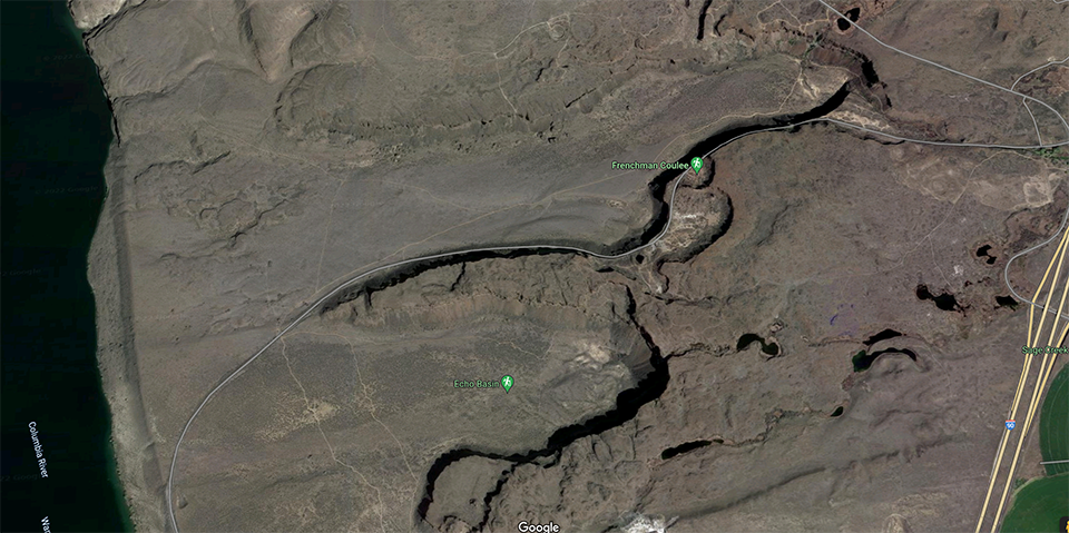
A satellite view of Frenchman Coulee, Ice Age Floods National Geologic Trail / Google Maps
Frenchman Coulee is less than two hours’ drive north, then east, of my central Washington town, across the Columbia River and located right off Interstate 90. Traveling east from Seattle, it’s about two-and-a-half hours, and traveling west from Spokane, it’s about two hours. For a little trivia, according to the Washington State Department of Natural Resources, the name “Frenchman” is said to have come from “a time when French-Canadian hunters and trappers roamed this landscape.”
FYI, for any trip you make along the eastern Washington portion of this NGT, it’s hot and dry, even in the springtime, and gets hotter and drier as the summer progresses. Services might, or might not, be close to your day-trip destination, and many roads you must travel to see these sights will be gravel. So, remember to bring plenty food and water and make sure your vehicle is gassed up and in good working condition. Oh, and bring tick repellant. Spring and summer mean those nasty little buggers will literally be waiting with open arms to latch onto the unsuspecting hiker. I use Sawyer Products Premium Permethrin spray-on insect repellent for my clothing that you can get through Amazon.
I start my day trips quite early, not only because I want interesting light on my subjects, but also for cooler temperatures. Arriving at Frenchman Coulee early in the morning means it’s quiet, except for birdsong and perhaps the sound of the seasonal waterfall near the head of the coulee. Campers are either still asleep or just getting their day started. Oh, did I mention there are spots for camping right at the edge of the canyon?

The seasonal waterfall in Frenchman Coulee, Ice Age Floods National Geologic Trail / Rebecca Latson

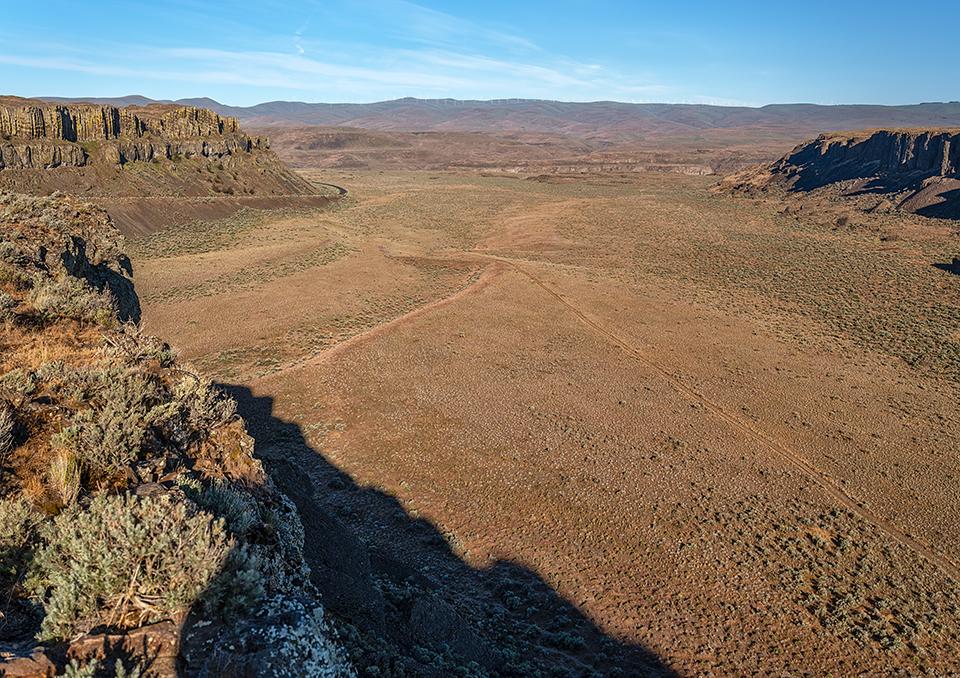
Looking down the length of Frenchman Coulee toward the Columbia River, Ice Age Floods National Geologic Trail / Rebecca Latson
Much of the coulee is shaded during morning. In the summer that’s great because of the heat. However, while the play of shadows is interesting, you’ll need to adjust your camera settings to expose for the brighter parts of your composition and lighten up the shaded areas later with a little photo editing. Believe it or not, mid-morning light up to noontime is better in terms of illuminating the entirety of the columnar basalt walls and coulee floor.
After you’ve finished photographing the length of the coulee and any observable waterfall (which disappears during the summer), drive a few hundred feet further to a pullout directly across the road from The Feathers, a line of eroded basalt fins popular with rock climbers. If there are any cars or people there, get a shot including car/people just to show your audience the size of those basalt rocks.

"The Feathers" in Frenchman Coulee, Ice Age Floods National Geologic Trail / Rebecca Latson

Climbing "The Feathers" on the opposite side in Frenchman Coulee, Ice Age Floods National Geologic Trail / Rebecca Latson
After viewing The Feathers, turn your camera the other way to capture images of the canyon and columnar basalts beyond that look amazingly like “crinkle-cut French fries,” in the words of Nick Zentner from one of his Nick on The Rocks videos.

"Crinkle-cut French fry" columnar basalts in Frenchman Coulee, Ice Age Floods National Geologic Trail / Rebecca Latson
A short distance down the road from The Feathers is a dirt-and-gravel parking area with restrooms. Two trails that wend their way across this landscape begin there. Take plenty of water and be careful hiking the routes, which are more like rutted jeep trails or narrow, single-track, sometimes steep paths. Watch out for rattlesnakes, too (yeah, it’s always something). The views at the end of whatever trail you hike, though, are pretty cool and the trails aren’t very long.
Take a look around you, from time to time. Maybe get a leading line shot of the trail.

Hiking one of the trails in Frenchman Coulee, Ice Age Floods National Geologic Trail / Rebecca Latson
Capture a wildflower shot or two.

Pretty flowers along the trail in Frenchman Coulee, Ice Age Floods National Geologic Trail / Rebecca Latson
It’s possible you’ll chance upon a lush, green, hidden oasis surrounded by an otherwise dry, dusty, rocky landscape.

An oasis in Frenchman Coulee, Ice Age Floods National Geologic Trail / Rebecca Latson
At the edge of the canyon, just stop and listen to the birds. Observe your surroundings and breathe in the fresh, scented air. You might even see a coyote turn tail to leave you to your reverie, like I did during my hike to the South Alcove for a look down into Echo Basin.

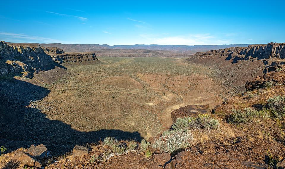
Looking down upon Echo Basin from atop the South Alcove of Frenchman Coulee, Ice Age Floods National Geologic Trail / Rebecca Latson
Get another shot or two of those “crinkle-cut French fry” columnar basalts on either side for a slightly different perspective. Use your telephoto lens to zoom for a closer inspection. You might even be surprised (like I was) during the editing stage to see the tiny figure of another hiker wandering atop those basalt columns at the upper center-left portion of the composition.

I spy wtih my little eye: a tiny hiker on top of columnar basalts in Frenchman Coulee, Ice Age Floods National Geologic Trail / Rebecca Latson
After you’ve gotten a little exercise hiking around, get back in your vehicle and drive toward the end of the road and the coulee, an opening from which colossal floodwaters reaching a level of about 700 feet in height drained out into the Columbia River tens of thousands of years ago. As you watch and photograph the Columbia, try to imagine floodwaters higher than the basalt walls around you, their powerful rush gouging out huge rocks and eroding soils to leave behind the scoured landscape seen today.

Roll on, Columbia, Ice Age Floods National Geologic Trail / Rebecca Latson
BTW, along that road, there is a very small gated area with a pullout on either side and a trail on one side of the road that leads back to the waterfall, and on the other side of the road that leads to an ancient plunge pool beneath columnar basalts.
Depending upon how much time you wish to spend hiking the web of narrow, sometimes-faint trails at Frenchman Coulee, it’s a perfect day trip, but you might find yourself with some daylight time left. If that’s the case, head back the opposite way on I-90 toward Royal City (about 17 miles past the turnoff you’d take to the bridge crossing the Columbia River at Vantage). Between the towns of Royal City and Othello is the Drumheller Channels National Natural Landmark and the subject of another column about my explorations along the Ice Age Floods NGT.

The "butte-and-basin" channeled scablands of Drumheller Channels National Natural Landmark, Ice Age Floods National Geologic Trail / Rebecca Latson
There is so much more to the National Park System than just the "national parks" themselves. While I encourage you to visit different national parks, you might want to think about traveling to or through any of the other 423 park units, such as the Ice Age Floods NGT. If you are traveling from Seattle or Spokane, then a tour of the Channeled Scablands makes for a perfect multi-day road trip from either city. Yes, you’d be doing a bit of driving, but there are plenty of places to stop and hike and reasonable lodging choices along the route. You’ll also encounter few to no people on the trails, capture photos of amazing sights, and learn new things. You can’t ask for much more than that from a park experience, can you?
Note: Rangers are out and about at Washington state parks, but maybe not so much at other lands requiring a pass. However, it doesn’t hurt to play it safe and avoid a fine that might cost more than the annual price of a Discovery Pass by going online to purchase a $10 day pass or $30 annual Discover Pass ahead of time (https://www.discoverpass.wa.gov/). This is an especially good idea since a place like Frenchman Coulee (unlike Sun Lakes – Dry Falls State Park) has no day pass kiosks available but still requires a Discovery Pass to park anywhere there.
References
You can read more about Frenchman Coulee and other parts of the Channeled Scablands with the following books:
Bruce Bjornstad, On The Trail Of The Ice Age Foods – Washington, 2017 Fourth Print, Keokee Books
John Soennichsen, Washington’s Channeled Scablands Guide, 2012,The Mountaineers Books

 Support Essential Coverage of Essential Places


Comments
Very cool, never knew about this area. Add another hot, dry rocky place to my list of sunburn locations. Hiked Big Bend earlier this year. Remarkable place. Thanks for the article
For an eye-opening, aerial perspective of massive Frenchman Coulee go to: https://youtu.be/oUyxRWSYTgM
Definitely a great place to see and photograph. Thanks for sharing the geological information about how these wonderful features were created.