Sheltered from the sprinkling rain under the train station’s broad roof, I stood on the wooden platform, waiting expectantly. Nearby, a mother with a stroller tried to corral her excited children, while two white-haired couples, clearly old friends, sat on the benches chatting and laughing. Road bikers in spandex and cleated shoes leaned amiably against the far wall, comparing times and distances, their bicycles behind them. A family consisting of middle-aged parents, their young teenager, and a doting grandfather, all gathered by the ticket window, the teen peppering the ticket agent with railroad questions. I checked my watch, smiling to myself.
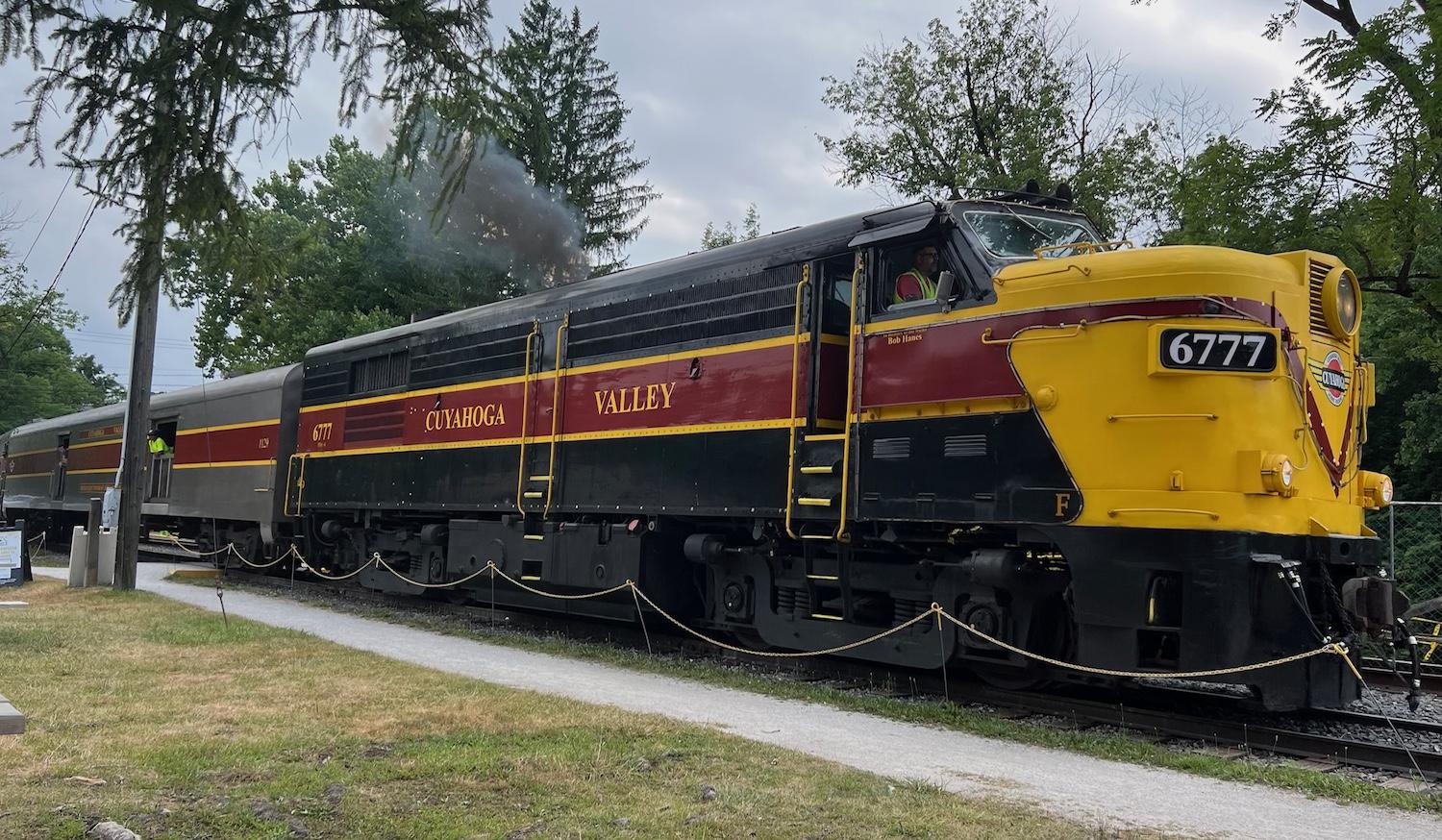
Suddenly, a whistle blew and the train arrived: the Cuyahoga Valley Scenic Railroad through Cuyahoga Valley National Park in Ohio, one of the very few national parks with an active passenger train running through it. At $20 for the ticket, I was allowing myself an inexpensive indulgence, making the roundtrip from North Akron Station to Peninsula Depot the easy way, staying dry and comfortable, watching the Cuyahoga River gliding by my window — and the canal that traced the river. Settling into my seat, I found myself on one of the most accessible trails I had ever taken.
Ohio & Erie Canal Towpath Trail
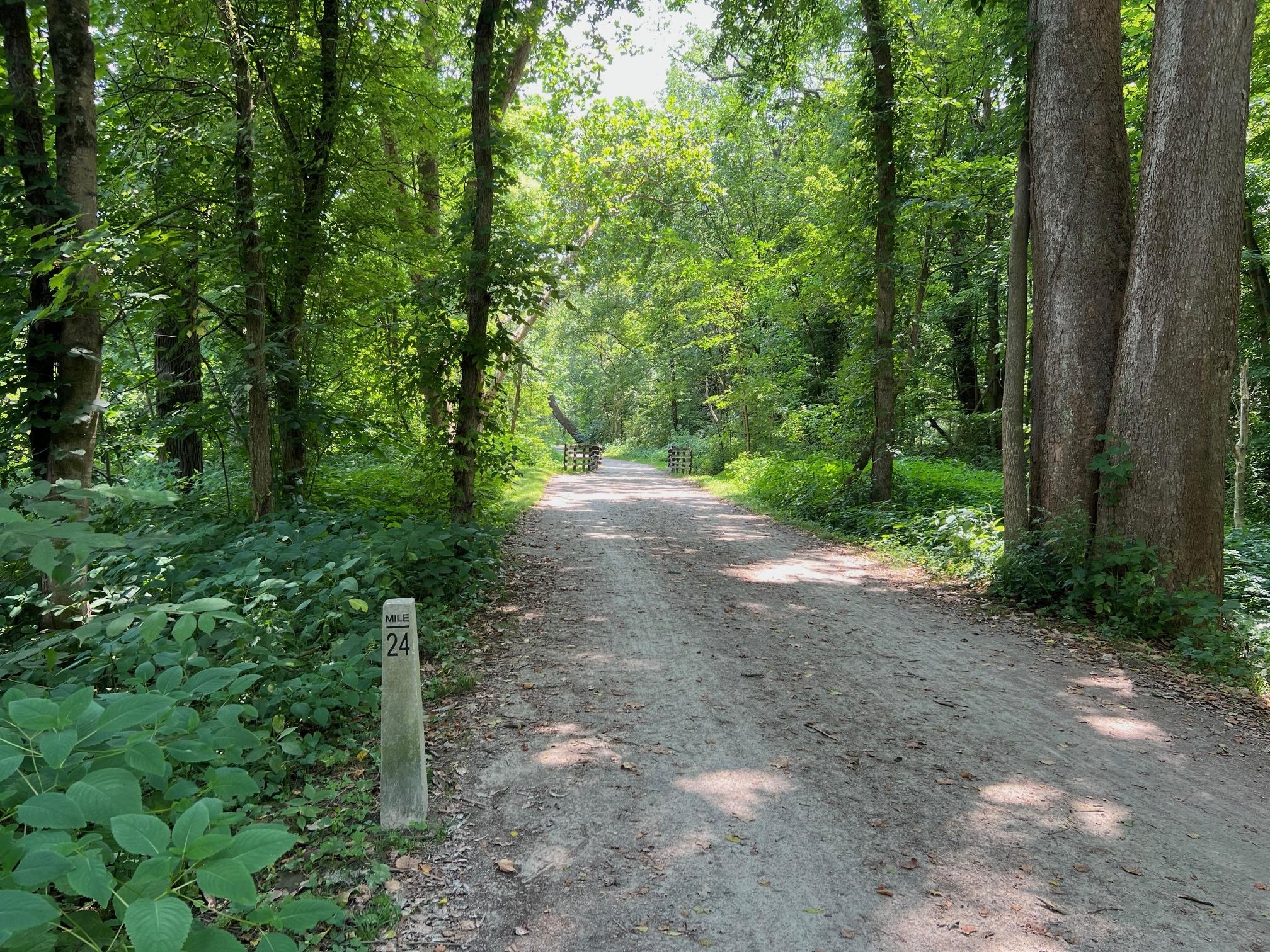
The tracks closely follow the Ohio & Erie Canal Towpath Trail, a designated National Recreation Trail since 1977. Long before airways, highways, and even railways crisscrossed the country, rivers — our great waterways — were used regularly to transport goods and passengers. In Ohio, the prime destination was Lake Erie, where ferries and larger ships known as “lakers” provided access to East Coast cities and points beyond.
River transportation presented challenges including dangerous rapids, shallows and sandbars, and seasonal flooding, all of which limited or temporarily halted access. Delays in getting crops and other products to larger markets created negative economic impacts for Ohio. Following the successful completion of the Erie Canal in western New York, Ohio decided to pursue canal building, as well. In 1825, work began on the Ohio & Erie Canal linking Portsmouth on the Ohio River with Cleveland on Lake Erie. Over the next seven years, 308 miles of canal would be hand-dug, mostly by newly arrived Irish and German immigrants. According to Case Western Reserve University’s Encyclopedia of Cleveland History, “The canal was a minimum of 40' wide at the water line, 26' at the bottom, and 4' deep, dug by laborers using picks, shovels, and wheelbarrows, with oxen to drag heavy trees and stones. When construction began in 1825, wages were $5 per month plus temporary housing, board, and daily rations of whiskey.”
When it was completed in 1832, the canal turned Cleveland into a national transportation hub and major center of commerce. Canal boats, sometimes called packet boats, were usually 14 feet wide and could be 70-90 feet long. They could carry up to 60 passengers and were arguably more comfortable, safer, and faster than overland stagecoaches. Similarly sized freight-laden versions traveled at an average speed of three miles per hour, typically carrying from 10-30 tons of cargo, far more than any wagon.
The canal and expanding port caused Cleveland to grow quickly. Its population in 1820 was only 606 people; by 1850, the population had exploded to 17,034. The next year, at the peak of the canal’s usage, “some 2.5 million bushels of wheat, 600,000 barrels of flour, a million bushels of corn and three million bushels of coal came through Cleveland via the canal,” per TeachingCleveland.org. Iron ore, oats, pork, lard, cheese, salt, wool, and whiskey began to be shipped east, while manufactured cookstoves and cast ironware, cotton fabric, and imported coffee, tea, sugar, and even China were floated west. The 1840s to early 1850s witnessed the heyday of canal transport.
What Was A Towpath?
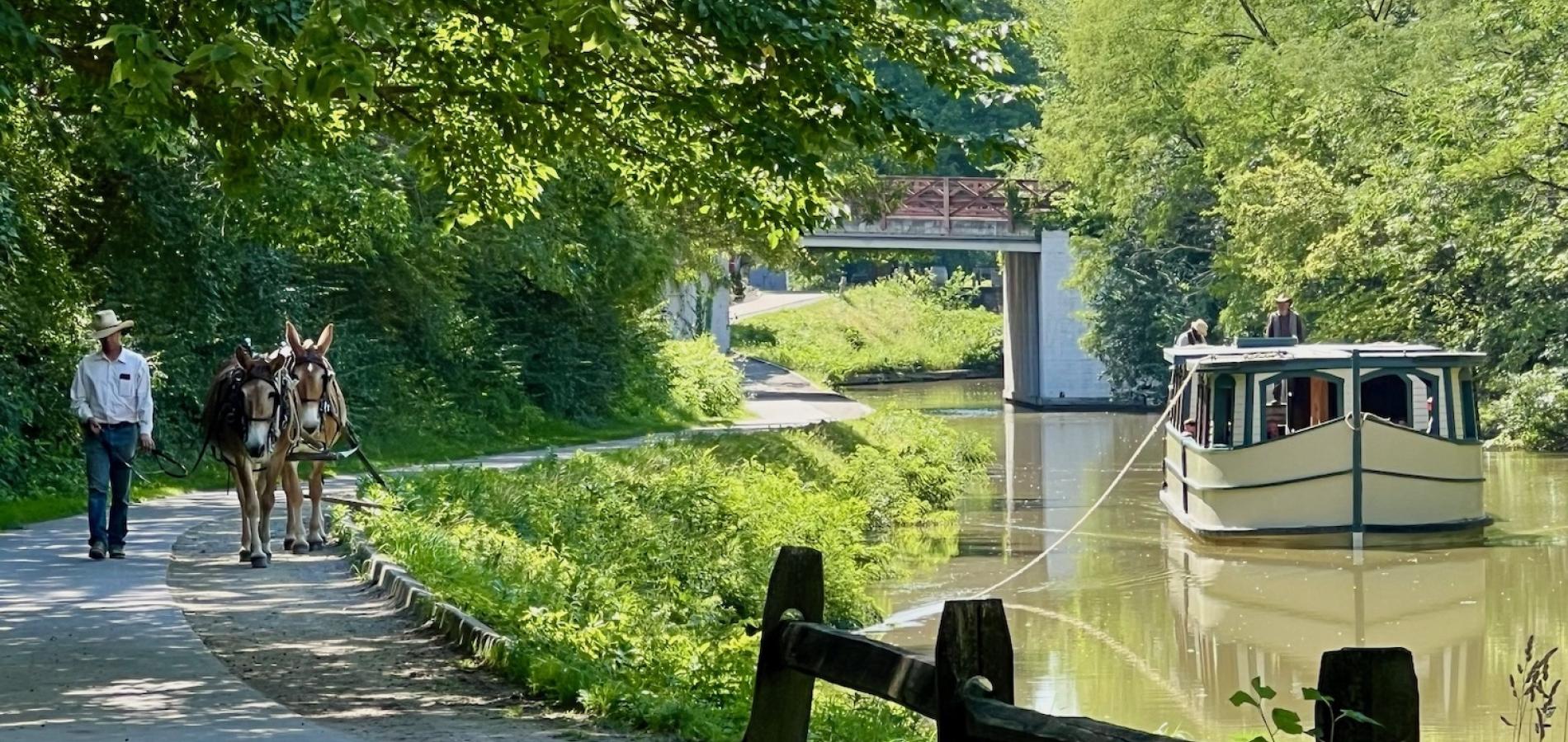
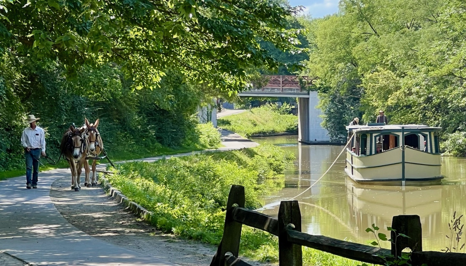
The previous day, purely by chance, I had been lucky enough to stumble into a historical celebration near Grand Rapids, Ohio, featuring live reenactments of canal boat travel on Ohio’s other major north-south canal, the Miami & Erie Canal between Cincinnati and Toledo. I saw that the canal had a berm alongside it, with a wide, smooth path. A team of two mules, led by a teamster (or “hoggee,” as they were sometimes called), walked along the path, towing the low-roofed canal boat on a long, thick rope. Every few miles, a new team would have taken over, the original team returning down the path for the next boat. Often these hoggees were young farm boys.
Standing on a bridge over the canal, I had observed the team and boat pass below me. I remembered a lyric from the old “Erie Canal” folk song: low bridge, everybody down, low bridge, we’re comin’ to a town. Now I understood what it meant. The passenger cabin had been built low, for sitting, with minimal headroom; the boat hands working on top jumped down from the flat roof to the deck just before reaching the overhanging arch.

A diesel engine pulls the Cuyahoga Valley Scenic Railroad on the day of this story, while the historic steam locomotive was undergoing maintenance/Barbara 'Bo' Jensen
Learning About Locks
The Cuyahoga Valley train arrived at the village of Peninsula, and I got off. I had scheduled my return trip to allow enough time to venture from Lock 29 Trailhead down some of the towpath trail on foot. I’d never explored canals before, and didn’t completely understand the mechanics of the canal system; conveniently, I found interpretive signs along the way that filled in the gaps for me.
I learned a canal wasn’t just a smooth, straight, easily-navigated channel. The key to a canal was its lift locks, raising and lowering boats over changes in elevation and water levels. A boat entered a lock, wooden gates on both ends were closed by hand using levers and cranks, and water was either released into or drained from the enclosed space to match the upcoming water level. Elevators for boats! In fact, within one mile, it took a series of 15 locks, like stairsteps, to move boats up and over the summit ridge near Akron, crossing the St. Lawrence Continental Divide between the Ohio River and Lake Erie drainages. A mile down the trail, I came to Lock 28, known as Deep Lock for its 14-foot lift, “the greatest on the canal” per the National Park Service sign. I marveled at the 200-year-old ingenuity.

Now silted in, Lock 28 was known as Deep Lock for its 14-foot lift/Barbara 'Bo' Jensen
Maintaining Access To The Historic Canal Route
Bikes zipped past me on the smooth gravel towpath trail. Trees lined the path. The mom with her stroller lagged farther behind, the little ones quiet and sleepy on their shady ride. Heading back, I passed the white-haired couples having a picnic in a sitting area near the first bridge at Lock 29. Just as the canals had once facilitated boat travel, now ramps and bridges allowed all of us to reach this destination with ease.
As did the Cuyahoga Valley Scenic Railroad. When the time came, we waited momentarily to board the train back to Akron, only because the train’s on-board wheelchair lifts needed time to allow those passengers to get on first. I was impressed with this feature, and talked with one of the railroad’s dapper conductors in black vest and cap about the variety of train access. He reminded me that bicyclists often ride down the towpath trail and then catch the train, signaling for a lift by waving their arms at waysides. The train provides lots of options for many kinds of trail and park visitors.
Yet, traveling on — or near — a river is still challenging. A history of intense industrial pollution once made the Cuyahoga River susceptible to catching fire; an inspiration for the Clean Water Act, conservation measures are finally succeeding in restoring the river’s ecosystem. Now, severe weather events caused by climate change increase risks of river flood damage to the park, the towpath trail, the whole valley.
I pointed out to the conductor the heavy equipment working on the far side of the river as we pulled out of the station.
“The track was washed out by the river a couple of years ago,” he told me. “Since then, they found a lot of erosion, and they’re working to stabilize that, stabilize the riverbank.”
“That’s why the train isn’t running all the way to Cleveland, and ends in Peninsula?” I asked.
“Right,” he confirmed. “For now. They’re hoping to have that operational soon, at least past Peninsula to Rockside Station.”

Visitors can walk into granite-walled Lock 29 near the Lock 29 Trailhead on the Ohio & Erie Canal Towpath Trail/Barbara 'Bo' Jensen
The 26 miles of track through the park originally were laid in 1880 for the Valley Railway. Now the system is managed in partnership: the National Park Service maintains the tracks, and the nonprofit Cuyahoga Valley Scenic Railroad operates the trains themselves.
“Nonprofit?” I repeated.
“We’re all volunteers,” he replied. “Today, they’re running a diesel engine, but when it’s operational, we do have a historic steam locomotive that pulls the train. That’s pretty neat.”
When I asked why he volunteered, he told me it was about more than the train itself.
“I like the mix of people, from all over,” he nodded. “That makes it fun. And I think the train makes the trip easier for some."
It was an ironic observation. By the end of the 1850s, it would be the expanding national railroad network that would spell the beginning of the end for canal transport
READ MORE: Ohio & Erie Canalway: Ohio and Erie Canalway National Heritage Area
Cuyahoga River Cleanup: National Public Radio story, Scott Neuman, October 12, 2024
Bo Jensen is a writer and artist who likes to go off-grid, whether it's backpacking through national parks, trekking up the Continental Divide Trail, or following the Camino Norte across Spain. For over 20 years, social work has paid the bills, allowing them to meet and talk with people living homeless in the streets of America. You can find more of Bo's work on Out There podcast, Deep Wild Journal, Wanderlust, Journey, Months to Years.


 Support Essential Coverage of Essential Places


Comments
Canal Fulton, Coshocton, both in Ohio, offer Canalboat rides.