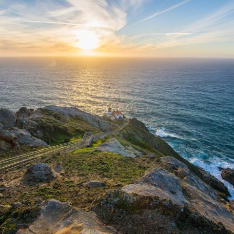
The Drakes Bay Historic and Archeological District is being commemorated at Point Reyes National Seashore, marking the spot where Francis Drake grounded his ship in 1579/NPS photo of mouth of Drakes Estero
Editor's note: The following is an unedited release from the National Park Service.
Nearly four decades before the settlement of Jamestown, Englishman Francis Drake navigated the Pacific Coast of California. In his attempt to return to England, he careened his ship and established a temporary encampment while repairs to the ship were made. The designation of the Drakes Bay Historic and Archeological District at Point Reyes National Seashore recognizes the historic and archeological evidence identifying Drakes Bay as the most likely site of Francis Drake’s California Landing in 1579, signifying one of the earliest instances of European contact and interaction with the native peoples on the west coast, the Coast Miwok Indians.
Sixteen years later, a storm grounded and sank a Manila Galleon, the San Agustin in the bay, while her captain, Sebastian Rodriguez Cermeño, and his men watched helplessly from the shore.
On Saturday, October 22, at 11 a.m. the National Park Service will commemorate the designation of the Drakes Bay National Historic and Archaeological District through the unveiling of the National Historic Landmark plaque at Limantour Beach. With views of Drakes Bay and its commanding bluffs, the commemoration site evokes the character of the landscape that has prevailed for more than 400 years.
"This is an important story. There are few places in the United States where it is possible to learn about this initial contact and its consequences," said Point Reyes National Seashore Superintendent Cicely Muldoon.
Greg Sarris, tribal chairman, Federated Indians of Graton Rancheria said, “The story told on our side of this context is one of confusion. Our ancestors thought the dead were returning. Ironically, in time, future contact with the Europeans would bring much death to us. We might now tell the story of confusion as a lesson that will help all of us today navigate an increasingly complex and socially diverse world.”
Edward Von der Porten, president of the Drake Navigators Guild, added that “the Guild's members are pleased that this official recognition of their sixty-seven years of research will enable the history of the Drake and Cermeño landings and the Coast Miwok Peoples interactions with the explorers to be interpreted effectively for the American public.”
Join speakers from the National Park Service, the Federated Indians of Graton Rancheria, the Drake Navigators Guild, and others as we remember the significance of these encounters and what they mean to different cultural groups today in understanding our shared history.
Point Reyes National Seashore is the home of two National Historic Landmarks. The Point Reyes Marine Lifeboat Station and quarters preserves resources significant to the maritime history of the Pacific Coast and the United States Lifesaving Service. The Drakes Bay National Historic and Archaeological District was designated as a National Historic Landmark in 2012 and protected in perpetuity within Point Reyes National Seashore.


 Support Essential Coverage of Essential Places


Comments
Totally Bogus. Drake never saw California. He anchored in Nehalem Bay, Oregon.
The first park I worked as a Seasonal Ranger is still my favorite park for many reasons. I remember patrolling in the fog and listening to the waves crash and sea lions barking in the distance. A very special place!
The public is free to examine the evidence. The conclusion is that Drakes Bay is the "most likely" and "most probable" place Drake landed.
The fifty pieces of evidence all fit.
Yes, a few folks believe Drake was in Canada or Washington or Oregon or other places in California, but the only realistic site is at Point Reyes. There are even people who believe that there was never even a Pacific side of the USA landing by Drake. That's why the National Park Service and the Secretary of the Interior have made this designation at Drakes Bay.
Those who accept Pt. Reyes have never compared the theorized sites with "The World Encompassed" journal of the circumnavigation and 1579 5-week summer anchorage. Nehalem Bay compares with EVERY item, event, flora & fauna in the journal. It also has a Civil Engineering Thesis documenting an old survey displaying everything pointing to a navigational survey performed by Francis Drake.
The California case is smoke and mirrors. It has used a bully pulpit of long-time piece meal of faux stories of a plate of brass which proved to be a fake which Berkely Anthropologist Robert Heizer based his native stories. The ignoring of the native culture by the first surveyor George Davidson and the Drake Navigators piece meal of false claims have convinced the unknowing that Drake landed in an alluvial sand deposit inside the estuary.
And Pt. Reyes doesn't want to loose the visitors to their park which was first established in the mid-20th century by the Sierra Club's claim of ranchettes cutting up the land along that are of the coast.
Nehalem Bay's sparse population and little media exposure compared with the California media of SF has limited the true anchorage site.
I have offered to debate anyone and anytime without any takers. Come and comparer Nehalem Bay anytime. Feel free to contact me at 503 354-7668 or [email protected] or www.FortNehalem.net.