There's 244,000 acres of landscape to explore at Badlands National Park / NPS map
You would be excused if you only chose to spend a couple of hours touring Badlands National Park in South Dakota from your car, since there aren’t many trails, and most of what you can see is from the road and overlooks. However, to really get a feel for this national park and surrounding area, you should spend more than just a day. The landscape, geology, wildlife, and history make for plenty of things to see and do for a full three days.
Getting There

Yes, you *can* get there from here, Badlands National Park / Google Maps
You can fly in to Rapid City, South Dakota, and drive an hour east to the Badlands Pinnacles Entrance. You can fly in to Sioux Falls, South Dakota, for a four-hour drive west, or fly into Bismarck, North Dakota, for a five-hour drive south. Or, you can skip the flying and make a road trip from wherever you live.
Staying There
Eight miles north of Badlands’ Pinnacles Entrance is the small town of Wall (pop. 700). Home to the famous Wall Drug Store and gateway town to Badlands, Wall offers several lodging choices, including a campground and RV park. This is the place to stock up on water and food supplies, while you are at it.
The community of Interior (pop. 67), located less than three miles from the Ben Reifel Visitor Center, offers up the Badlands Hotel & Campground, open late-April through mid-October. There’s a very small grocery store and a mini mart at Interior with limited grocery supplies.
You can park your RV or pitch a tent at the Cedar Pass Campground, or reserve a recently remodeled cabin at Cedar Pass Lodge. Both campground and cabins are within walking distance to the Ben Reifel Visitor Center and are seasonal, open mid-April through late October.

Cedar Pass Campground, Badlands National Park / Rebecca Latson

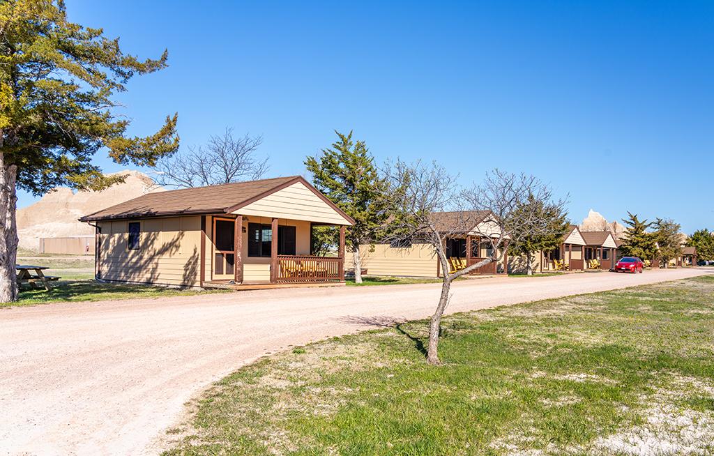
Cedar Pass Lodge cabins, Badlands National Park / Rebecca Latson
If you really feel like getting away from it all, there’s the Sage Creek Campground located off the unpaved Sage Creek Rim Road (motor homes, pull behind trailers, and other RVs greater than 18 feet in length are prohibited). Click here for more information on Badlands’ campgrounds.
Dining There
Dining options are limited. Unless you bring your own food with you, Wall, Cedar Pass Lodge, or Interior are the closest locations for eating out.
Now that you are all settled in, what can you do for three days?
Day 1
Drive the Loop Road through the park. Stop at each view area and really take your time looking at the amazing landscape. Read those informational signs for a better understanding of the geology, environment, and history. Do a little recon work to figure out which overlook might be good for sunrise, sunset, and blue hour photography.

The start to sunrise at Burns Basin Overlook, Badlands National Park / Rebecca Latson
Hike all or parts of any of the trails. There’s the accessible Fossil Exhibit boardwalk trail about ¼ mile long, and across the road is one end of the six-mile Castle Trail. This trail is not the kind you might be used to seeing at other parks – it’s marked with tall stakes to keep you on the right course, although you can explore in any direction you wish. Just keep note of your location since it’s easy to lose your bearings out there. You might also want to spray your clothing with tick repellant before heading out anywhere with tall grass.

The Window Trail, Badlands National Park / Rebecca Latson
Halfway between the Ben Reifel Visitor Center and the Big Badlands Overlook is a large parking lot at the Door, Window, Notch, and Castle trailheads. They are easy trails allowing you to explore the area and you can even do a little fossil hunting.
Note: if you happen to find a fossil, leave it in place, take photos of it, get GPS coordinates for the location, note what the surrounding area looks like, and go tell a ranger. Leaving the fossil in place gives scientists a better idea of the age range and type of environment. Also, collecting of fossils, rocks, minerals, and artifacts is prohibited.
Stop at one of the prairie dog towns you spy along the road. There are more of them than just the Roberts Prairie Dog Town marked on the park map and accessed by driving the unpaved Sage Creek Rim Road, although this prairie dog town is the most accessible. Venturing out onto the “town” or just sit in your car with the window rolled down to quietly watch the antics of these furry little pipsqueak members of the squirrel family. You might see them busily digging on their mounds, clumps of dirt flying everywhere, or standing guard (and letting the other townsfolk know of your presence), or engaging in an interesting “jump-yip” action to (theoretically) test the alertness of its nearby neighbors.

Black-tailed prairie dog, Badlands National Park / Rebecca Latson
Day 2
Drive part or all of Sage Creek Rim Road, located about ¼ mile south of the Pinnacles Entrance. This unpaved road runs approximately 13 miles to the park boundary and Sage Creek Campground. Be aware, after winter storms and spring rains, this road may temporarily close.

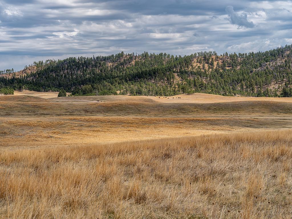
A view across the prairie toward Sage Creek Rim Road in the distance, Badlands National Park / Rebecca Latson
Continue along Sage Creek Rim Road out of the park toward the community of Scenic, South Dakota (pop. 66) and another 20 miles further south along County Road 589 to the White River Visitor Center and that portion of the park within the confines of the Pine Ridge Indian Reservation. The White River Visitor Center is open seasonally, and at the time of my late-April visit, it was still closed.
If you don’t feel like driving the entire Sage Creek Rim Road, you can travel as far as the Sage Creek Basin Overlook then return to the paved portion of the park road (Hwy 240) and head north eight miles to Wall. Surely, seeing billboard signs dotting Interstate 90 every ¼ mile or so for Wall Drug will have piqued your curiosity.
Day 3
Spend an hour at the Minuteman Missile National Historic Site Visitor Center, viewing the 30-minute show and touring the small museum filled with Cold War memorabilia and exhibits pertaining to the Minuteman missile. From there, drive west toward Wall and take Exit 116 to walk around the Delta-09 missile silo, peering through the display glass onto the missile below (sans nuclear warhead). If you’ve planned ahead, you’ll have a reservation for a ranger-led tour of the Delta-01 Launch Control Facility, located via Exit 127. Limited to six people, these reservations are “harder to snag than a Broadway ticket,” according to the ranger who led my tour.

The visitor center at Minuteman Missile National Historic Site / Rebecca Latson

Artist drawing of Delta-01 and Delta-09 sites (not as close as shown here), Minuteman Missile National Historic Site / NPS file
If Cold War history is not your thing, instead drive two hours to Wind Cave National Park via Hwy 79 to Hot Springs, South Dakota.

Wind Cave National Park map / NPS file
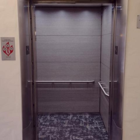
Don’t listen to your GPS, which will try to direct you onto the unpaved Hwy 101 into the park. Check with the visitor center to see if there are any tickets for one of the cave tours offered. Note: All cave tours are currently closed from May 6, 2024 into the fall for complete replacement and modernization of the elevator system.

Boxwork formation on the cave ceiling, Wind Cave National Park / Rebecca Latson
In lieu of a cave tour, drive through the park, stopping to view bison, prairie dogs, pronghorn, and rolling Black Hills landscape. Stretch your legs by hiking one of several trails within the park. Keep a wide distance between yourself and the wildlife, use your telephoto lens or binoculars for a closer look, and please don’t pet the fluffy cows.

Bison dot the landscape at Wind Cave National Park / Rebecca Latson

Pronghorn portrait, Wind Cave National Park / Rebecca Latson

The view from Wind Cave National Park into Custer State Park / Rebecca Latson
You can also visit Jewel Cave National Monument, Mount Rushmore National Memorial, and/or Custer State Park (more bison and Black Hills scenery).

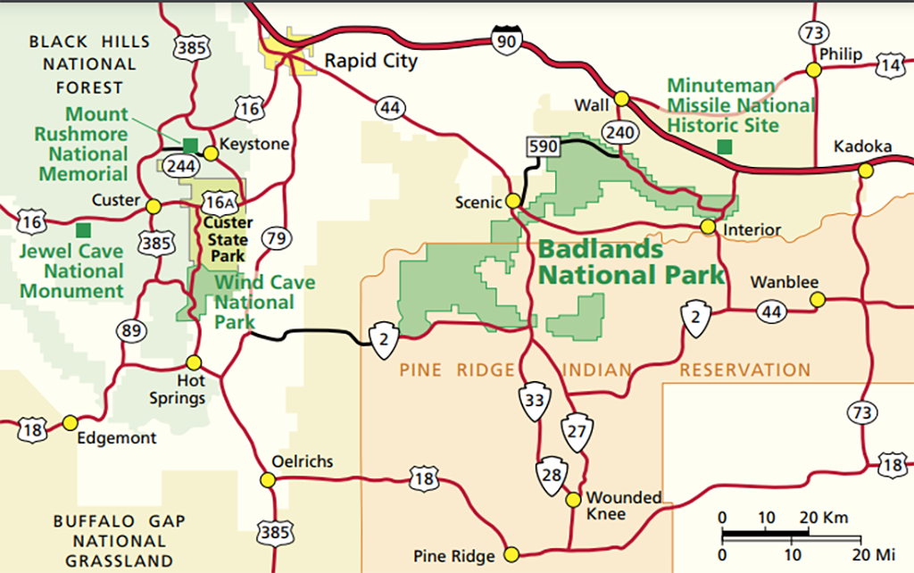
Area map around Badlands National Park / NPS file
Whew! A visit to Badlands National Park and surrounding area will keep you busy for a full three days. Heck, you might even want to stay four days for all of this.

The road into the badlands, Badlands National Park / Rebecca Latson


 Support Essential Coverage of Essential Places


Comments
You may want to make sure to see Night Sky at Badlands they do a great presentation at the Visitors Center and have telescopes set up to view thru. If your there during a new moon it's extordinary. I was fortunate to see saturn and its rings on a visit thru the telescope.
Wind Cave: "All cave tours are currently closed [...]." A ranger told me that cave geological formations, including boxwork, are visible along the Cold Brook Canyon Trail. It's a cave hike with the sky above (and it's open, free, and available without waiting for a tour).
I second the recommendation for Custer State Park.
Personally, I would not try to make a day trip from Badlands to Wind Cave NP, Jewel Cave NM, or Custer SP, and probably not even Mount Rushmore NM. Between travel time and activity time, the day would be too long. I would pack up, travel to the Black Hills, and spend a night (or seven) there.
Thanks for another great article, Rebecca.