Using Commercial Satellite Images To Help Map And Monitor Yellowstone’s Thermal Areas

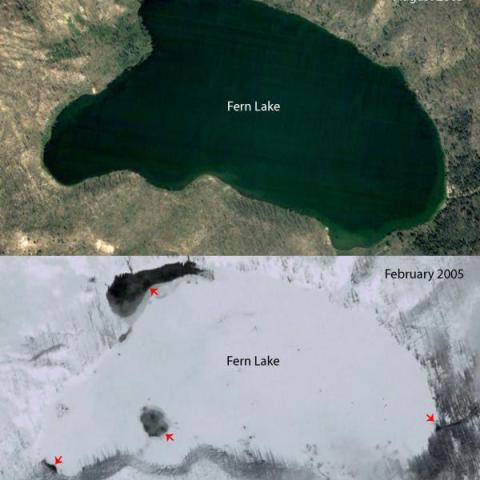
Satellite remote sensing data from numerous orbiting spacecraft have long been instrumental in studying and monitoring Yellowstone—especially the thermal areas and geyser basins that make Yellowstone National Park famous.
- By NPT Staff - September 19th, 2023 2:30am


